Property Record
5571 Colerain Ave, Cincinnati, OH 45239
Property Detail
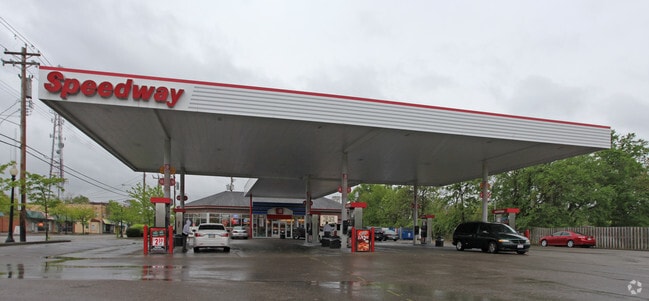
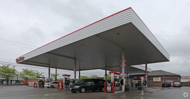
5571 Colerain Ave
231-0004-0139
COLERAIN AVE 12.50 X 19.68 IRR R2-T2-S6 SE EX-5 IRR DO
Servicestation
Hamilton
CCM
Ohio
B and X Area of moderate flood hazard, usually the area between the limits of the 100-year and 500-year floods.
0.65 AC
0
Forest Park/West
2025
Cincinnati/Dayton
008300
Cincinnati, OH-KY-IN
NEARBY LISTINGS FOR SALE OR LEASE
DEMOGRAPHICS near 5571 Colerain Ave
1 mile
3 mile
5 mile
2025 Total Population
12,584
93,785
251,530
2030 Population
12,817
94,784
253,923
Pop Growth 2025-2030
+ 1.85%
+ 1.07%
+ 0.95%
Average Age
37
40
39
2025 Total Households
5,275
39,979
105,979
HH Growth 2025-2030
+ 1.80%
+ 0.99%
+ 0.94%
Median Household Inc
$46,765
$58,181
$58,121
Avg Household Size
2.30
2.20
2.30
2025 Avg HH Vehicles
1.00
2.00
2.00
Median Home Value
$167,871
$188,530
$191,946
Median Year Built
1964
1960
1961
Nearby Places
Map Layers
Map Styles
 Street
 Aerial
Layers
 Traffic
 Biking
Places
Listings with unknown addresses are not visible on the map
- Restaurants
- Banks
- Shops
- Fitness
- Groceries
PUBLIC TRANSPORTATION
COMMUTER RAIL
Cincinnati Union Terminal (Cardinal - Amtrak)
Drive
Walk
Distance
Cincinnati Union Terminal (Cardinal - Amtrak)
13 min
6.9 mi
AIRPORT
Cincinnati/Northern Kentucky International
Drive
Walk
Distance
Cincinnati/Northern Kentucky International
38 min
20.9 mi
Freight Ports
Port of Toledo
Drive
Walk
Distance
Port of Toledo
241 min
205.7 mi
Nearby Properties
Address
Land Use
TOTAL SIZE
Lot Size
Zoning
Address
Land Use
TOTAL SIZE
Lot Size
Zoning
Address
Land Use
TOTAL SIZE
Lot Size
Zoning
26.16 AC
Address
Land Use
TOTAL SIZE
Lot Size
Zoning
112.35 AC
RM20
Address
Land Use
TOTAL SIZE
Lot Size
Zoning
Address
Land Use
TOTAL SIZE
Lot Size
Zoning
60.86 AC
Address
Land Use
TOTAL SIZE
Lot Size
Zoning
5,984 SF
15.91 AC
Address
Land Use
TOTAL SIZE
Lot Size
Zoning
Address
Land Use
TOTAL SIZE
Lot Size
Zoning
30.43 AC
Address
Land Use
TOTAL SIZE
Lot Size
Zoning
2,678 SF
8.76 AC
Address
Land Use
TOTAL SIZE
Lot Size
Zoning
6,620 SF
16.91 AC
Address
Land Use
TOTAL SIZE
Lot Size
Zoning
41,564 SF
13.21 AC
Address
Land Use
TOTAL SIZE
Lot Size
Zoning
50.02 AC
Address
Land Use
TOTAL SIZE
Lot Size
Zoning
13.81 AC
Address
Land Use
TOTAL SIZE
Lot Size
Zoning
Address
Land Use
TOTAL SIZE
Lot Size
Zoning
60,614 SF
13.35 AC
SF6
Address
Land Use
TOTAL SIZE
Lot Size
Zoning
Address
Land Use
TOTAL SIZE
Lot Size
Zoning
8.66 AC
SF2
Address
Land Use
TOTAL SIZE
Lot Size
Zoning
Address
Land Use
TOTAL SIZE
Lot Size
Zoning
6.15 AC
SF2
Address
Land Use
TOTAL SIZE
Lot Size
Zoning
8.57 AC
Address
Land Use
TOTAL SIZE
Lot Size
Zoning
1,860 SF
12.01 AC
A2
Address
Land Use
TOTAL SIZE
Lot Size
Zoning
20.33 AC
SF6
Address
Land Use
TOTAL SIZE
Lot Size
Zoning
49,056 SF
5.70 AC
RM20
Address
Land Use
TOTAL SIZE
Lot Size
Zoning
10,036 SF
22.06 AC
RM20
Address
Land Use
TOTAL SIZE
Lot Size
Zoning
Address
Land Use
TOTAL SIZE
Lot Size
Zoning
4.28 AC
OO
Address
Land Use
TOTAL SIZE
Lot Size
Zoning
84,810 SF
12.66 AC
C
Address
Land Use
TOTAL SIZE
Lot Size
Zoning
9.47 AC
SF6
Address
Land Use
TOTAL SIZE
Lot Size
Zoning
34.88 AC
Address
Land Use
TOTAL SIZE
Lot Size
Zoning
The World's #1 Commercial Real Estate Marketplace
Connect with us
© 2026 CoStar Group
The information above has been obtained from sources believed reliable. While we do not doubt its accuracy we have not verified it and make no guarantee, warranty or representation about it. It is your responsibility to independently confirm its accuracy and completeness. Any projections, opinions, assumptions, or estimates used are for example only and do not represent the current or future performance of the property. The value of this transaction to you depends on tax and other factors which should be evaluated by your tax, financial, and legal advisors. You and your advisors should conduct a careful, independent investigation of the property to determine to your satisfaction the suitability of the property for your needs.