Property Record
560 Sargent St, Beatrice, NE 68310
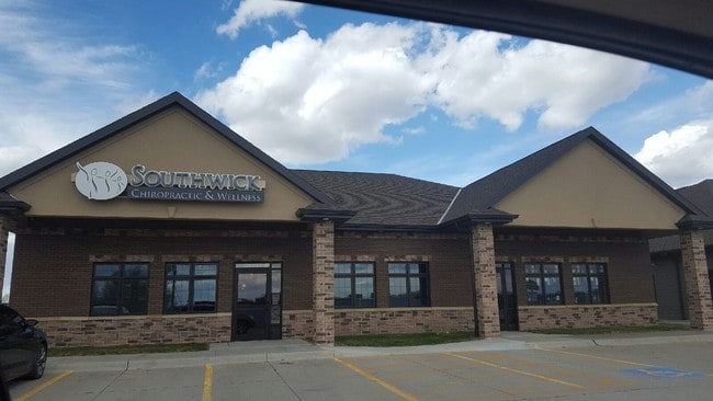

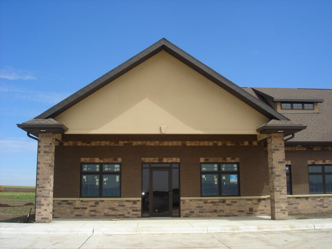

Property Detail
560 Sargent St
013784701
LOT 1 NORTHRIDGE VILLAGE FIRST ADDITION
Officebuilding
Gage
03-COMMERC
Nebraska
B and X Area of moderate flood hazard, usually the area between the limits of the 100-year and 500-year floods.
1
2025
0.98 AC
2025
Nebraska Area
964800
Other Market Areas
4,513 SF
Beatrice, NE
NEARBY LISTINGS FOR SALE OR LEASE
DEMOGRAPHICS near 560 Sargent St
1 mile
3 mile
5 mile
2025 Total Population
1,310
12,207
13,523
2030 Population
1,319
12,335
13,646
Pop Growth 2025-2030
+ 0.69%
+ 1.05%
+ 0.91%
Average Age
43
43
43
2025 Total Households
589
5,394
5,946
HH Growth 2025-2030
+ 0.68%
+ 1.02%
+ 0.87%
Median Household Inc
$59,436
$55,341
$57,234
Avg Household Size
2.10
2.10
2.20
2025 Avg HH Vehicles
2.00
2.00
2.00
Median Home Value
$177,563
$167,150
$176,013
Median Year Built
1969
1964
1965
Nearby Places
Map Layers
Map Styles
 Street
 Aerial
Layers
 Traffic
 Biking
Places
Listings with unknown addresses are not visible on the map
- Restaurants
- Banks
- Shops
- Fitness
- Groceries
PUBLIC TRANSPORTATION
AIRPORT
Lincoln
Drive
Walk
Distance
Lincoln
48 min
42.4 mi
SALE & LEASE HISTORY
LISTING DATE
SALE/LEASE

Sep 25, 2016
For Lease
Aug 05, 2020
For Lease
Nearby Properties
Address
Land Use
TOTAL SIZE
Lot Size
Zoning
Address
Land Use
TOTAL SIZE
Lot Size
Zoning
53,380 SF
14.85 AC
04-INDUSTR
Address
Land Use
TOTAL SIZE
Lot Size
Zoning
154,700 SF
17.86 AC
03-COMMERC
Address
Land Use
TOTAL SIZE
Lot Size
Zoning
110,870 SF
16.52 AC
04-INDUSTR
Address
Land Use
TOTAL SIZE
Lot Size
Zoning
54,036 SF
6.76 AC
04-INDUSTR
Address
Land Use
TOTAL SIZE
Lot Size
Zoning
269,380 SF
03-COMMERC
Address
Land Use
TOTAL SIZE
Lot Size
Zoning
25,115 SF
5.50 AC
04-INDUSTR
Address
Land Use
TOTAL SIZE
Lot Size
Zoning
23,487 SF
03-COMMERC
Address
Land Use
TOTAL SIZE
Lot Size
Zoning
23,016 SF
2.01 AC
03-COMMERC
Address
Land Use
TOTAL SIZE
Lot Size
Zoning
10,906 SF
3.99 AC
03-COMMERC
Address
Land Use
TOTAL SIZE
Lot Size
Zoning
121,372 SF
4.03 AC
04-INDUSTR
Address
Land Use
TOTAL SIZE
Lot Size
Zoning
41,658 SF
0.36 AC
02-MULTI-F
Address
Land Use
TOTAL SIZE
Lot Size
Zoning
6,483 SF
5.13 AC
03-COMMERC
Address
Land Use
TOTAL SIZE
Lot Size
Zoning
40,000 SF
3.10 AC
04-INDUSTR
Address
Land Use
TOTAL SIZE
Lot Size
Zoning
17,364 SF
13.53 AC
03-COMMERC
Address
Land Use
TOTAL SIZE
Lot Size
Zoning
25,379 SF
9 AC
Address
Land Use
TOTAL SIZE
Lot Size
Zoning
27,672 SF
8.12 AC
03-COMMERC
Address
Land Use
TOTAL SIZE
Lot Size
Zoning
9,120 SF
03-COMMERC
Address
Land Use
TOTAL SIZE
Lot Size
Zoning
15,750 SF
2.03 AC
01-SINGLE
Address
Land Use
TOTAL SIZE
Lot Size
Zoning
31,802 SF
2.41 AC
03-COMMERC
Address
Land Use
TOTAL SIZE
Lot Size
Zoning
25,560 SF
5.54 AC
04-INDUSTR
Address
Land Use
TOTAL SIZE
Lot Size
Zoning
20,192 SF
1.37 AC
03-COMMERC
Address
Land Use
TOTAL SIZE
Lot Size
Zoning
4,752 SF
0.87 AC
03-COMMERC
Address
Land Use
TOTAL SIZE
Lot Size
Zoning
79,098 SF
4.90 AC
04-INDUSTR
The World's #1 Commercial Real Estate Marketplace
Connect with us
© 2026 CoStar Group
The information above has been obtained from sources believed reliable. While we do not doubt its accuracy we have not verified it and make no guarantee, warranty or representation about it. It is your responsibility to independently confirm its accuracy and completeness. Any projections, opinions, assumptions, or estimates used are for example only and do not represent the current or future performance of the property. The value of this transaction to you depends on tax and other factors which should be evaluated by your tax, financial, and legal advisors. You and your advisors should conduct a careful, independent investigation of the property to determine to your satisfaction the suitability of the property for your needs.