Property Record
5600 W 13Th Ave, Lakewood, CO 80214
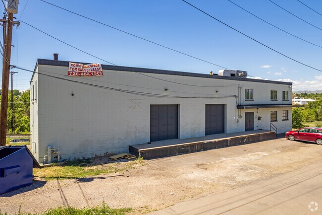


Property Detail
5600 W 13Th Ave
49-011-00-126
SECTION 01 TOWNSHIP 04 RANGE 69 QTR NE SIZE: 11081 VALUE: .254 KEY=305
Industrialgeneral
Jefferson
B and X Area of moderate flood hazard, usually the area between the limits of the 100-year and 500-year floods.
Colorado
2025
0.25 AC
2025
West Denver
011552
Denver
10,022 SF
Denver-Aurora-Centennial, CO
NEARBY LISTINGS FOR SALE OR LEASE
DEMOGRAPHICS near 5600 W 13Th Ave
1 mile
3 mile
5 mile
2025 Total Population
23,433
169,291
479,730
2030 Population
24,070
171,739
488,029
Pop Growth 2025-2030
+ 2.72%
+ 1.45%
+ 1.73%
Average Age
38
38
39
2025 Total Households
10,535
72,912
222,496
HH Growth 2025-2030
+ 2.85%
+ 1.64%
+ 1.98%
Median Household Inc
$69,755
$83,461
$91,606
Avg Household Size
2.10
2.20
2.00
2025 Avg HH Vehicles
1.00
2.00
2.00
Median Home Value
$595,122
$655,863
$652,663
Median Year Built
1973
1965
1970
Nearby Places
Map Layers
Map Styles
 Street
 Aerial
Layers
 Traffic
 Biking
Places
Listings with unknown addresses are not visible on the map
- Restaurants
- Banks
- Shops
- Fitness
- Groceries
PUBLIC TRANSPORTATION
TRANSIT/SUBWAY
Sheridan (W Line - Denver Regional Transportation District Light Rail (TheRide))
Drive
Walk
Distance
Sheridan (W Line - Denver Regional Transportation District Light Rail (TheRide))
1 min
7 min
0.4 mi
Lamar (W Line - Denver Regional Transportation District Light Rail (TheRide))
Drive
Walk
Distance
Lamar (W Line - Denver Regional Transportation District Light Rail (TheRide))
2 min
8 min
0.5 mi
Perry (W Line - Denver Regional Transportation District Light Rail (TheRide))
Drive
Walk
Distance
Perry (W Line - Denver Regional Transportation District Light Rail (TheRide))
5 min
20 min
1.1 mi
COMMUTER RAIL
Union Station: Lodo-Coors Field-16Th Street Mall (C Line - Denver Regional Transportation District Light Rail (TheRide), E Line - Denver Regional Transportation District Light Rail (TheRide), W Line - Denver Regional Transportation District Light Rail (TheRide))
Drive
Walk
Distance
Union Station: Lodo-Coors Field-16Th Street Mall (C Line - Denver Regional Transportation District Light Rail (TheRide), E Line - Denver Regional Transportation District Light Rail (TheRide), W Line - Denver Regional Transportation District Light Rail (TheRide))
10 min
4.0 mi
Denver (California Zephyr - Amtrak)
Drive
Walk
Distance
Denver (California Zephyr - Amtrak)
11 min
4.2 mi
AIRPORT
Denver International
Drive
Walk
Distance
Denver International
40 min
29.1 mi
Freight Ports
Tulsa Port Of Catoosa
Drive
Walk
Distance
Tulsa Port Of Catoosa
737 min
714.6 mi
SALE & LEASE HISTORY
LISTING DATE
SALE/LEASE

Sep 01, 2022
For Sale
Jan 31, 2020
For Lease
Jan 19, 2022
For Lease
Dec 14, 2017
For Lease
Apr 16, 2025
For Lease
Apr 16, 2025
For Sale
Nearby Properties
Address
Land Use
TOTAL SIZE
Lot Size
Zoning
Address
Land Use
TOTAL SIZE
Lot Size
Zoning
1,721,086 SF
21.34 AC
C-MU-30
Address
Land Use
TOTAL SIZE
Lot Size
Zoning
565,418 SF
4.07 AC
C-RX
Address
Land Use
TOTAL SIZE
Lot Size
Zoning
729,679 SF
C-MX
Address
Land Use
TOTAL SIZE
Lot Size
Zoning
411,402 SF
6.34 AC
C-RX
Address
Land Use
TOTAL SIZE
Lot Size
Zoning
310,267 SF
1.69 AC
C-MX
Address
Land Use
TOTAL SIZE
Lot Size
Zoning
245,760 SF
1.48 AC
C-MS
Address
Land Use
TOTAL SIZE
Lot Size
Zoning
252,092 SF
4.75 AC
C-RX
Address
Land Use
TOTAL SIZE
Lot Size
Zoning
187,817 SF
1.02 AC
C-MX
Address
Land Use
TOTAL SIZE
Lot Size
Zoning
162,639 SF
1.44 AC
C-MX
Address
Land Use
TOTAL SIZE
Lot Size
Zoning
1,078,109 SF
36.79 AC
CMP-EI
Address
Land Use
TOTAL SIZE
Lot Size
Zoning
185,265 SF
4.37 AC
G-MU
Address
Land Use
TOTAL SIZE
Lot Size
Zoning
150,106 SF
2.40 AC
C-RX
Address
Land Use
TOTAL SIZE
Lot Size
Zoning
168,523 SF
44.89 AC
CPV-R
Address
Land Use
TOTAL SIZE
Lot Size
Zoning
424,862 SF
32.28 AC
G-MU-3
Address
Land Use
TOTAL SIZE
Lot Size
Zoning
133,938 SF
1.72 AC
Address
Land Use
TOTAL SIZE
Lot Size
Zoning
101,906 SF
2.30 AC
C-RX
Address
Land Use
TOTAL SIZE
Lot Size
Zoning
92,072 SF
2.98 AC
Address
Land Use
TOTAL SIZE
Lot Size
Zoning
44.93 AC
CPV-C
Address
Land Use
TOTAL SIZE
Lot Size
Zoning
76,877 SF
1.45 AC
C-RX
Address
Land Use
TOTAL SIZE
Lot Size
Zoning
104,837 SF
0.72 AC
U-MS
Address
Land Use
TOTAL SIZE
Lot Size
Zoning
113,932 SF
9.60 AC
I-B
Address
Land Use
TOTAL SIZE
Lot Size
Zoning
61,026 SF
2.81 AC
Address
Land Use
TOTAL SIZE
Lot Size
Zoning
128,779 SF
3.80 AC
Address
Land Use
TOTAL SIZE
Lot Size
Zoning
134,360 SF
1.45 AC
C-MX
Address
Land Use
TOTAL SIZE
Lot Size
Zoning
33.40 AC
C-MU-30
Address
Land Use
TOTAL SIZE
Lot Size
Zoning
112,266 SF
2.41 AC
Address
Land Use
TOTAL SIZE
Lot Size
Zoning
139,413 SF
1.68 AC
C-MX
Address
Land Use
TOTAL SIZE
Lot Size
Zoning
88,507 SF
5.53 AC
Address
Land Use
TOTAL SIZE
Lot Size
Zoning
514,899 SF
15.51 AC
CMP-EI
Address
Land Use
TOTAL SIZE
Lot Size
Zoning
111,544 SF
2.90 AC
The World's #1 Commercial Real Estate Marketplace
Connect with us
© 2026 CoStar Group
The information above has been obtained from sources believed reliable. While we do not doubt its accuracy we have not verified it and make no guarantee, warranty or representation about it. It is your responsibility to independently confirm its accuracy and completeness. Any projections, opinions, assumptions, or estimates used are for example only and do not represent the current or future performance of the property. The value of this transaction to you depends on tax and other factors which should be evaluated by your tax, financial, and legal advisors. You and your advisors should conduct a careful, independent investigation of the property to determine to your satisfaction the suitability of the property for your needs.