Property Record
5602 S Wilson Rd, Buckeye, AZ 85326

Property Detail
5602 S Wilson Rd
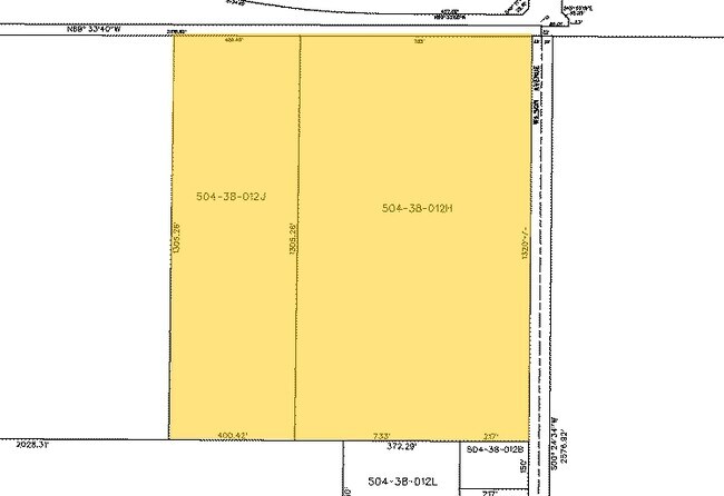
504-38-012H
E 766F OF N2 SE4 SEC 28 EX E 33F RD
Commercialnec
MARICOPA
R-43
Arizona
C and X Area of minimal flood hazard, usually depicted on FIRMs as above the 500-year flood level.
22.21 AC
2025
Southwest Outlying
2025
Phoenix
050617
Phoenix-Mesa-Chandler, AZ
4,730 SF
NEARBY LISTINGS FOR SALE OR LEASE
DEMOGRAPHICS near 5602 S Wilson Rd
1 mile
3 mile
5 mile
2025 Total Population
62
939
26,706
2030 Population
65
1,014
28,430
Pop Growth 2025-2030
+ 4.84%
+ 7.99%
+ 6.46%
Average Age
37
34
34
2025 Total Households
17
288
7,916
HH Growth 2025-2030
+ 5.88%
+ 8.33%
+ 6.56%
Median Household Inc
$74,999
$45,714
$82,941
Avg Household Size
3.00
3.00
3.30
2025 Avg HH Vehicles
2.00
1.00
2.00
Median Home Value
$391,666
$391,935
$370,372
Median Year Built
2002
2005
2007
Nearby Places
Map Layers
Map Styles
 Street
 Aerial
Layers
 Traffic
 Biking
Places
Listings with unknown addresses are not visible on the map
- Restaurants
- Banks
- Shops
- Fitness
- Groceries
SALE & LEASE HISTORY
LISTING DATE
SALE/LEASE

Apr 26, 2021
For Sale
Nearby Properties
Address
Land Use
TOTAL SIZE
Lot Size
Zoning
Address
Land Use
TOTAL SIZE
Lot Size
Zoning
127,192 SF
307.39 AC
C-G
Address
Land Use
TOTAL SIZE
Lot Size
Zoning
43,524 SF
614.67 AC
RU43
Address
Land Use
TOTAL SIZE
Lot Size
Zoning
52,648 SF
10.15 AC
C-G
Address
Land Use
TOTAL SIZE
Lot Size
Zoning
307.39 AC
C-G
Address
Land Use
TOTAL SIZE
Lot Size
Zoning
83.41 AC
GC
Address
Land Use
TOTAL SIZE
Lot Size
Zoning
43,912 SF
151.98 AC
RU43
Address
Land Use
TOTAL SIZE
Lot Size
Zoning
473.17 AC
R-43
Address
Land Use
TOTAL SIZE
Lot Size
Zoning
59,598 SF
8.79 AC
C-G
Address
Land Use
TOTAL SIZE
Lot Size
Zoning
34.42 AC
Address
Land Use
TOTAL SIZE
Lot Size
Zoning
81.59 AC
R-43
Address
Land Use
TOTAL SIZE
Lot Size
Zoning
13,196 SF
5.35 AC
I-2
Address
Land Use
TOTAL SIZE
Lot Size
Zoning
15,608 SF
51.01 AC
RU43
Address
Land Use
TOTAL SIZE
Lot Size
Zoning
39.36 AC
R-43
Address
Land Use
TOTAL SIZE
Lot Size
Zoning
10.62 AC
Address
Land Use
TOTAL SIZE
Lot Size
Zoning
9.20 AC
Address
Land Use
TOTAL SIZE
Lot Size
Zoning
10,048 SF
2.96 AC
I-2
Address
Land Use
TOTAL SIZE
Lot Size
Zoning
7,168 SF
2.76 AC
C-3
Address
Land Use
TOTAL SIZE
Lot Size
Zoning
7,716 SF
3.24 AC
I-1
Address
Land Use
TOTAL SIZE
Lot Size
Zoning
10,054 SF
74.10 AC
R-R
Address
Land Use
TOTAL SIZE
Lot Size
Zoning
3,874 SF
0.93 AC
C-G
Address
Land Use
TOTAL SIZE
Lot Size
Zoning
7.13 AC
C-G
Address
Land Use
TOTAL SIZE
Lot Size
Zoning
6,395 SF
1.62 AC
R-43
Address
Land Use
TOTAL SIZE
Lot Size
Zoning
19.26 AC
The World's #1 Commercial Real Estate Marketplace
Connect with us
© 2026 CoStar Group
The information above has been obtained from sources believed reliable. While we do not doubt its accuracy we have not verified it and make no guarantee, warranty or representation about it. It is your responsibility to independently confirm its accuracy and completeness. Any projections, opinions, assumptions, or estimates used are for example only and do not represent the current or future performance of the property. The value of this transaction to you depends on tax and other factors which should be evaluated by your tax, financial, and legal advisors. You and your advisors should conduct a careful, independent investigation of the property to determine to your satisfaction the suitability of the property for your needs.