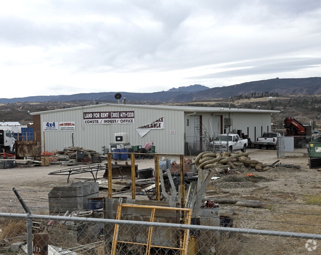
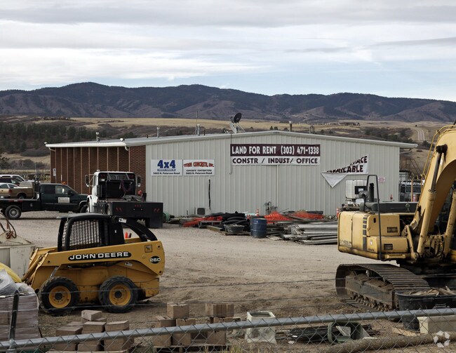
Property Record
5605 Peterson Rd, Sedalia, CO 80135

Property Detail
5605 Peterson Rd
2353-140-01-006
LOT 6 SEDALIA INDUSTRIAL PARK 303-1001 TOTAL ACREAGE 4.9 AM/L
Commercialnec
Douglas
GI
Colorado
B and X Area of moderate flood hazard, usually the area between the limits of the 100-year and 500-year floods.
6
2024
4.90 AC
2025
Southwest C-470
014135
Denver
6,000 SF
Denver-Aurora-Centennial, CO
NEARBY LISTINGS FOR SALE OR LEASE
DEMOGRAPHICS near 5605 Peterson Rd
1 mile
3 mile
5 mile
2025 Total Population
265
1,151
31,191
2030 Population
285
1,267
33,634
Pop Growth 2025-2030
+ 7.55%
+ 10.08%
+ 7.83%
Average Age
40
43
42
2025 Total Households
84
404
10,811
HH Growth 2025-2030
+ 8.33%
+ 10.64%
+ 8.27%
Median Household Inc
$245,283
$184,285
$169,635
Avg Household Size
3.00
2.80
2.90
2025 Avg HH Vehicles
3.00
3.00
2.00
Median Home Value
$1,127,941
$1,032,452
$849,436
Median Year Built
2010
2010
2002
Nearby Places
Map Layers
Map Styles
 Street
 Aerial
Layers
 Traffic
 Biking
Places
Listings with unknown addresses are not visible on the map
- Restaurants
- Banks
- Shops
- Fitness
- Groceries
PUBLIC TRANSPORTATION
AIRPORT
Denver International
Drive
Walk
Distance
Denver International
55 min
46.7 mi
Nearby Properties
Address
Land Use
TOTAL SIZE
Lot Size
Zoning
Address
Land Use
TOTAL SIZE
Lot Size
Zoning
29,950 SF
4.53 AC
GI
Address
Land Use
TOTAL SIZE
Lot Size
Zoning
2,338 SF
320 AC
A1
Address
Land Use
TOTAL SIZE
Lot Size
Zoning
8,770 SF
40.75 AC
Address
Land Use
TOTAL SIZE
Lot Size
Zoning
30,357 SF
1.90 AC
GI
Address
Land Use
TOTAL SIZE
Lot Size
Zoning
22,595 SF
2.21 AC
GI
Address
Land Use
TOTAL SIZE
Lot Size
Zoning
20,732 SF
2.97 AC
GI
Address
Land Use
TOTAL SIZE
Lot Size
Zoning
14,380 SF
3.11 AC
Address
Land Use
TOTAL SIZE
Lot Size
Zoning
12,000 SF
3.98 AC
GI
Address
Land Use
TOTAL SIZE
Lot Size
Zoning
171 SF
11.64 AC
Address
Land Use
TOTAL SIZE
Lot Size
Zoning
12,000 SF
1.52 AC
GI
Address
Land Use
TOTAL SIZE
Lot Size
Zoning
1 SF
35.31 AC
PDU
Address
Land Use
TOTAL SIZE
Lot Size
Zoning
9,869 SF
1.34 AC
GI
Address
Land Use
TOTAL SIZE
Lot Size
Zoning
23,014 SF
4.51 AC
RR
Address
Land Use
TOTAL SIZE
Lot Size
Zoning
26,505 SF
169.55 AC
A1
Address
Land Use
TOTAL SIZE
Lot Size
Zoning
9,600 SF
1.17 AC
GI
Address
Land Use
TOTAL SIZE
Lot Size
Zoning
7,953 SF
2.29 AC
GI
Address
Land Use
TOTAL SIZE
Lot Size
Zoning
19,375 SF
6.45 AC
GI
Address
Land Use
TOTAL SIZE
Lot Size
Zoning
9,633 SF
2.13 AC
GI
Address
Land Use
TOTAL SIZE
Lot Size
Zoning
5,400 SF
2.21 AC
LI
Address
Land Use
TOTAL SIZE
Lot Size
Zoning
6,950 SF
4.77 AC
GI
Address
Land Use
TOTAL SIZE
Lot Size
Zoning
5,865 SF
1.41 AC
B
Address
Land Use
TOTAL SIZE
Lot Size
Zoning
145 AC
A1
Address
Land Use
TOTAL SIZE
Lot Size
Zoning
11,464 SF
4.52 AC
GI
Address
Land Use
TOTAL SIZE
Lot Size
Zoning
6,000 SF
2.21 AC
Address
Land Use
TOTAL SIZE
Lot Size
Zoning
5,100 SF
2.11 AC
GI
Address
Land Use
TOTAL SIZE
Lot Size
Zoning
6,143 SF
0.53 AC
LI
Address
Land Use
TOTAL SIZE
Lot Size
Zoning
5,250 SF
2.20 AC
GI
Address
Land Use
TOTAL SIZE
Lot Size
Zoning
5,227 SF
0.75 AC
LI
Address
Land Use
TOTAL SIZE
Lot Size
Zoning
6,630 SF
1.09 AC
D
The World's #1 Commercial Real Estate Marketplace
Connect with us
© 2026 CoStar Group
The information above has been obtained from sources believed reliable. While we do not doubt its accuracy we have not verified it and make no guarantee, warranty or representation about it. It is your responsibility to independently confirm its accuracy and completeness. Any projections, opinions, assumptions, or estimates used are for example only and do not represent the current or future performance of the property. The value of this transaction to you depends on tax and other factors which should be evaluated by your tax, financial, and legal advisors. You and your advisors should conduct a careful, independent investigation of the property to determine to your satisfaction the suitability of the property for your needs.