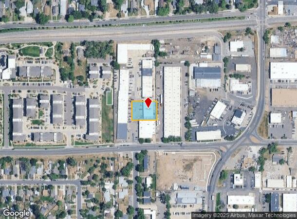
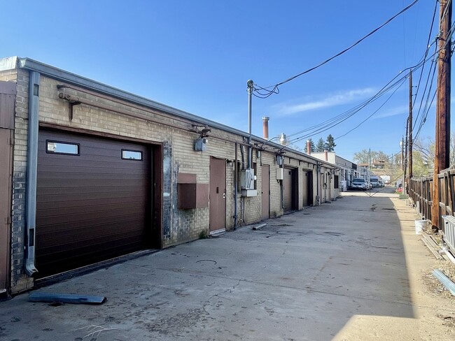
Property Record
5612 Newland Way, Arvada, CO 80002

NEARBY LISTINGS FOR SALE OR LEASE
Property Detail
5612 Newland Way
39-123-00-083
SECTION 12 TOWNSHIP 03 RANGE 69 QTR SW SIZE: 17687 VALUE: .406 KEY=067
Industrialgeneral
Jefferson
X
Colorado
08059C0212F
0.41 AC
2023
Northwest Denver
2024
Denver
010406
Denver-Aurora-Lakewood, CO
6,000 SF
DEMOGRAPHICS near 5612 Newland Way
1 Mile
3 Mile
5 Mile
2024 Total Population
12,180
129,825
366,334
2029 Population
12,032
130,099
370,018
Pop Growth 2024-2029
(1.22%)
+ 0.21%
+ 1.01%
Average Age
39
40
39
2024 Total Households
5,560
55,030
158,108
HH Growth 2024-2029
(1.33%)
+ 0.09%
+ 0.97%
Median Household Inc
$63,064
$80,285
$83,235
Avg Household Size
2.10
2.30
2.20
2024 Avg HH Vehicles
2.00
2.00
2.00
Median Home Value
$439,191
$491,501
$510,144
Median Year Built
1974
1969
1974
Nearby Places
Map Layers
Map Styles
 Street
 Aerial
- Restaurants
- Banks
- Shops
- Fitness
- Groceries
PUBLIC TRANSPORTATION
COMMUTER RAIL
DRIVE
WALK
Distance
2 min
13 min
0.7 mi
DRIVE
WALK
Distance
3 min
13 min
0.7 mi
AIRPORT
Denver International
DRIVE
WALK
Distance
Denver International
37 min
27.6 mi
SALE & LEASE HISTORY
LISTING DATE
SALE/LEASE

Sep 09, 2024
For Sale
Apr 21, 2025
For Lease
Nearby Properties
Address
Land Use
TOTAL SIZE
Lot Size
Zoning
Address
Land Use
TOTAL SIZE
Lot Size
Zoning
860,132 SF
68.50 AC
R-5
Address
Land Use
TOTAL SIZE
Lot Size
Zoning
398,180 SF
33.31 AC
R1C
Address
Land Use
TOTAL SIZE
Lot Size
Zoning
111,673 SF
29.06 AC
Address
Land Use
TOTAL SIZE
Lot Size
Zoning
298,150 SF
24.21 AC
Address
Land Use
TOTAL SIZE
Lot Size
Zoning
6,731 SF
80.77 AC
Address
Land Use
TOTAL SIZE
Lot Size
Zoning
436,238 SF
13.94 AC
Address
Land Use
TOTAL SIZE
Lot Size
Zoning
310,267 SF
1.69 AC
C-MX
Address
Land Use
TOTAL SIZE
Lot Size
Zoning
389,561 SF
10.73 AC
Address
Land Use
TOTAL SIZE
Lot Size
Zoning
142,635 SF
6.84 AC
U-SU-B1
Address
Land Use
TOTAL SIZE
Lot Size
Zoning
262,699 SF
13.10 AC
A2
Address
Land Use
TOTAL SIZE
Lot Size
Zoning
76,078 SF
6.64 AC
U-SU-C
Address
Land Use
TOTAL SIZE
Lot Size
Zoning
87,567 SF
14.98 AC
R-5
Address
Land Use
TOTAL SIZE
Lot Size
Zoning
115,719 SF
5.93 AC
Address
Land Use
TOTAL SIZE
Lot Size
Zoning
142,200 SF
9.82 AC
Address
Land Use
TOTAL SIZE
Lot Size
Zoning
149,115 SF
18 AC
Address
Land Use
TOTAL SIZE
Lot Size
Zoning
83,675 SF
13.43 AC
R2
Address
Land Use
TOTAL SIZE
Lot Size
Zoning
163,361 SF
17.09 AC
Address
Land Use
TOTAL SIZE
Lot Size
Zoning
91,734 SF
9.69 AC
Address
Land Use
TOTAL SIZE
Lot Size
Zoning
73,269 SF
3.72 AC
U-SU-B1
Address
Land Use
TOTAL SIZE
Lot Size
Zoning
307,377 SF
15.12 AC
Address
Land Use
TOTAL SIZE
Lot Size
Zoning
144,325 SF
13.22 AC
Address
Land Use
TOTAL SIZE
Lot Size
Zoning
114,348 SF
3 AC
Address
Land Use
TOTAL SIZE
Lot Size
Zoning
139,913 SF
2.87 AC
Address
Land Use
TOTAL SIZE
Lot Size
Zoning
113,903 SF
12.25 AC
Address
Land Use
TOTAL SIZE
Lot Size
Zoning
121,389 SF
3.58 AC
Address
Land Use
TOTAL SIZE
Lot Size
Zoning
177,075 SF
8.71 AC
Address
Land Use
TOTAL SIZE
Lot Size
Zoning
474,246 SF
10.89 AC
B-3
Address
Land Use
TOTAL SIZE
Lot Size
Zoning
72,333 SF
7.04 AC
Address
Land Use
TOTAL SIZE
Lot Size
Zoning
212,974 SF
26.65 AC
A1
Address
Land Use
TOTAL SIZE
Lot Size
Zoning
86,706 SF
6.36 AC
The World's #1 Commercial Real Estate Marketplace
Connect with us
© 2025 CoStar Group
The information above has been obtained from sources believed reliable. While we do not doubt its accuracy we have not verified it and make no guarantee, warranty or representation about it. It is your responsibility to independently confirm its accuracy and completeness. Any projections, opinions, assumptions, or estimates used are for example only and do not represent the current or future performance of the property. The value of this transaction to you depends on tax and other factors which should be evaluated by your tax, financial, and legal advisors. You and your advisors should conduct a careful, independent investigation of the property to determine to your satisfaction the suitability of the property for your needs.