Property Record
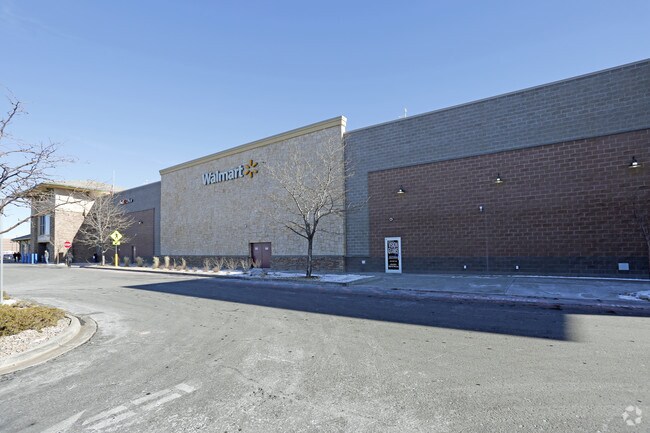
5650 S Chambers Rd, Aurora, CO 80015


Property Detail
5650 S Chambers Rd
2073-18-4-02-007
LOT 1 BLK 1 PIONEER HILLS SUB 1ST FLG EXCEPT THAT PART DESC AS BEG 1318.23 FT SW OF THE NW COR OF THE SE4 OF SEC 18-5-66 TH SW 70.09 FT TH ALG CURVE RT 17.26 FT SW 67.87 FT TH NW 108.36 FT TH NE 5 FT TH NW 80 FT TH N 29.94 FT TH NE 85.84 FT TH ALG CU
Miscellaneous
ARAPAHOE
RPD
Colorado
B and X Area of moderate flood hazard, usually the area between the limits of the 100-year and 500-year floods.
1
2021
20.45 AC
2025
Southeast
084900
Denver
220,184 SF
Denver-Aurora-Centennial, CO
NEARBY LISTINGS FOR SALE OR LEASE
DEMOGRAPHICS near 5650 S Chambers Rd
1 mile
3 mile
5 mile
2025 Total Population
10,082
91,724
288,866
2030 Population
10,222
92,328
293,483
Pop Growth 2025-2030
+ 1.39%
+ 0.66%
+ 1.60%
Average Age
43
39
39
2025 Total Households
3,585
32,728
110,604
HH Growth 2025-2030
+ 1.45%
+ 0.71%
+ 1.83%
Median Household Inc
$128,755
$113,790
$103,390
Avg Household Size
2.80
2.70
2.50
2025 Avg HH Vehicles
2.00
2.00
2.00
Median Home Value
$755,132
$618,548
$576,354
Median Year Built
1994
1988
1990
Nearby Places
Map Layers
Map Styles
 Street
 Aerial
Transit
 Traffic
 Biking
Places
Listings with unknown addresses are not visible on the map
- Restaurants
- Banks
- Shops
- Fitness
- Groceries
PUBLIC TRANSPORTATION
AIRPORT
Denver International
Drive
Walk
Distance
Denver International
34 min
25.4 mi
Nearby Properties
Address
Land Use
TOTAL SIZE
Lot Size
Zoning
Address
Land Use
TOTAL SIZE
Lot Size
Zoning
234,214 SF
5.23 AC
Address
Land Use
TOTAL SIZE
Lot Size
Zoning
280,586 SF
60.97 AC
RPD
Address
Land Use
TOTAL SIZE
Lot Size
Zoning
284,862 SF
23.37 AC
PUD
Address
Land Use
TOTAL SIZE
Lot Size
Zoning
525,600 SF
57.90 AC
Address
Land Use
TOTAL SIZE
Lot Size
Zoning
246,768 SF
12.37 AC
PUD
Address
Land Use
TOTAL SIZE
Lot Size
Zoning
134,316 SF
26.52 AC
Address
Land Use
TOTAL SIZE
Lot Size
Zoning
216,853 SF
5.42 AC
PUD
Address
Land Use
TOTAL SIZE
Lot Size
Zoning
103,811 SF
6.36 AC
RPD
Address
Land Use
TOTAL SIZE
Lot Size
Zoning
304,620 SF
23.95 AC
AMU
Address
Land Use
TOTAL SIZE
Lot Size
Zoning
107,760 SF
5.41 AC
AMU
Address
Land Use
TOTAL SIZE
Lot Size
Zoning
253,296 SF
16.41 AC
Address
Land Use
TOTAL SIZE
Lot Size
Zoning
217,273 SF
18.28 AC
Address
Land Use
TOTAL SIZE
Lot Size
Zoning
171,600 SF
10.32 AC
AA2
Address
Land Use
TOTAL SIZE
Lot Size
Zoning
281,429 SF
22.55 AC
PUD
Address
Land Use
TOTAL SIZE
Lot Size
Zoning
337,765 SF
23.46 AC
Address
Land Use
TOTAL SIZE
Lot Size
Zoning
91.37 AC
Address
Land Use
TOTAL SIZE
Lot Size
Zoning
168,500 SF
24.03 AC
Address
Land Use
TOTAL SIZE
Lot Size
Zoning
166,431 SF
19.37 AC
Address
Land Use
TOTAL SIZE
Lot Size
Zoning
122,965 SF
12.30 AC
RPD
Address
Land Use
TOTAL SIZE
Lot Size
Zoning
12,726 SF
17.94 AC
Address
Land Use
TOTAL SIZE
Lot Size
Zoning
132,300 SF
11.09 AC
AMU
Address
Land Use
TOTAL SIZE
Lot Size
Zoning
288,737 SF
26.40 AC
AMU
Address
Land Use
TOTAL SIZE
Lot Size
Zoning
150,000 SF
10.83 AC
AA2
Address
Land Use
TOTAL SIZE
Lot Size
Zoning
106,000 SF
27.41 AC
Address
Land Use
TOTAL SIZE
Lot Size
Zoning
105,809 SF
48.79 AC
Address
Land Use
TOTAL SIZE
Lot Size
Zoning
157,906 SF
14.47 AC
Address
Land Use
TOTAL SIZE
Lot Size
Zoning
141,360 SF
16.64 AC
Address
Land Use
TOTAL SIZE
Lot Size
Zoning
145,176 SF
11.11 AC
PUD
Address
Land Use
TOTAL SIZE
Lot Size
Zoning
119,074 SF
9.38 AC
AMU
Address
Land Use
TOTAL SIZE
Lot Size
Zoning
337,565 SF
17.11 AC
The World's #1 Commercial Real Estate Marketplace
Connect with us
© 2026 CoStar Group
The information above has been obtained from sources believed reliable. While we do not doubt its accuracy we have not verified it and make no guarantee, warranty or representation about it. It is your responsibility to independently confirm its accuracy and completeness. Any projections, opinions, assumptions, or estimates used are for example only and do not represent the current or future performance of the property. The value of this transaction to you depends on tax and other factors which should be evaluated by your tax, financial, and legal advisors. You and your advisors should conduct a careful, independent investigation of the property to determine to your satisfaction the suitability of the property for your needs.