Property Record
5699 Rapid Run Rd, Cincinnati, OH 45238
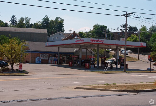

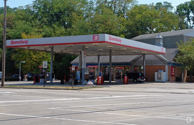
Property Detail
5699 Rapid Run Rd
540-0062-0078
RAPID RUN 196.48 X 188.13 IR LT 1 TH 4 DONALD W ISAACS 2ND SUB PRS 78-79-80-81 CONS
Servicestation
HAMILTON
EE
Ohio
B and X Area of moderate flood hazard, usually the area between the limits of the 100-year and 500-year floods.
1
2025
0.72 AC
2025
Forest Park/West
009901
Cincinnati/Dayton
1,980 SF
Cincinnati, OH-KY-IN
NEARBY LISTINGS FOR SALE OR LEASE
DEMOGRAPHICS near 5699 Rapid Run Rd
1 mile
3 mile
5 mile
2025 Total Population
8,869
78,316
180,915
2030 Population
8,891
78,289
183,382
Pop Growth 2025-2030
+ 0.25%
(0.03%)
+ 1.36%
Average Age
43
39
39
2025 Total Households
3,316
31,226
72,342
HH Growth 2025-2030
+ 0.48%
+ 0.02%
+ 1.35%
Median Household Inc
$93,293
$68,558
$64,315
Avg Household Size
2.50
2.40
2.40
2025 Avg HH Vehicles
2.00
2.00
2.00
Median Home Value
$245,391
$198,407
$205,809
Median Year Built
1968
1962
1962
Nearby Places
Map Layers
Map Styles
 Street
 Aerial
Layers
 Traffic
 Biking
Places
Listings with unknown addresses are not visible on the map
- Restaurants
- Banks
- Shops
- Fitness
- Groceries
PUBLIC TRANSPORTATION
COMMUTER RAIL
Drive
Walk
Distance
17 min
6.7 mi
AIRPORT
Cincinnati/Northern Kentucky International
Drive
Walk
Distance
Cincinnati/Northern Kentucky International
36 min
18.8 mi
Nearby Properties
Address
Land Use
TOTAL SIZE
Lot Size
Zoning
Address
Land Use
TOTAL SIZE
Lot Size
Zoning
177,092 SF
8.64 AC
Address
Land Use
TOTAL SIZE
Lot Size
Zoning
38.97 AC
Address
Land Use
TOTAL SIZE
Lot Size
Zoning
3.90 AC
RFC
Address
Land Use
TOTAL SIZE
Lot Size
Zoning
26.62 AC
Address
Land Use
TOTAL SIZE
Lot Size
Zoning
493,680 SF
25 AC
Address
Land Use
TOTAL SIZE
Lot Size
Zoning
458,800 SF
49.35 AC
Address
Land Use
TOTAL SIZE
Lot Size
Zoning
30.43 AC
AA
Address
Land Use
TOTAL SIZE
Lot Size
Zoning
426,420 SF
20.59 AC
Address
Land Use
TOTAL SIZE
Lot Size
Zoning
136,000 SF
20.52 AC
Address
Land Use
TOTAL SIZE
Lot Size
Zoning
9.50 AC
Address
Land Use
TOTAL SIZE
Lot Size
Zoning
66,040 SF
22.34 AC
Address
Land Use
TOTAL SIZE
Lot Size
Zoning
316,800 SF
15.66 AC
Address
Land Use
TOTAL SIZE
Lot Size
Zoning
320,000 SF
18.50 AC
Address
Land Use
TOTAL SIZE
Lot Size
Zoning
217,800 SF
9.22 AC
Address
Land Use
TOTAL SIZE
Lot Size
Zoning
80,520 SF
10.85 AC
Address
Land Use
TOTAL SIZE
Lot Size
Zoning
116,160 SF
15.04 AC
Address
Land Use
TOTAL SIZE
Lot Size
Zoning
9.52 AC
B
Address
Land Use
TOTAL SIZE
Lot Size
Zoning
17,857 SF
26.60 AC
CGA
Address
Land Use
TOTAL SIZE
Lot Size
Zoning
12.28 AC
AA
Address
Land Use
TOTAL SIZE
Lot Size
Zoning
8.18 AC
SF4
Address
Land Use
TOTAL SIZE
Lot Size
Zoning
13.44 AC
Address
Land Use
TOTAL SIZE
Lot Size
Zoning
122,854 SF
18.68 AC
Address
Land Use
TOTAL SIZE
Lot Size
Zoning
108,000 SF
6.87 AC
Address
Land Use
TOTAL SIZE
Lot Size
Zoning
124,200 SF
7.29 AC
Address
Land Use
TOTAL SIZE
Lot Size
Zoning
47,532 SF
1.37 AC
Address
Land Use
TOTAL SIZE
Lot Size
Zoning
43,200 SF
1.54 AC
Address
Land Use
TOTAL SIZE
Lot Size
Zoning
25,200 SF
6.15 AC
Address
Land Use
TOTAL SIZE
Lot Size
Zoning
6,537 SF
12.55 AC
Address
Land Use
TOTAL SIZE
Lot Size
Zoning
8,214 SF
6.17 AC
Address
Land Use
TOTAL SIZE
Lot Size
Zoning
25,795 SF
31.93 AC
DD
The World's #1 Commercial Real Estate Marketplace
Connect with us
© 2026 CoStar Group
The information above has been obtained from sources believed reliable. While we do not doubt its accuracy we have not verified it and make no guarantee, warranty or representation about it. It is your responsibility to independently confirm its accuracy and completeness. Any projections, opinions, assumptions, or estimates used are for example only and do not represent the current or future performance of the property. The value of this transaction to you depends on tax and other factors which should be evaluated by your tax, financial, and legal advisors. You and your advisors should conduct a careful, independent investigation of the property to determine to your satisfaction the suitability of the property for your needs.