Property Record
5705 S State Route 48, Maineville, OH 45039
NEARBY LISTINGS FOR SALE OR LEASE
Property Detail
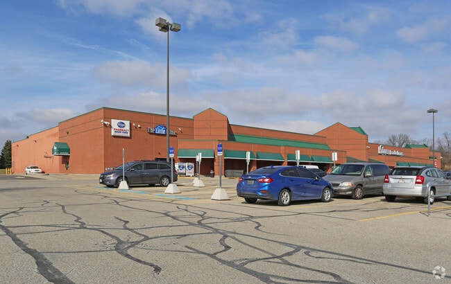
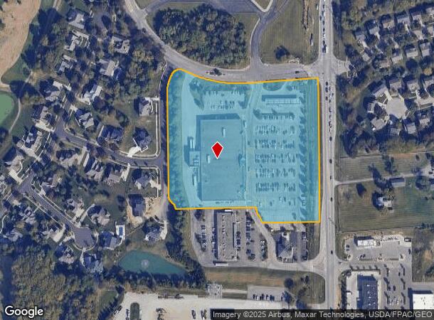
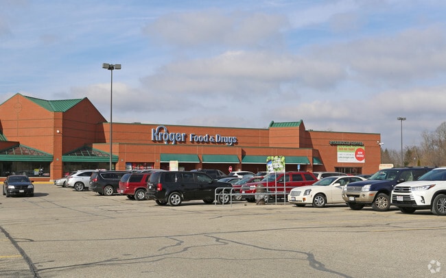
5705 S State Route 48
Cincinnati, OH-KY-IN
Shoppes Rivers Bend
16-06-425-035-1
SHOPPES RIVERS BEND LOT PT. 1
Supermarket
Warren
X
Ohio
39165C0226F
1
2024
6.14 AC
2024
Outlying Warren County
032203
Cincinnati/Dayton
65,906 SF
DEMOGRAPHICS near 5705 S State Route 48
1 Mile
3 Mile
5 Mile
2024 Total Population
6,379
36,994
81,316
2029 Population
7,040
40,632
88,894
Pop Growth 2024-2029
+ 10.36%
+ 9.83%
+ 9.32%
Average Age
38
39
40
2024 Total Households
2,252
13,424
30,029
HH Growth 2024-2029
+ 10.35%
+ 9.80%
+ 9.27%
Median Household Inc
$122,511
$107,204
$107,102
Avg Household Size
2.80
2.70
2.70
2024 Avg HH Vehicles
3.00
2.00
2.00
Median Home Value
$260,843
$276,309
$287,208
Median Year Built
2001
2002
1996
Nearby Places
Map Layers
Map Styles
 Street
 Aerial
- Restaurants
- Banks
- Shops
- Fitness
- Groceries
PUBLIC TRANSPORTATION
AIRPORT
Cincinnati/Northern Kentucky International
DRIVE
WALK
Distance
Cincinnati/Northern Kentucky International
65 min
40.3 mi
SALE & LEASE HISTORY
LISTING DATE
SALE/LEASE

Oct 30, 2017
For Sale
Aug 30, 2017
For Sale
Nearby Properties
Address
Land Use
TOTAL SIZE
Lot Size
Zoning
Address
Land Use
TOTAL SIZE
Lot Size
Zoning
23,695 SF
51.32 AC
Address
Land Use
TOTAL SIZE
Lot Size
Zoning
590.28 AC
Address
Land Use
TOTAL SIZE
Lot Size
Zoning
219,265 SF
41.57 AC
Address
Land Use
TOTAL SIZE
Lot Size
Zoning
142,640 SF
17.70 AC
Address
Land Use
TOTAL SIZE
Lot Size
Zoning
12,761 SF
47.72 AC
Address
Land Use
TOTAL SIZE
Lot Size
Zoning
17,924 SF
23.38 AC
Address
Land Use
TOTAL SIZE
Lot Size
Zoning
102.64 AC
Address
Land Use
TOTAL SIZE
Lot Size
Zoning
144,562 SF
12.17 AC
Address
Land Use
TOTAL SIZE
Lot Size
Zoning
131,524 SF
11.33 AC
Address
Land Use
TOTAL SIZE
Lot Size
Zoning
18,400 SF
56.65 AC
Address
Land Use
TOTAL SIZE
Lot Size
Zoning
9,432 SF
40.41 AC
Address
Land Use
TOTAL SIZE
Lot Size
Zoning
Address
Land Use
TOTAL SIZE
Lot Size
Zoning
76.03 AC
Address
Land Use
TOTAL SIZE
Lot Size
Zoning
63,117 SF
8.03 AC
Address
Land Use
TOTAL SIZE
Lot Size
Zoning
21,601 SF
12.40 AC
Address
Land Use
TOTAL SIZE
Lot Size
Zoning
89,389 SF
6.88 AC
Address
Land Use
TOTAL SIZE
Lot Size
Zoning
56.65 AC
Address
Land Use
TOTAL SIZE
Lot Size
Zoning
Address
Land Use
TOTAL SIZE
Lot Size
Zoning
117,046 SF
20.33 AC
Address
Land Use
TOTAL SIZE
Lot Size
Zoning
39,415 SF
18.67 AC
Address
Land Use
TOTAL SIZE
Lot Size
Zoning
258,387 SF
56.65 AC
Address
Land Use
TOTAL SIZE
Lot Size
Zoning
Address
Land Use
TOTAL SIZE
Lot Size
Zoning
23.89 AC
Address
Land Use
TOTAL SIZE
Lot Size
Zoning
23.62 AC
Address
Land Use
TOTAL SIZE
Lot Size
Zoning
Address
Land Use
TOTAL SIZE
Lot Size
Zoning
155,746 SF
15.15 AC
Address
Land Use
TOTAL SIZE
Lot Size
Zoning
98,816 SF
31 AC
Address
Land Use
TOTAL SIZE
Lot Size
Zoning
16,196 SF
5.81 AC
Address
Land Use
TOTAL SIZE
Lot Size
Zoning
Address
Land Use
TOTAL SIZE
Lot Size
Zoning
16,289 SF
0.41 AC
The World's #1 Commercial Real Estate Marketplace
Connect with us
© 2026 CoStar Group
The information above has been obtained from sources believed reliable. While we do not doubt its accuracy we have not verified it and make no guarantee, warranty or representation about it. It is your responsibility to independently confirm its accuracy and completeness. Any projections, opinions, assumptions, or estimates used are for example only and do not represent the current or future performance of the property. The value of this transaction to you depends on tax and other factors which should be evaluated by your tax, financial, and legal advisors. You and your advisors should conduct a careful, independent investigation of the property to determine to your satisfaction the suitability of the property for your needs.