Property Record
5710 75Th St, Kenosha, WI 53142

Save to a Folder
{{folder.Name}}
{{folder.ListingIds.length}} Properties
{{folder.ListingIds.length}} Property
Create a New Folder
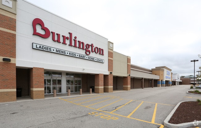
Property Detail
5710 75Th St
03-122-03-477-021
PT SE 1/4 SEC 3 T 1 R 22 BEING A RE-DIV OF LOT 3 CSM #2413 BEG AT SE COR LOT 3 CSM #2413 TH W 60 FT ALG N ROW 75TH ST TH N 17
Commercialnec
KENOSHA
B2
Wisconsin
B and X Area of moderate flood hazard, usually the area between the limits of the 100-year and 500-year floods.
3
2025
5.51 AC
2025
Kenosha East
001402
Chicago
67,850 SF
Kenosha, WI
NEARBY LISTINGS FOR SALE OR LEASE
DEMOGRAPHICS near 5710 75Th St
1 mile
3 mile
5 mile
2025 Total Population
10,124
75,652
118,762
2030 Population
10,064
74,808
117,912
Pop Growth 2025-2030
(0.59%)
(1.12%)
(0.72%)
Average Age
42
39
40
2025 Total Households
3,982
29,366
46,927
HH Growth 2025-2030
(0.65%)
(1.13%)
(0.70%)
Median Household Inc
$86,078
$71,326
$71,308
Avg Household Size
2.50
2.50
2.40
2025 Avg HH Vehicles
2.00
2.00
2.00
Median Home Value
$256,741
$232,854
$251,917
Median Year Built
1976
1969
1972
Nearby Places
Map Layers
Map Styles
 Street
 Aerial
Layers
 Traffic
 Biking
Places
Listings with unknown addresses are not visible on the map
- Restaurants
- Banks
- Shops
- Fitness
- Groceries
PUBLIC TRANSPORTATION
COMMUTER RAIL
Kenosha Station (Union Pacific North Line - Northeast Illinois Regional Commuter Railroad (Metra))
Drive
Walk
Distance
Kenosha Station (Union Pacific North Line - Northeast Illinois Regional Commuter Railroad (Metra))
9 min
4.4 mi
Winthrop Harbor Station (Union Pacific North Line - Northeast Illinois Regional Commuter Railroad (Metra))
Drive
Walk
Distance
Winthrop Harbor Station (Union Pacific North Line - Northeast Illinois Regional Commuter Railroad (Metra))
18 min
9.3 mi
AIRPORT
General Mitchell International
Drive
Walk
Distance
General Mitchell International
40 min
32.0 mi
Freight Ports
Port Milwaukee
Drive
Walk
Distance
Port Milwaukee
45 min
35.9 mi
SALE & LEASE HISTORY
LISTING DATE
SALE/LEASE

Sep 28, 2022
For Lease
May 28, 2019
For Sale
May 10, 2022
For Sale
Jan 18, 2022
For Lease
Nearby Properties
Address
Land Use
TOTAL SIZE
Lot Size
Zoning
Address
Land Use
TOTAL SIZE
Lot Size
Zoning
271,533 SF
125.41 AC
Address
Land Use
TOTAL SIZE
Lot Size
Zoning
731,186 SF
81.94 AC
M2
Address
Land Use
TOTAL SIZE
Lot Size
Zoning
176,386 SF
58.38 AC
Address
Land Use
TOTAL SIZE
Lot Size
Zoning
603,010 SF
51.30 AC
Address
Land Use
TOTAL SIZE
Lot Size
Zoning
3,886 SF
20.04 AC
Address
Land Use
TOTAL SIZE
Lot Size
Zoning
850,230 SF
39.46 AC
M2
Address
Land Use
TOTAL SIZE
Lot Size
Zoning
763,999 SF
57.67 AC
FW
Address
Land Use
TOTAL SIZE
Lot Size
Zoning
69,139 SF
12.40 AC
Address
Land Use
TOTAL SIZE
Lot Size
Zoning
424,072 SF
29.14 AC
Address
Land Use
TOTAL SIZE
Lot Size
Zoning
10.37 AC
IP
Address
Land Use
TOTAL SIZE
Lot Size
Zoning
35,092 SF
26.34 AC
B2
Address
Land Use
TOTAL SIZE
Lot Size
Zoning
357,885 SF
26.58 AC
M1
Address
Land Use
TOTAL SIZE
Lot Size
Zoning
3,721 SF
24.57 AC
FW
Address
Land Use
TOTAL SIZE
Lot Size
Zoning
26,016 SF
14.02 AC
FW
Address
Land Use
TOTAL SIZE
Lot Size
Zoning
451,022 SF
30.04 AC
Address
Land Use
TOTAL SIZE
Lot Size
Zoning
32,526 SF
47.82 AC
Address
Land Use
TOTAL SIZE
Lot Size
Zoning
52,016 SF
25.40 AC
FW
Address
Land Use
TOTAL SIZE
Lot Size
Zoning
194,281 SF
19.13 AC
B2
Address
Land Use
TOTAL SIZE
Lot Size
Zoning
85,847 SF
5.03 AC
RM2
Address
Land Use
TOTAL SIZE
Lot Size
Zoning
50,145 SF
12.76 AC
Address
Land Use
TOTAL SIZE
Lot Size
Zoning
4,643 SF
60 AC
Address
Land Use
TOTAL SIZE
Lot Size
Zoning
109,526 SF
6.61 AC
M2
Address
Land Use
TOTAL SIZE
Lot Size
Zoning
32,245 SF
22 AC
RM2
Address
Land Use
TOTAL SIZE
Lot Size
Zoning
279,872 SF
14.60 AC
M2
Address
Land Use
TOTAL SIZE
Lot Size
Zoning
15.32 AC
Address
Land Use
TOTAL SIZE
Lot Size
Zoning
253,256 SF
15.22 AC
Address
Land Use
TOTAL SIZE
Lot Size
Zoning
48,284 SF
4.99 AC
Address
Land Use
TOTAL SIZE
Lot Size
Zoning
14.40 AC
Address
Land Use
TOTAL SIZE
Lot Size
Zoning
2,963 SF
13.16 AC
Address
Land Use
TOTAL SIZE
Lot Size
Zoning
148,330 SF
17.55 AC
The World's #1 Commercial Real Estate Marketplace
Connect with us
© 2026 CoStar Group
The information above has been obtained from sources believed reliable. While we do not doubt its accuracy we have not verified it and make no guarantee, warranty or representation about it. It is your responsibility to independently confirm its accuracy and completeness. Any projections, opinions, assumptions, or estimates used are for example only and do not represent the current or future performance of the property. The value of this transaction to you depends on tax and other factors which should be evaluated by your tax, financial, and legal advisors. You and your advisors should conduct a careful, independent investigation of the property to determine to your satisfaction the suitability of the property for your needs.