Property Record
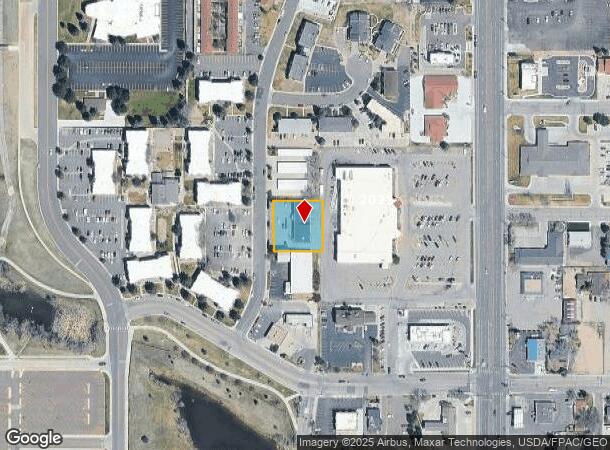
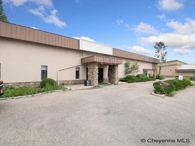
5801 Osage Ave, Cheyenne, WY 82009

NEARBY LISTINGS FOR SALE OR LEASE
Property Detail
5801 Osage Ave
Cheyenne, WY
Westgate Addition
1-9222-0005-0003-0
WESTGATE ADDITION: LOT 3, BLOCK 5
Commercialnec
Laramie
X
Wyoming
56021C1087F
3
2024
0.50 AC
2025
I-80 Corridor/Cheyenne
001200
Other Market Areas
5,400 SF
DEMOGRAPHICS near 5801 Osage Ave
1 mile
3 mile
5 mile
2024 Total Population
8,083
34,049
73,780
2029 Population
8,148
34,451
74,854
Pop Growth 2024-2029
+ 0.80%
+ 1.18%
+ 1.46%
Average Age
44
42
40
2024 Total Households
3,606
14,875
31,503
HH Growth 2024-2029
+ 0.86%
+ 1.30%
+ 1.59%
Median Household Inc
$76,528
$68,739
$61,448
Avg Household Size
2.20
2.20
2.30
2024 Avg HH Vehicles
2.00
2.00
2.00
Median Home Value
$314,037
$332,418
$282,462
Median Year Built
1978
1971
1976
Nearby Places
Map Layers
Map Styles
 Street
 Aerial
Transit
 Traffic
 Biking
Places
Listings with unknown addresses are not visible on the map
- Restaurants
- Banks
- Shops
- Fitness
- Groceries
SALE & LEASE HISTORY
LISTING DATE
SALE/LEASE

Mar 04, 2025
For Sale
Nearby Properties
Address
Land Use
TOTAL SIZE
Lot Size
Zoning
Address
Land Use
TOTAL SIZE
Lot Size
Zoning
172,393 SF
12.16 AC
Address
Land Use
TOTAL SIZE
Lot Size
Zoning
Address
Land Use
TOTAL SIZE
Lot Size
Zoning
91,021 SF
7.40 AC
Address
Land Use
TOTAL SIZE
Lot Size
Zoning
148,018 SF
Address
Land Use
TOTAL SIZE
Lot Size
Zoning
210,717 SF
18.28 AC
Address
Land Use
TOTAL SIZE
Lot Size
Zoning
219,227 SF
21.97 AC
CB
Address
Land Use
TOTAL SIZE
Lot Size
Zoning
118,588 SF
3.20 AC
CB
Address
Land Use
TOTAL SIZE
Lot Size
Zoning
69,726 SF
0.80 AC
CBD
Address
Land Use
TOTAL SIZE
Lot Size
Zoning
323,835 SF
Address
Land Use
TOTAL SIZE
Lot Size
Zoning
109,744 SF
7.04 AC
Address
Land Use
TOTAL SIZE
Lot Size
Zoning
204,822 SF
6.88 AC
HR1
Address
Land Use
TOTAL SIZE
Lot Size
Zoning
76,524 SF
6 AC
Address
Land Use
TOTAL SIZE
Lot Size
Zoning
132,839 SF
6.38 AC
Address
Land Use
TOTAL SIZE
Lot Size
Zoning
85,314 SF
5.50 AC
P
Address
Land Use
TOTAL SIZE
Lot Size
Zoning
81,948 SF
9.39 AC
CB
Address
Land Use
TOTAL SIZE
Lot Size
Zoning
142,588 SF
3.54 AC
PUD
Address
Land Use
TOTAL SIZE
Lot Size
Zoning
86,860 SF
1.70 AC
CB
Address
Land Use
TOTAL SIZE
Lot Size
Zoning
59,325 SF
0.85 AC
CBD
Address
Land Use
TOTAL SIZE
Lot Size
Zoning
79,186 SF
3.09 AC
Address
Land Use
TOTAL SIZE
Lot Size
Zoning
108,332 SF
0.80 AC
MUB
Address
Land Use
TOTAL SIZE
Lot Size
Zoning
67,628 SF
2.23 AC
Address
Land Use
TOTAL SIZE
Lot Size
Zoning
148,152 SF
15.54 AC
CB
Address
Land Use
TOTAL SIZE
Lot Size
Zoning
70,251 SF
0.77 AC
Address
Land Use
TOTAL SIZE
Lot Size
Zoning
137,640 SF
14.43 AC
CB
Address
Land Use
TOTAL SIZE
Lot Size
Zoning
83,059 SF
8.88 AC
CB
Address
Land Use
TOTAL SIZE
Lot Size
Zoning
720 SF
125 AC
Address
Land Use
TOTAL SIZE
Lot Size
Zoning
56,714 SF
5.69 AC
CB
Address
Land Use
TOTAL SIZE
Lot Size
Zoning
323,835 SF
Address
Land Use
TOTAL SIZE
Lot Size
Zoning
66,099 SF
4.46 AC
PUD
Address
Land Use
TOTAL SIZE
Lot Size
Zoning
25,369 SF
1.64 AC
PUD
The World's #1 Commercial Real Estate Marketplace
Connect with us
© 2026 CoStar Group
The information above has been obtained from sources believed reliable. While we do not doubt its accuracy we have not verified it and make no guarantee, warranty or representation about it. It is your responsibility to independently confirm its accuracy and completeness. Any projections, opinions, assumptions, or estimates used are for example only and do not represent the current or future performance of the property. The value of this transaction to you depends on tax and other factors which should be evaluated by your tax, financial, and legal advisors. You and your advisors should conduct a careful, independent investigation of the property to determine to your satisfaction the suitability of the property for your needs.