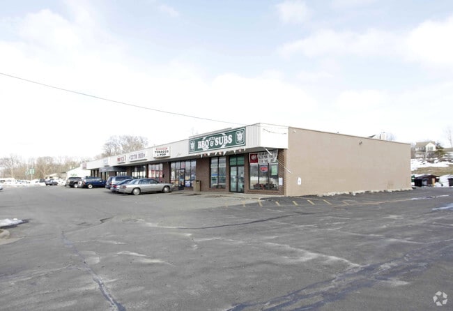
Property Record
5811 Forest Hills Rd, Rockford, IL 61114


NEARBY LISTINGS FOR SALE OR LEASE
Property Detail
5811 Forest Hills Rd
Rockford, IL
Forest Hills View No 13
12-07-226-016
FOREST HILLS VIEW NO 13 PT NE1/4 SEC 7-44-2 LOTS 34 & 35
Commercialnec
Winnebago
X
Illinois
17201C0266E
34,35
2024
1.90 AC
2024
I-39 Corr/Winnebago Cnty
000403
Chicago
16,766 SF
DEMOGRAPHICS near 5811 Forest Hills Rd
1 Mile
3 Mile
5 Mile
2024 Total Population
8,097
76,568
171,842
2029 Population
7,934
75,293
169,864
Pop Growth 2024-2029
(2.01%)
(1.67%)
(1.15%)
Average Age
44
42
40
2024 Total Households
3,518
32,282
70,819
HH Growth 2024-2029
(2.02%)
(1.70%)
(1.21%)
Median Household Inc
$52,619
$58,910
$51,253
Avg Household Size
2.20
2.30
2.30
2024 Avg HH Vehicles
2.00
2.00
2.00
Median Home Value
$156,470
$136,878
$128,927
Median Year Built
1968
1966
1965
Nearby Places
Map Layers
Map Styles
 Street
 Aerial
- Restaurants
- Banks
- Shops
- Fitness
- Groceries
PUBLIC TRANSPORTATION
AIRPORT
Chicago/Rockford International
DRIVE
WALK
Distance
Chicago/Rockford International
26 min
12.7 mi
SALE & LEASE HISTORY
LISTING DATE
SALE/LEASE

May 17, 2017
For Sale
May 12, 2021
For Lease
Nearby Properties
Address
Land Use
TOTAL SIZE
Lot Size
Zoning
Address
Land Use
TOTAL SIZE
Lot Size
Zoning
189,000 SF
56.75 AC
IL - INDUS
Address
Land Use
TOTAL SIZE
Lot Size
Zoning
212,200 SF
21 AC
C3
Address
Land Use
TOTAL SIZE
Lot Size
Zoning
106,145 SF
8.54 AC
R3
Address
Land Use
TOTAL SIZE
Lot Size
Zoning
51,580 SF
6.13 AC
Address
Land Use
TOTAL SIZE
Lot Size
Zoning
676,780 SF
32.88 AC
IG
Address
Land Use
TOTAL SIZE
Lot Size
Zoning
182,391 SF
17.90 AC
R3
Address
Land Use
TOTAL SIZE
Lot Size
Zoning
114,176 SF
4.94 AC
R4
Address
Land Use
TOTAL SIZE
Lot Size
Zoning
119,560 SF
2.89 AC
R1
Address
Land Use
TOTAL SIZE
Lot Size
Zoning
67,360 SF
5.91 AC
C2
Address
Land Use
TOTAL SIZE
Lot Size
Zoning
Address
Land Use
TOTAL SIZE
Lot Size
Zoning
151,517 SF
7.52 AC
R3
Address
Land Use
TOTAL SIZE
Lot Size
Zoning
140,085 SF
14.90 AC
Address
Land Use
TOTAL SIZE
Lot Size
Zoning
79,147 SF
5.08 AC
R3
Address
Land Use
TOTAL SIZE
Lot Size
Zoning
373,791 SF
25.40 AC
IL
Address
Land Use
TOTAL SIZE
Lot Size
Zoning
63,016 SF
5.48 AC
C1
Address
Land Use
TOTAL SIZE
Lot Size
Zoning
Address
Land Use
TOTAL SIZE
Lot Size
Zoning
32,027 SF
117.18 AC
AG
Address
Land Use
TOTAL SIZE
Lot Size
Zoning
13.45 AC
Address
Land Use
TOTAL SIZE
Lot Size
Zoning
58,526 SF
134.42 AC
RE
Address
Land Use
TOTAL SIZE
Lot Size
Zoning
645,384 SF
25.22 AC
I1
Address
Land Use
TOTAL SIZE
Lot Size
Zoning
160,937 SF
10 AC
CR
Address
Land Use
TOTAL SIZE
Lot Size
Zoning
243,057 SF
21.38 AC
C2
Address
Land Use
TOTAL SIZE
Lot Size
Zoning
123,414 SF
8.86 AC
C3
Address
Land Use
TOTAL SIZE
Lot Size
Zoning
60,479 SF
117 AC
R1
Address
Land Use
TOTAL SIZE
Lot Size
Zoning
113,175 SF
5 AC
R3
Address
Land Use
TOTAL SIZE
Lot Size
Zoning
71,305 SF
2.97 AC
R3
Address
Land Use
TOTAL SIZE
Lot Size
Zoning
82,582 SF
7.92 AC
CR
Address
Land Use
TOTAL SIZE
Lot Size
Zoning
64,848 SF
5.16 AC
R3
Address
Land Use
TOTAL SIZE
Lot Size
Zoning
119,108 SF
3.06 AC
R3
Address
Land Use
TOTAL SIZE
Lot Size
Zoning
44,213 SF
12.04 AC
R2
The World's #1 Commercial Real Estate Marketplace
Connect with us
© 2026 CoStar Group
The information above has been obtained from sources believed reliable. While we do not doubt its accuracy we have not verified it and make no guarantee, warranty or representation about it. It is your responsibility to independently confirm its accuracy and completeness. Any projections, opinions, assumptions, or estimates used are for example only and do not represent the current or future performance of the property. The value of this transaction to you depends on tax and other factors which should be evaluated by your tax, financial, and legal advisors. You and your advisors should conduct a careful, independent investigation of the property to determine to your satisfaction the suitability of the property for your needs.