Property Record
5905 S Eastern Ave, Las Vegas, NV 89119
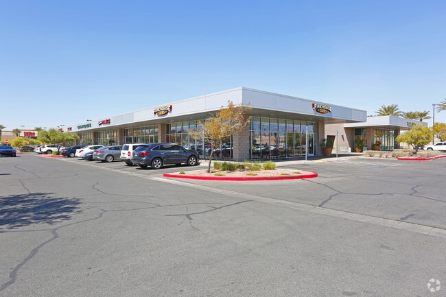


Property Detail
5905 S Eastern Ave
162-35-611-003
AIRPORT EAST LOT PLAT BOOK 113 PAGE 71 PT LOT 1
Storebuilding
Clark
C2
Nevada
B and X Area of moderate flood hazard, usually the area between the limits of the 100-year and 500-year floods.
1
2026
2.13 AC
2026
East Las Vegas
002707
Las Vegas
24,800 SF
Las Vegas-Henderson-North Las Vegas, NV
NEARBY LISTINGS FOR SALE OR LEASE
DEMOGRAPHICS near 5905 S Eastern Ave
1 mile
3 mile
5 mile
2025 Total Population
6,017
131,352
397,561
2030 Population
6,209
137,185
416,421
Pop Growth 2025-2030
+ 3.19%
+ 4.44%
+ 4.74%
Average Age
42
41
41
2025 Total Households
2,165
55,427
165,326
HH Growth 2025-2030
+ 2.96%
+ 4.46%
+ 4.90%
Median Household Inc
$71,881
$63,153
$65,298
Avg Household Size
2.60
2.30
2.30
2025 Avg HH Vehicles
2.00
2.00
2.00
Median Home Value
$402,110
$419,599
$411,630
Median Year Built
1985
1985
1990
Nearby Places
Map Layers
Map Styles
 Street
 Aerial
Layers
 Traffic
 Biking
Places
Listings with unknown addresses are not visible on the map
- Restaurants
- Banks
- Shops
- Fitness
- Groceries
PUBLIC TRANSPORTATION
AIRPORT
Harry Reid International
Drive
Walk
Distance
Harry Reid International
36 min
7.9 mi
Boulder City Municipal
Drive
Walk
Distance
Boulder City Municipal
31 min
20.5 mi
Nearby Properties
Address
Land Use
TOTAL SIZE
Lot Size
Zoning
Address
Land Use
TOTAL SIZE
Lot Size
Zoning
2,828,726 SF
101.88 AC
Address
Land Use
TOTAL SIZE
Lot Size
Zoning
79.03 AC
PF
Address
Land Use
TOTAL SIZE
Lot Size
Zoning
323,696 SF
24.62 AC
H1
Address
Land Use
TOTAL SIZE
Lot Size
Zoning
76.93 AC
PF
Address
Land Use
TOTAL SIZE
Lot Size
Zoning
138.07 AC
PF
Address
Land Use
TOTAL SIZE
Lot Size
Zoning
321,990 SF
76.15 AC
PF
Address
Land Use
TOTAL SIZE
Lot Size
Zoning
56.95 AC
PF
Address
Land Use
TOTAL SIZE
Lot Size
Zoning
459,983 SF
12.65 AC
M1
Address
Land Use
TOTAL SIZE
Lot Size
Zoning
44.69 AC
PF
Address
Land Use
TOTAL SIZE
Lot Size
Zoning
94,442 SF
6.91 AC
H1
Address
Land Use
TOTAL SIZE
Lot Size
Zoning
50,000 SF
72.01 AC
PF
Address
Land Use
TOTAL SIZE
Lot Size
Zoning
25,128 SF
3.48 AC
C:H-1
Address
Land Use
TOTAL SIZE
Lot Size
Zoning
72.03 AC
PF
Address
Land Use
TOTAL SIZE
Lot Size
Zoning
399,206 SF
22.06 AC
MD
Address
Land Use
TOTAL SIZE
Lot Size
Zoning
95,928 SF
3.71 AC
C:U-V
Address
Land Use
TOTAL SIZE
Lot Size
Zoning
8,611 SF
10 AC
H1
Address
Land Use
TOTAL SIZE
Lot Size
Zoning
239,785 SF
2.20 AC
C:R-5
Address
Land Use
TOTAL SIZE
Lot Size
Zoning
340,439 SF
3.50 AC
C:H-1
Address
Land Use
TOTAL SIZE
Lot Size
Zoning
9,164 SF
22.81 AC
R3
Address
Land Use
TOTAL SIZE
Lot Size
Zoning
148.64 AC
PF
Address
Land Use
TOTAL SIZE
Lot Size
Zoning
8,891 SF
11.59 AC
Address
Land Use
TOTAL SIZE
Lot Size
Zoning
513,085 SF
53.27 AC
C2
Address
Land Use
TOTAL SIZE
Lot Size
Zoning
198.15 AC
PF
Address
Land Use
TOTAL SIZE
Lot Size
Zoning
88,061 SF
16.87 AC
H1
Address
Land Use
TOTAL SIZE
Lot Size
Zoning
271,755 SF
2.18 AC
C:H-1
Address
Land Use
TOTAL SIZE
Lot Size
Zoning
4,460 SF
27.52 AC
Address
Land Use
TOTAL SIZE
Lot Size
Zoning
94,198 SF
22.36 AC
H1
Address
Land Use
TOTAL SIZE
Lot Size
Zoning
160 AC
PF
Address
Land Use
TOTAL SIZE
Lot Size
Zoning
125,393 SF
12.33 AC
Address
Land Use
TOTAL SIZE
Lot Size
Zoning
181,573 SF
7.68 AC
The World's #1 Commercial Real Estate Marketplace
Connect with us
© 2026 CoStar Group
The information above has been obtained from sources believed reliable. While we do not doubt its accuracy we have not verified it and make no guarantee, warranty or representation about it. It is your responsibility to independently confirm its accuracy and completeness. Any projections, opinions, assumptions, or estimates used are for example only and do not represent the current or future performance of the property. The value of this transaction to you depends on tax and other factors which should be evaluated by your tax, financial, and legal advisors. You and your advisors should conduct a careful, independent investigation of the property to determine to your satisfaction the suitability of the property for your needs.