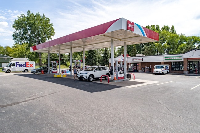
Property Record
5910 Lexington Ave N, Saint Paul, MN 55126


NEARBY LISTINGS FOR SALE OR LEASE
Property Detail
5910 Lexington Ave N
Minneapolis-St. Paul-Bloomington, MN-WI
Willow Creek Two
03-30-23-24-0064
WILLOW CREEK TWO SUBJ TO RD; OUTLOT A
Stripcommercialcenter
Ramsey
X
Minnesota
27053C0250F
a
2024
2.35 AC
2025
Rosedale
040705
Minneapolis/St Paul
14,500 SF
DEMOGRAPHICS near 5910 Lexington Ave N
1 Mile
3 Mile
5 Mile
2024 Total Population
6,403
46,599
125,290
2029 Population
6,314
46,780
126,294
Pop Growth 2024-2029
(1.39%)
+ 0.39%
+ 0.80%
Average Age
43
41
41
2024 Total Households
2,520
17,936
48,033
HH Growth 2024-2029
(1.47%)
+ 0.19%
+ 0.63%
Median Household Inc
$114,525
$91,058
$92,111
Avg Household Size
2.50
2.60
2.50
2024 Avg HH Vehicles
2.00
2.00
2.00
Median Home Value
$357,661
$308,035
$316,663
Median Year Built
1985
1983
1981
Nearby Places
Map Layers
Map Styles
 Street
 Aerial
- Restaurants
- Banks
- Shops
- Fitness
- Groceries
PUBLIC TRANSPORTATION
AIRPORT
Minneapolis-St Paul International/Wold-Chamberlain
DRIVE
WALK
Distance
Minneapolis-St Paul International/Wold-Chamberlain
35 min
23.4 mi
Freight Ports
Port Milwaukee
DRIVE
WALK
Distance
Port Milwaukee
380 min
342.4 mi
SALE & LEASE HISTORY
LISTING DATE
SALE/LEASE

Aug 29, 2019
For Sale
Nearby Properties
Address
Land Use
TOTAL SIZE
Lot Size
Zoning
Address
Land Use
TOTAL SIZE
Lot Size
Zoning
2,443,869 SF
31.79 AC
Address
Land Use
TOTAL SIZE
Lot Size
Zoning
467.27 AC
Address
Land Use
TOTAL SIZE
Lot Size
Zoning
372.05 AC
Address
Land Use
TOTAL SIZE
Lot Size
Zoning
141,716 SF
567.20 AC
Address
Land Use
TOTAL SIZE
Lot Size
Zoning
226,201 SF
70.59 AC
Address
Land Use
TOTAL SIZE
Lot Size
Zoning
33,060 SF
20.14 AC
Address
Land Use
TOTAL SIZE
Lot Size
Zoning
223.30 AC
Address
Land Use
TOTAL SIZE
Lot Size
Zoning
264,300 SF
4.16 AC
Address
Land Use
TOTAL SIZE
Lot Size
Zoning
Address
Land Use
TOTAL SIZE
Lot Size
Zoning
260,375 SF
4.24 AC
Address
Land Use
TOTAL SIZE
Lot Size
Zoning
606,798 SF
49.16 AC
Address
Land Use
TOTAL SIZE
Lot Size
Zoning
239,318 SF
Address
Land Use
TOTAL SIZE
Lot Size
Zoning
109.41 AC
Address
Land Use
TOTAL SIZE
Lot Size
Zoning
150,034 SF
48.48 AC
Address
Land Use
TOTAL SIZE
Lot Size
Zoning
115.62 AC
Address
Land Use
TOTAL SIZE
Lot Size
Zoning
91,679 SF
35.89 AC
Address
Land Use
TOTAL SIZE
Lot Size
Zoning
Address
Land Use
TOTAL SIZE
Lot Size
Zoning
208 SF
228 AC
Address
Land Use
TOTAL SIZE
Lot Size
Zoning
248,816 SF
14.02 AC
Address
Land Use
TOTAL SIZE
Lot Size
Zoning
186,928 SF
4.07 AC
Address
Land Use
TOTAL SIZE
Lot Size
Zoning
146,862 SF
41.08 AC
Address
Land Use
TOTAL SIZE
Lot Size
Zoning
398,544 SF
17.52 AC
Address
Land Use
TOTAL SIZE
Lot Size
Zoning
190,377 SF
9.61 AC
Address
Land Use
TOTAL SIZE
Lot Size
Zoning
109,136 SF
Address
Land Use
TOTAL SIZE
Lot Size
Zoning
61,740 SF
16.10 AC
Address
Land Use
TOTAL SIZE
Lot Size
Zoning
77,940 SF
19.07 AC
Address
Land Use
TOTAL SIZE
Lot Size
Zoning
121,740 SF
9.40 AC
Address
Land Use
TOTAL SIZE
Lot Size
Zoning
Address
Land Use
TOTAL SIZE
Lot Size
Zoning
112,500 SF
7.55 AC
Address
Land Use
TOTAL SIZE
Lot Size
Zoning
392,607 SF
30.31 AC
The World's #1 Commercial Real Estate Marketplace
Connect with us
© 2026 CoStar Group
The information above has been obtained from sources believed reliable. While we do not doubt its accuracy we have not verified it and make no guarantee, warranty or representation about it. It is your responsibility to independently confirm its accuracy and completeness. Any projections, opinions, assumptions, or estimates used are for example only and do not represent the current or future performance of the property. The value of this transaction to you depends on tax and other factors which should be evaluated by your tax, financial, and legal advisors. You and your advisors should conduct a careful, independent investigation of the property to determine to your satisfaction the suitability of the property for your needs.