Property Record
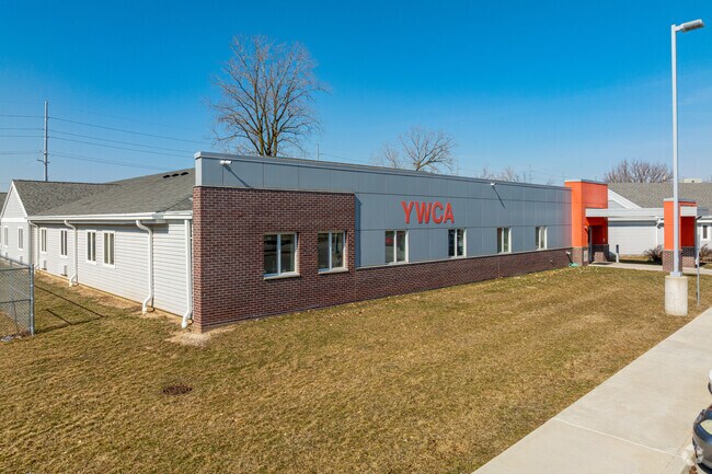
5920 Decatur Rd, Fort Wayne, IN 46816


NEARBY LISTINGS FOR SALE OR LEASE
Property Detail
5920 Decatur Rd
02-12-25-126-004.000-074
7.01 A IRR TRACT 388.57 S OF NW COR NE 1/4 NW 1/4 SEC 25
Charitableorganization
Allen
X
Indiana
18003C0294G
70.10 AC
0
South Fort Wayne
2025
Fort Wayne
003600
Fort Wayne, IN
22,841 SF
DEMOGRAPHICS near 5920 Decatur Rd
1 Mile
3 Mile
5 Mile
2024 Total Population
13,721
82,845
131,955
2029 Population
14,360
86,674
138,075
Pop Growth 2024-2029
+ 4.66%
+ 4.62%
+ 4.64%
Average Age
34
35
36
2024 Total Households
4,897
31,364
52,846
HH Growth 2024-2029
+ 4.59%
+ 4.57%
+ 4.68%
Median Household Inc
$39,676
$41,975
$43,085
Avg Household Size
2.70
2.50
2.40
2024 Avg HH Vehicles
2.00
2.00
2.00
Median Home Value
$69,521
$100,636
$109,353
Median Year Built
1958
1960
1957
Nearby Places
Map Layers
Map Styles
 Street
 Aerial
- Restaurants
- Banks
- Shops
- Fitness
- Groceries
PUBLIC TRANSPORTATION
AIRPORT
Fort Wayne International
DRIVE
WALK
Distance
Fort Wayne International
15 min
7.8 mi
Freight Ports
Port of Toledo
DRIVE
WALK
Distance
Port of Toledo
141 min
107.4 mi
SALE & LEASE HISTORY
LISTING DATE
SALE/LEASE

Dec 02, 2020
For Sale
Nearby Properties
Address
Land Use
TOTAL SIZE
Lot Size
Zoning
Address
Land Use
TOTAL SIZE
Lot Size
Zoning
385,470 SF
36.85 AC
Address
Land Use
TOTAL SIZE
Lot Size
Zoning
270,448 SF
41.83 AC
Address
Land Use
TOTAL SIZE
Lot Size
Zoning
300,402 SF
259.60 AC
Address
Land Use
TOTAL SIZE
Lot Size
Zoning
217,151 SF
207.20 AC
Address
Land Use
TOTAL SIZE
Lot Size
Zoning
316,421 SF
25.01 AC
Address
Land Use
TOTAL SIZE
Lot Size
Zoning
167,836 SF
4.30 AC
Address
Land Use
TOTAL SIZE
Lot Size
Zoning
43,122 SF
11.44 AC
Address
Land Use
TOTAL SIZE
Lot Size
Zoning
243,087 SF
324.91 AC
Address
Land Use
TOTAL SIZE
Lot Size
Zoning
95,432 SF
386.87 AC
Address
Land Use
TOTAL SIZE
Lot Size
Zoning
187,552 SF
15.32 AC
Address
Land Use
TOTAL SIZE
Lot Size
Zoning
39,902 SF
25.87 AC
Address
Land Use
TOTAL SIZE
Lot Size
Zoning
172,656 SF
14.44 AC
Address
Land Use
TOTAL SIZE
Lot Size
Zoning
169,011 SF
171.40 AC
Address
Land Use
TOTAL SIZE
Lot Size
Zoning
178,278 SF
10.59 AC
Address
Land Use
TOTAL SIZE
Lot Size
Zoning
398,376 SF
31.30 AC
Address
Land Use
TOTAL SIZE
Lot Size
Zoning
118,008 SF
0.89 AC
Address
Land Use
TOTAL SIZE
Lot Size
Zoning
171,454 SF
19.38 AC
Address
Land Use
TOTAL SIZE
Lot Size
Zoning
72,383 SF
10 AC
Address
Land Use
TOTAL SIZE
Lot Size
Zoning
174,206 SF
10.50 AC
Address
Land Use
TOTAL SIZE
Lot Size
Zoning
156,593 SF
12.27 AC
Address
Land Use
TOTAL SIZE
Lot Size
Zoning
77,504 SF
5.92 AC
Address
Land Use
TOTAL SIZE
Lot Size
Zoning
27,060 SF
220.99 AC
Address
Land Use
TOTAL SIZE
Lot Size
Zoning
101,294 SF
10.08 AC
Address
Land Use
TOTAL SIZE
Lot Size
Zoning
186,975 SF
14.79 AC
Address
Land Use
TOTAL SIZE
Lot Size
Zoning
113,012 SF
6.71 AC
Address
Land Use
TOTAL SIZE
Lot Size
Zoning
121,790 SF
94.43 AC
Address
Land Use
TOTAL SIZE
Lot Size
Zoning
155,867 SF
218.80 AC
Address
Land Use
TOTAL SIZE
Lot Size
Zoning
50,453 SF
0.87 AC
Address
Land Use
TOTAL SIZE
Lot Size
Zoning
163,842 SF
130.90 AC
Address
Land Use
TOTAL SIZE
Lot Size
Zoning
160,526 SF
433.70 AC
The World's #1 Commercial Real Estate Marketplace
Connect with us
© 2026 CoStar Group
The information above has been obtained from sources believed reliable. While we do not doubt its accuracy we have not verified it and make no guarantee, warranty or representation about it. It is your responsibility to independently confirm its accuracy and completeness. Any projections, opinions, assumptions, or estimates used are for example only and do not represent the current or future performance of the property. The value of this transaction to you depends on tax and other factors which should be evaluated by your tax, financial, and legal advisors. You and your advisors should conduct a careful, independent investigation of the property to determine to your satisfaction the suitability of the property for your needs.