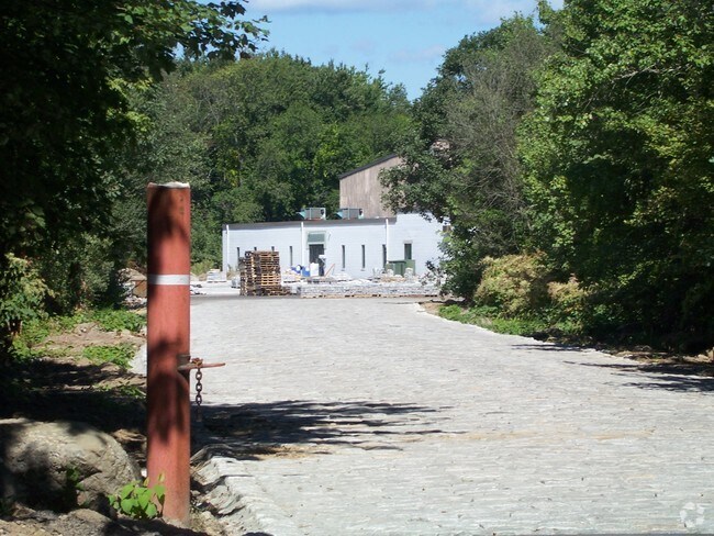
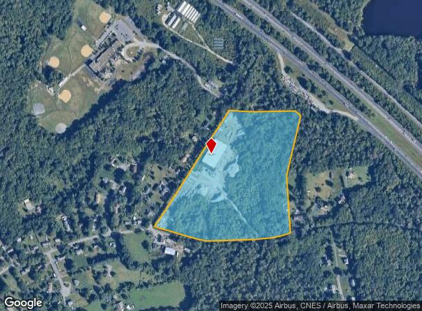
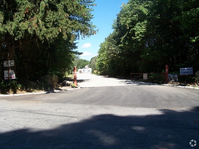
Property Record
6 Colletti Ln, Swansea, MA 02777

NEARBY LISTINGS FOR SALE OR LEASE
Property Detail
6 Colletti Ln
Manufacturinglight
Bristol
X
Massachusetts
25005C0238G
20 AC
2025
Attleboro/New Bedford
2025
Boston
645103
Providence-Warwick, RI-MA
33,204 SF
SWAN-000130-000032
DEMOGRAPHICS near 6 Colletti Ln
1 Mile
3 Mile
5 Mile
2024 Total Population
1,999
20,194
71,190
2029 Population
1,982
20,116
70,973
Pop Growth 2024-2029
(0.85%)
(0.39%)
(0.30%)
Average Age
45
44
44
2024 Total Households
773
8,046
27,779
HH Growth 2024-2029
(1.03%)
(0.50%)
(0.38%)
Median Household Inc
$108,952
$101,097
$106,858
Avg Household Size
2.50
2.50
2.50
2024 Avg HH Vehicles
2.00
2.00
2.00
Median Home Value
$438,889
$396,161
$410,424
Median Year Built
1977
1969
1965
Nearby Places
Map Layers
Map Styles
 Street
 Aerial
- Restaurants
- Banks
- Shops
- Fitness
- Groceries
PUBLIC TRANSPORTATION
AIRPORT
Rhode Island Tf Green International
DRIVE
WALK
Distance
Rhode Island Tf Green International
32 min
18.8 mi
Nearby Properties
Address
Land Use
TOTAL SIZE
Lot Size
Zoning
Address
Land Use
TOTAL SIZE
Lot Size
Zoning
179,889 SF
17.96 AC
C
Address
Land Use
TOTAL SIZE
Lot Size
Zoning
143,084 SF
12.60 AC
R1
Address
Land Use
TOTAL SIZE
Lot Size
Zoning
152,620 SF
20.73 AC
C
Address
Land Use
TOTAL SIZE
Lot Size
Zoning
137,976 SF
10.59 AC
C
Address
Land Use
TOTAL SIZE
Lot Size
Zoning
140,460 SF
12.50 AC
R10
Address
Land Use
TOTAL SIZE
Lot Size
Zoning
70,741 SF
16.24 AC
Address
Land Use
TOTAL SIZE
Lot Size
Zoning
1.97 AC
R10
Address
Land Use
TOTAL SIZE
Lot Size
Zoning
24,480 SF
4.69 AC
C
Address
Land Use
TOTAL SIZE
Lot Size
Zoning
199,796 SF
9.11 AC
RB
Address
Land Use
TOTAL SIZE
Lot Size
Zoning
51,308 SF
10.34 AC
C
Address
Land Use
TOTAL SIZE
Lot Size
Zoning
177,003 SF
26.96 AC
C
Address
Land Use
TOTAL SIZE
Lot Size
Zoning
31,588 SF
18.21 AC
RE
Address
Land Use
TOTAL SIZE
Lot Size
Zoning
91,510 SF
Address
Land Use
TOTAL SIZE
Lot Size
Zoning
29,058 SF
21.97 AC
R40
Address
Land Use
TOTAL SIZE
Lot Size
Zoning
1,800 SF
3.39 AC
R1
Address
Land Use
TOTAL SIZE
Lot Size
Zoning
36,188 SF
65 AC
R1
Address
Land Use
TOTAL SIZE
Lot Size
Zoning
64,850 SF
11.67 AC
CI
Address
Land Use
TOTAL SIZE
Lot Size
Zoning
91,235 SF
Address
Land Use
TOTAL SIZE
Lot Size
Zoning
112,123 SF
Address
Land Use
TOTAL SIZE
Lot Size
Zoning
23,758 SF
6 AC
C
Address
Land Use
TOTAL SIZE
Lot Size
Zoning
61,743 SF
42.75 AC
R20
Address
Land Use
TOTAL SIZE
Lot Size
Zoning
2,878 SF
29.25 AC
R1
Address
Land Use
TOTAL SIZE
Lot Size
Zoning
36,316 SF
8.38 AC
C
Address
Land Use
TOTAL SIZE
Lot Size
Zoning
54,751 SF
4.30 AC
C
Address
Land Use
TOTAL SIZE
Lot Size
Zoning
6,540 SF
27.30 AC
Address
Land Use
TOTAL SIZE
Lot Size
Zoning
13,314 SF
1.73 AC
C
Address
Land Use
TOTAL SIZE
Lot Size
Zoning
46,100 SF
17.79 AC
C
Address
Land Use
TOTAL SIZE
Lot Size
Zoning
39,809 SF
4.80 AC
C
Address
Land Use
TOTAL SIZE
Lot Size
Zoning
27,848 SF
3.37 AC
C
Address
Land Use
TOTAL SIZE
Lot Size
Zoning
48,192 SF
5.62 AC
C
The World's #1 Commercial Real Estate Marketplace
Connect with us
© 2025 CoStar Group
The information above has been obtained from sources believed reliable. While we do not doubt its accuracy we have not verified it and make no guarantee, warranty or representation about it. It is your responsibility to independently confirm its accuracy and completeness. Any projections, opinions, assumptions, or estimates used are for example only and do not represent the current or future performance of the property. The value of this transaction to you depends on tax and other factors which should be evaluated by your tax, financial, and legal advisors. You and your advisors should conduct a careful, independent investigation of the property to determine to your satisfaction the suitability of the property for your needs.