Property Record
60 E State St, Hartford, WI 53027

Property Detail
60 E State St
Milwaukee-Waukesha, WI
PT OF NW NE S OF RR DOC 1555080+1617536+1618937 EXC PT ANNEXED
T6-047700Z
WASHINGTON
Vacantlandnec
Wisconsin
B and X Area of moderate flood hazard, usually the area between the limits of the 100-year and 500-year floods.
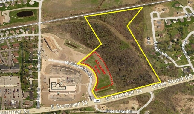
9.11 AC
2025
Washington West
2025
Milwaukee/Madison
440200
NEARBY LISTINGS FOR SALE OR LEASE
DEMOGRAPHICS near 60 E State St
1 mile
3 mile
5 mile
2025 Total Population
3,207
21,718
30,410
2030 Population
3,258
22,141
31,022
Pop Growth 2025-2030
+ 1.59%
+ 1.95%
+ 2.01%
Average Age
45
41
42
2025 Total Households
1,419
9,013
12,377
HH Growth 2025-2030
+ 1.48%
+ 1.83%
+ 1.91%
Median Household Inc
$79,294
$81,390
$89,838
Avg Household Size
2.20
2.40
2.40
2025 Avg HH Vehicles
2.00
2.00
2.00
Median Home Value
$350,769
$313,307
$342,069
Median Year Built
1992
1991
1991
Nearby Places
Map Layers
Map Styles
 Street
 Aerial
Layers
 Traffic
 Biking
Places
Listings with unknown addresses are not visible on the map
- Restaurants
- Banks
- Shops
- Fitness
- Groceries
SALE & LEASE HISTORY
LISTING DATE
SALE/LEASE

Sep 24, 2016
For Sale
Nov 28, 2016
For Sale
Aug 09, 2017
For Sale
Apr 12, 2017
For Sale
Nearby Properties
Address
Land Use
TOTAL SIZE
Lot Size
Zoning
Address
Land Use
TOTAL SIZE
Lot Size
Zoning
49,735 SF
9.99 AC
Address
Land Use
TOTAL SIZE
Lot Size
Zoning
13,314 SF
16.91 AC
Address
Land Use
TOTAL SIZE
Lot Size
Zoning
70,221 SF
7.09 AC
Address
Land Use
TOTAL SIZE
Lot Size
Zoning
94,819 SF
0.18 AC
Address
Land Use
TOTAL SIZE
Lot Size
Zoning
11.63 AC
Address
Land Use
TOTAL SIZE
Lot Size
Zoning
22,814 SF
8.85 AC
Address
Land Use
TOTAL SIZE
Lot Size
Zoning
184,928 SF
22.37 AC
Address
Land Use
TOTAL SIZE
Lot Size
Zoning
16.35 AC
Address
Land Use
TOTAL SIZE
Lot Size
Zoning
15,408 SF
9.39 AC
Address
Land Use
TOTAL SIZE
Lot Size
Zoning
57,888 SF
2.45 AC
Address
Land Use
TOTAL SIZE
Lot Size
Zoning
37,038 SF
1.02 AC
Address
Land Use
TOTAL SIZE
Lot Size
Zoning
5.09 AC
Address
Land Use
TOTAL SIZE
Lot Size
Zoning
8.10 AC
Address
Land Use
TOTAL SIZE
Lot Size
Zoning
6,620 SF
1.26 AC
Address
Land Use
TOTAL SIZE
Lot Size
Zoning
26,340 SF
5.01 AC
Address
Land Use
TOTAL SIZE
Lot Size
Zoning
5.03 AC
Address
Land Use
TOTAL SIZE
Lot Size
Zoning
36,686 SF
1.86 AC
Address
Land Use
TOTAL SIZE
Lot Size
Zoning
55,326 SF
1.37 AC
Address
Land Use
TOTAL SIZE
Lot Size
Zoning
14,276 SF
9.02 AC
Address
Land Use
TOTAL SIZE
Lot Size
Zoning
14,015 SF
2.50 AC
Address
Land Use
TOTAL SIZE
Lot Size
Zoning
15,408 SF
5.25 AC
Address
Land Use
TOTAL SIZE
Lot Size
Zoning
63,705 SF
6.85 AC
Address
Land Use
TOTAL SIZE
Lot Size
Zoning
7.96 AC
Address
Land Use
TOTAL SIZE
Lot Size
Zoning
28,326 SF
3.27 AC
Address
Land Use
TOTAL SIZE
Lot Size
Zoning
7.30 AC
Address
Land Use
TOTAL SIZE
Lot Size
Zoning
Address
Land Use
TOTAL SIZE
Lot Size
Zoning
8.28 AC
Address
Land Use
TOTAL SIZE
Lot Size
Zoning
6,334 SF
2.86 AC
Address
Land Use
TOTAL SIZE
Lot Size
Zoning
184,483 SF
13.89 AC
Address
Land Use
TOTAL SIZE
Lot Size
Zoning
10,870 SF
2.99 AC
The World's #1 Commercial Real Estate Marketplace
Connect with us
© 2026 CoStar Group
The information above has been obtained from sources believed reliable. While we do not doubt its accuracy we have not verified it and make no guarantee, warranty or representation about it. It is your responsibility to independently confirm its accuracy and completeness. Any projections, opinions, assumptions, or estimates used are for example only and do not represent the current or future performance of the property. The value of this transaction to you depends on tax and other factors which should be evaluated by your tax, financial, and legal advisors. You and your advisors should conduct a careful, independent investigation of the property to determine to your satisfaction the suitability of the property for your needs.