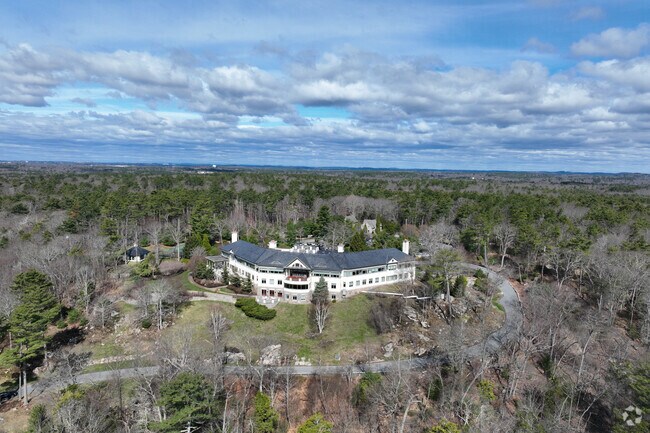
Property Record
600 Hale St, Beverly, MA 01915
NEARBY LISTINGS FOR SALE OR LEASE
Property Detail
600 Hale St
Boston-Cambridge-Newton, MA-NH
Essex
BEVE-000036-000028
Massachusetts
Commercialnec
86.67 AC
X
Danvers/Beverly
25009C0429G
Boston
44,966 SF
DEMOGRAPHICS near 600 Hale St
1 Mile
3 Mile
5 Mile
2024 Total Population
2,795
28,108
96,580
2029 Population
2,749
27,906
96,023
Pop Growth 2024-2029
(1.65%)
(0.72%)
(0.58%)
Average Age
36
40
42
2024 Total Households
673
10,095
39,735
HH Growth 2024-2029
(2.23%)
(0.76%)
(0.73%)
Median Household Inc
$215,385
$108,136
$97,110
Avg Household Size
2.30
2.40
2.30
2024 Avg HH Vehicles
2.00
2.00
2.00
Median Home Value
$859,735
$680,074
$653,193
Median Year Built
1961
1956
1951
Nearby Places
Map Layers
Map Styles
 Street
 Aerial
- Restaurants
- Banks
- Shops
- Fitness
- Groceries
PUBLIC TRANSPORTATION
COMMUTER RAIL
Beverly Farms (Newburyport/Rockport Line - Massachusetts Bay Transportation Authority Commuter Rail (Purple Line))
DRIVE
WALK
Distance
Beverly Farms (Newburyport/Rockport Line - Massachusetts Bay Transportation Authority Commuter Rail (Purple Line))
5 min
1.2 mi
Montserrat (Newburyport/Rockport Line - Massachusetts Bay Transportation Authority Commuter Rail (Purple Line))
DRIVE
WALK
Distance
Montserrat (Newburyport/Rockport Line - Massachusetts Bay Transportation Authority Commuter Rail (Purple Line))
8 min
2.8 mi
AIRPORT
General Edward Lawrence Logan International
DRIVE
WALK
Distance
General Edward Lawrence Logan International
40 min
20.4 mi
Freight Ports
Port of Boston
DRIVE
WALK
Distance
Port of Boston
46 min
23.1 mi
Nearby Properties
Address
Land Use
TOTAL SIZE
Lot Size
Zoning
Address
Land Use
TOTAL SIZE
Lot Size
Zoning
496,607 SF
71.29 AC
R45
Address
Land Use
TOTAL SIZE
Lot Size
Zoning
267,051 SF
41.08 AC
R10
Address
Land Use
TOTAL SIZE
Lot Size
Zoning
228,295 SF
12.50 AC
RMD
Address
Land Use
TOTAL SIZE
Lot Size
Zoning
138,311 SF
56.04 AC
R45
Address
Land Use
TOTAL SIZE
Lot Size
Zoning
170,652 SF
23.73 AC
HD
Address
Land Use
TOTAL SIZE
Lot Size
Zoning
10,464 SF
237.02 AC
Address
Land Use
TOTAL SIZE
Lot Size
Zoning
108,259 SF
17.30 AC
R45
Address
Land Use
TOTAL SIZE
Lot Size
Zoning
91,168 SF
2.09 AC
CC
Address
Land Use
TOTAL SIZE
Lot Size
Zoning
64,845 SF
6.50 AC
RMD
Address
Land Use
TOTAL SIZE
Lot Size
Zoning
75,348 SF
1.35 AC
RMD
Address
Land Use
TOTAL SIZE
Lot Size
Zoning
207,095 SF
IR
Address
Land Use
TOTAL SIZE
Lot Size
Zoning
15,923 SF
7.44 AC
E
Address
Land Use
TOTAL SIZE
Lot Size
Zoning
99,412 SF
5.55 AC
C
Address
Land Use
TOTAL SIZE
Lot Size
Zoning
79,964 SF
7.78 AC
R15
Address
Land Use
TOTAL SIZE
Lot Size
Zoning
50,742 SF
6.68 AC
RMD
Address
Land Use
TOTAL SIZE
Lot Size
Zoning
68,740 SF
6.50 AC
IR
Address
Land Use
TOTAL SIZE
Lot Size
Zoning
140,215 SF
4.89 AC
RMD
Address
Land Use
TOTAL SIZE
Lot Size
Zoning
156,675 SF
IR
Address
Land Use
TOTAL SIZE
Lot Size
Zoning
23,931 SF
3.16 AC
R90
Address
Land Use
TOTAL SIZE
Lot Size
Zoning
2.61 AC
E
Address
Land Use
TOTAL SIZE
Lot Size
Zoning
73,019 SF
1.43 AC
CC
Address
Land Use
TOTAL SIZE
Lot Size
Zoning
97,396 SF
IR
Address
Land Use
TOTAL SIZE
Lot Size
Zoning
60,343 SF
4.08 AC
HD
Address
Land Use
TOTAL SIZE
Lot Size
Zoning
93,605 SF
17.51 AC
R90
Address
Land Use
TOTAL SIZE
Lot Size
Zoning
12,116 SF
15 AC
R10
Address
Land Use
TOTAL SIZE
Lot Size
Zoning
27,649 SF
4.42 AC
R10
Address
Land Use
TOTAL SIZE
Lot Size
Zoning
142,596 SF
10.93 AC
IR
Address
Land Use
TOTAL SIZE
Lot Size
Zoning
4.02 AC
E
Address
Land Use
TOTAL SIZE
Lot Size
Zoning
127,674 SF
14.04 AC
IR
The World's #1 Commercial Real Estate Marketplace
Connect with us
© 2026 CoStar Group
The information above has been obtained from sources believed reliable. While we do not doubt its accuracy we have not verified it and make no guarantee, warranty or representation about it. It is your responsibility to independently confirm its accuracy and completeness. Any projections, opinions, assumptions, or estimates used are for example only and do not represent the current or future performance of the property. The value of this transaction to you depends on tax and other factors which should be evaluated by your tax, financial, and legal advisors. You and your advisors should conduct a careful, independent investigation of the property to determine to your satisfaction the suitability of the property for your needs.