Property Record
600 Marion Rd, Columbus, OH 43207
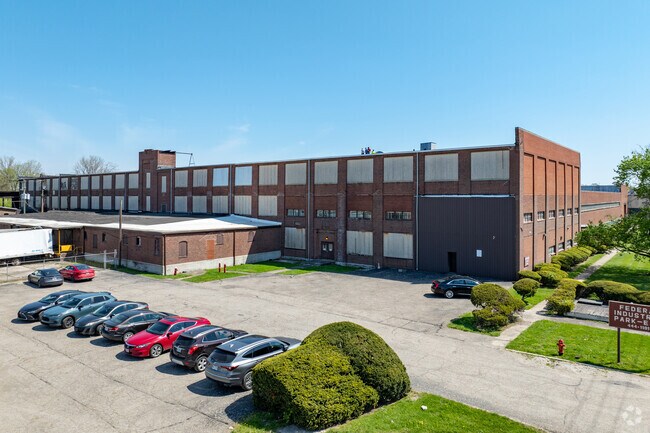

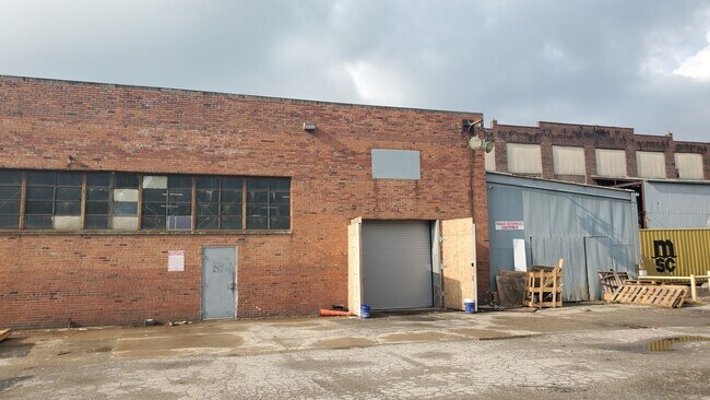
Property Detail
600 Marion Rd
Columbus, OH
MARION RD MARION SUB 3 26.670 ACRES
010-103969
FRANKLIN
Lightindustrial
Ohio
2024
26.67 AC
2025
Downtown South
008720
Columbus
472,448 SF
NEARBY LISTINGS FOR SALE OR LEASE
DEMOGRAPHICS near 600 Marion Rd
1 mile
3 mile
5 mile
2025 Total Population
12,609
97,024
266,099
2030 Population
13,221
102,180
278,059
Pop Growth 2025-2030
+ 4.85%
+ 5.31%
+ 4.49%
Average Age
38
38
38
2025 Total Households
5,252
44,223
117,765
HH Growth 2025-2030
+ 4.89%
+ 5.56%
+ 4.75%
Median Household Inc
$48,234
$59,975
$59,296
Avg Household Size
2.30
2.10
2.20
2025 Avg HH Vehicles
2.00
1.00
2.00
Median Home Value
$184,916
$269,505
$255,088
Median Year Built
1948
1957
1963
Nearby Places
Map Layers
Map Styles
 Street
 Aerial
Layers
 Traffic
 Biking
Places
Listings with unknown addresses are not visible on the map
- Restaurants
- Banks
- Shops
- Fitness
- Groceries
PUBLIC TRANSPORTATION
AIRPORT
John Glenn Columbus International
Drive
Walk
Distance
John Glenn Columbus International
17 min
10.0 mi
Freight Ports
Port of Baltimore
Drive
Walk
Distance
Port of Baltimore
1 min
342.6 mi
SALE & LEASE HISTORY
LISTING DATE
SALE/LEASE

Nov 07, 2016
For Lease
Nearby Properties
Address
Land Use
TOTAL SIZE
Lot Size
Zoning
Address
Land Use
TOTAL SIZE
Lot Size
Zoning
1,949,795 SF
20.56 AC
Address
Land Use
TOTAL SIZE
Lot Size
Zoning
1,467,891 SF
10.49 AC
Address
Land Use
TOTAL SIZE
Lot Size
Zoning
382.42 AC
Address
Land Use
TOTAL SIZE
Lot Size
Zoning
717,666 SF
17.99 AC
Address
Land Use
TOTAL SIZE
Lot Size
Zoning
304,340 SF
3.86 AC
Address
Land Use
TOTAL SIZE
Lot Size
Zoning
477,854 SF
0.72 AC
Address
Land Use
TOTAL SIZE
Lot Size
Zoning
798,272 SF
9.94 AC
Address
Land Use
TOTAL SIZE
Lot Size
Zoning
832,673 SF
2.87 AC
Address
Land Use
TOTAL SIZE
Lot Size
Zoning
481,704 SF
0.92 AC
Address
Land Use
TOTAL SIZE
Lot Size
Zoning
1,113,919 SF
1.63 AC
Address
Land Use
TOTAL SIZE
Lot Size
Zoning
1,462,053 SF
0.21 AC
Address
Land Use
TOTAL SIZE
Lot Size
Zoning
484,662 SF
2.28 AC
Address
Land Use
TOTAL SIZE
Lot Size
Zoning
339,231 SF
0.73 AC
Address
Land Use
TOTAL SIZE
Lot Size
Zoning
1,013,906 SF
1 AC
Address
Land Use
TOTAL SIZE
Lot Size
Zoning
669,626 SF
0.97 AC
Address
Land Use
TOTAL SIZE
Lot Size
Zoning
459,012 SF
3.71 AC
Address
Land Use
TOTAL SIZE
Lot Size
Zoning
697,192 SF
2.72 AC
Address
Land Use
TOTAL SIZE
Lot Size
Zoning
597,600 SF
68.91 AC
Address
Land Use
TOTAL SIZE
Lot Size
Zoning
180,636 SF
4.33 AC
Address
Land Use
TOTAL SIZE
Lot Size
Zoning
122,019 SF
0.92 AC
Address
Land Use
TOTAL SIZE
Lot Size
Zoning
573,031 SF
5.88 AC
Address
Land Use
TOTAL SIZE
Lot Size
Zoning
496,729 SF
3.47 AC
Address
Land Use
TOTAL SIZE
Lot Size
Zoning
243,888 SF
0.88 AC
Address
Land Use
TOTAL SIZE
Lot Size
Zoning
360,962 SF
33.91 AC
Address
Land Use
TOTAL SIZE
Lot Size
Zoning
440,454 SF
3.92 AC
Address
Land Use
TOTAL SIZE
Lot Size
Zoning
252,380 SF
0.80 AC
Address
Land Use
TOTAL SIZE
Lot Size
Zoning
523,793 SF
6.94 AC
Address
Land Use
TOTAL SIZE
Lot Size
Zoning
157,856 SF
0.74 AC
Address
Land Use
TOTAL SIZE
Lot Size
Zoning
705,600 SF
43.41 AC
Address
Land Use
TOTAL SIZE
Lot Size
Zoning
229,128 SF
1.18 AC
The World's #1 Commercial Real Estate Marketplace
Connect with us
© 2026 CoStar Group
The information above has been obtained from sources believed reliable. While we do not doubt its accuracy we have not verified it and make no guarantee, warranty or representation about it. It is your responsibility to independently confirm its accuracy and completeness. Any projections, opinions, assumptions, or estimates used are for example only and do not represent the current or future performance of the property. The value of this transaction to you depends on tax and other factors which should be evaluated by your tax, financial, and legal advisors. You and your advisors should conduct a careful, independent investigation of the property to determine to your satisfaction the suitability of the property for your needs.