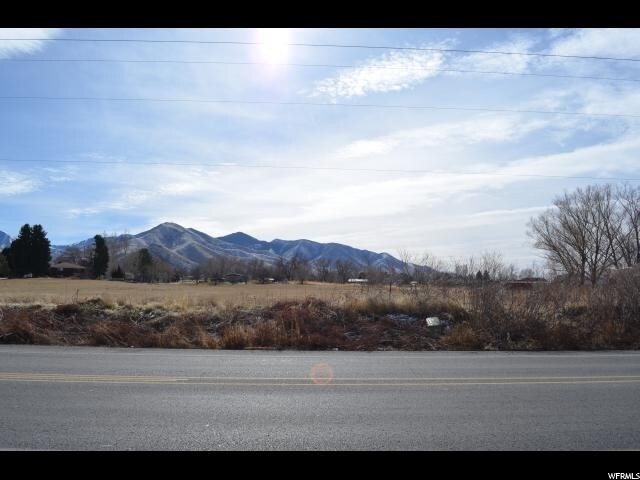
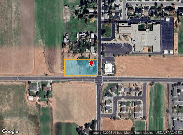
Property Record
251 N Coleman St, Tooele, UT 84074
NEARBY LISTINGS FOR SALE OR LEASE
Property Detail
251 N Coleman St
Salt Lake City, UT
Nix Sub
02-082-0-0015
Tooele
Sfr
Utah
X
1.16 AC
49045C1640C
Tooele County
898 SF
Salt Lake City
DEMOGRAPHICS near 251 N Coleman St
1 Mile
3 Mile
5 Mile
2024 Total Population
8,659
41,600
44,161
2029 Population
10,830
52,047
55,266
Pop Growth 2024-2029
+ 25.07%
+ 25.11%
+ 25.15%
Average Age
35
34
34
2024 Total Households
3,077
13,368
14,048
HH Growth 2024-2029
+ 25.45%
+ 25.52%
+ 25.54%
Median Household Inc
$73,704
$86,407
$88,148
Avg Household Size
2.80
3.10
3.10
2024 Avg HH Vehicles
2.00
3.00
3.00
Median Home Value
$262,095
$290,389
$297,418
Median Year Built
1990
1995
1996
Nearby Places
Map Layers
Map Styles
 Street
 Aerial
- Restaurants
- Banks
- Shops
- Fitness
- Groceries
PUBLIC TRANSPORTATION
AIRPORT
Salt Lake City International
DRIVE
WALK
Distance
Salt Lake City International
40 min
30.9 mi
Freight Ports
Port of Stockton
DRIVE
WALK
Distance
Port of Stockton
703 min
682.5 mi
SALE & LEASE HISTORY
LISTING DATE
SALE/LEASE

May 20, 2019
For Sale
Mar 07, 2018
For Sale
Jul 03, 2018
For Sale
Nearby Properties
Address
Land Use
TOTAL SIZE
Lot Size
Zoning
Address
Land Use
TOTAL SIZE
Lot Size
Zoning
205,900 SF
107.47 AC
Address
Land Use
TOTAL SIZE
Lot Size
Zoning
8.47 AC
Address
Land Use
TOTAL SIZE
Lot Size
Zoning
610,536 SF
48.93 AC
Address
Land Use
TOTAL SIZE
Lot Size
Zoning
263,948 SF
47.90 AC
Address
Land Use
TOTAL SIZE
Lot Size
Zoning
8.32 AC
Address
Land Use
TOTAL SIZE
Lot Size
Zoning
339,571 SF
35.61 AC
Address
Land Use
TOTAL SIZE
Lot Size
Zoning
166,140 SF
7 AC
Address
Land Use
TOTAL SIZE
Lot Size
Zoning
30,144 SF
6 AC
Address
Land Use
TOTAL SIZE
Lot Size
Zoning
90,340 SF
41.76 AC
Address
Land Use
TOTAL SIZE
Lot Size
Zoning
14,400 SF
5.48 AC
Address
Land Use
TOTAL SIZE
Lot Size
Zoning
3,188 SF
7.64 AC
Address
Land Use
TOTAL SIZE
Lot Size
Zoning
59,286 SF
4.84 AC
Address
Land Use
TOTAL SIZE
Lot Size
Zoning
54,648 SF
4.53 AC
Address
Land Use
TOTAL SIZE
Lot Size
Zoning
140,412 SF
10.38 AC
Address
Land Use
TOTAL SIZE
Lot Size
Zoning
86,615 SF
8.87 AC
Address
Land Use
TOTAL SIZE
Lot Size
Zoning
5.34 AC
Address
Land Use
TOTAL SIZE
Lot Size
Zoning
191,115 SF
18.09 AC
Address
Land Use
TOTAL SIZE
Lot Size
Zoning
3.50 AC
Address
Land Use
TOTAL SIZE
Lot Size
Zoning
114,155 SF
20 AC
Address
Land Use
TOTAL SIZE
Lot Size
Zoning
55,381 SF
4.68 AC
Address
Land Use
TOTAL SIZE
Lot Size
Zoning
59,960 SF
16.45 AC
Address
Land Use
TOTAL SIZE
Lot Size
Zoning
191,148 SF
11.08 AC
Address
Land Use
TOTAL SIZE
Lot Size
Zoning
60,127 SF
1.67 AC
Address
Land Use
TOTAL SIZE
Lot Size
Zoning
104,851 SF
11.36 AC
Address
Land Use
TOTAL SIZE
Lot Size
Zoning
53,151 SF
1.18 AC
Address
Land Use
TOTAL SIZE
Lot Size
Zoning
1,532 SF
40.33 AC
Address
Land Use
TOTAL SIZE
Lot Size
Zoning
2,540 SF
2.25 AC
Address
Land Use
TOTAL SIZE
Lot Size
Zoning
24,550 SF
0.86 AC
The World's #1 Commercial Real Estate Marketplace
Connect with us
© 2025 CoStar Group
The information above has been obtained from sources believed reliable. While we do not doubt its accuracy we have not verified it and make no guarantee, warranty or representation about it. It is your responsibility to independently confirm its accuracy and completeness. Any projections, opinions, assumptions, or estimates used are for example only and do not represent the current or future performance of the property. The value of this transaction to you depends on tax and other factors which should be evaluated by your tax, financial, and legal advisors. You and your advisors should conduct a careful, independent investigation of the property to determine to your satisfaction the suitability of the property for your needs.