Property Record
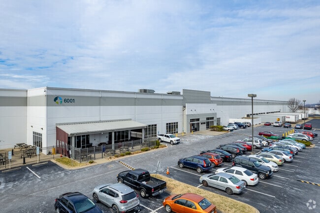
6001 Reliance Dr, La Vergne, TN 37086


Property Detail
6001 Reliance Dr
017-037.01-000
LOT 7 CENTREPOINTE RESUB PB 28 PG 60
Warehouse
RUTHERFORD
I2
Tennessee
B and X Area of moderate flood hazard, usually the area between the limits of the 100-year and 500-year floods.
7
2025
22.24 AC
2025
Southeast
040812
Nashville
503,475 SF
Nashville-Davidson--Murfreesboro--Franklin, TN
NEARBY LISTINGS FOR SALE OR LEASE
DEMOGRAPHICS near 6001 Reliance Dr
1 mile
3 mile
5 mile
2025 Total Population
3,038
35,889
134,208
2030 Population
3,327
38,950
143,947
Pop Growth 2025-2030
+ 9.51%
+ 8.53%
+ 7.26%
Average Age
35
37
36
2025 Total Households
962
12,374
47,147
HH Growth 2025-2030
+ 9.56%
+ 8.69%
+ 7.39%
Median Household Inc
$66,261
$87,396
$85,529
Avg Household Size
3.00
2.80
2.80
2025 Avg HH Vehicles
2.00
2.00
2.00
Median Home Value
$391,666
$377,852
$390,804
Median Year Built
1995
2004
2004
Nearby Places
Map Layers
Map Styles
 Street
 Aerial
Layers
 Traffic
 Biking
Places
Listings with unknown addresses are not visible on the map
- Restaurants
- Banks
- Shops
- Fitness
- Groceries
PUBLIC TRANSPORTATION
AIRPORT
Nashville International
Drive
Walk
Distance
Nashville International
20 min
13.0 mi
Freight Ports
Port of Mobile
Drive
Walk
Distance
Port of Mobile
494 min
449.7 mi
Nearby Properties
Address
Land Use
TOTAL SIZE
Lot Size
Zoning
Address
Land Use
TOTAL SIZE
Lot Size
Zoning
129,800 SF
73.44 AC
MULTIZONE
Address
Land Use
TOTAL SIZE
Lot Size
Zoning
12,156 SF
122.05 AC
IR
Address
Land Use
TOTAL SIZE
Lot Size
Zoning
323,961 SF
27.38 AC
I-2
Address
Land Use
TOTAL SIZE
Lot Size
Zoning
4,709 SF
25.76 AC
RM14
Address
Land Use
TOTAL SIZE
Lot Size
Zoning
17,953 SF
14.92 AC
Address
Land Use
TOTAL SIZE
Lot Size
Zoning
5,352 SF
30 AC
RMF
Address
Land Use
TOTAL SIZE
Lot Size
Zoning
4,974 SF
18.91 AC
C2
Address
Land Use
TOTAL SIZE
Lot Size
Zoning
28,187 SF
14 AC
SP
Address
Land Use
TOTAL SIZE
Lot Size
Zoning
516,516 SF
28.39 AC
MULTIZONE
Address
Land Use
TOTAL SIZE
Lot Size
Zoning
526,143 SF
25.75 AC
IR
Address
Land Use
TOTAL SIZE
Lot Size
Zoning
570,000 SF
36.49 AC
IR
Address
Land Use
TOTAL SIZE
Lot Size
Zoning
588,845 SF
72.56 AC
Address
Land Use
TOTAL SIZE
Lot Size
Zoning
163,177 SF
39.68 AC
Address
Land Use
TOTAL SIZE
Lot Size
Zoning
512,464 SF
42.43 AC
IR
Address
Land Use
TOTAL SIZE
Lot Size
Zoning
7,720 SF
31.19 AC
IR
Address
Land Use
TOTAL SIZE
Lot Size
Zoning
202,737 SF
41 AC
Address
Land Use
TOTAL SIZE
Lot Size
Zoning
600,604 SF
47.70 AC
Address
Land Use
TOTAL SIZE
Lot Size
Zoning
603,578 SF
47.11 AC
Address
Land Use
TOTAL SIZE
Lot Size
Zoning
484,476 SF
30.01 AC
Address
Land Use
TOTAL SIZE
Lot Size
Zoning
2,196,000 SF
135.70 AC
Address
Land Use
TOTAL SIZE
Lot Size
Zoning
768,304 SF
40.03 AC
I-2
Address
Land Use
TOTAL SIZE
Lot Size
Zoning
4,489 SF
17.51 AC
IR
Address
Land Use
TOTAL SIZE
Lot Size
Zoning
195,626 SF
40.50 AC
Address
Land Use
TOTAL SIZE
Lot Size
Zoning
212,268 SF
49 AC
Address
Land Use
TOTAL SIZE
Lot Size
Zoning
128,082 SF
19 AC
Address
Land Use
TOTAL SIZE
Lot Size
Zoning
10,132 SF
13.41 AC
IR
Address
Land Use
TOTAL SIZE
Lot Size
Zoning
3,142 SF
11.40 AC
C2
Address
Land Use
TOTAL SIZE
Lot Size
Zoning
697,724 SF
52.89 AC
IR
Address
Land Use
TOTAL SIZE
Lot Size
Zoning
105,638 SF
17.63 AC
Address
Land Use
TOTAL SIZE
Lot Size
Zoning
316,094 SF
13.97 AC
IR
The World's #1 Commercial Real Estate Marketplace
Connect with us
© 2026 CoStar Group
The information above has been obtained from sources believed reliable. While we do not doubt its accuracy we have not verified it and make no guarantee, warranty or representation about it. It is your responsibility to independently confirm its accuracy and completeness. Any projections, opinions, assumptions, or estimates used are for example only and do not represent the current or future performance of the property. The value of this transaction to you depends on tax and other factors which should be evaluated by your tax, financial, and legal advisors. You and your advisors should conduct a careful, independent investigation of the property to determine to your satisfaction the suitability of the property for your needs.