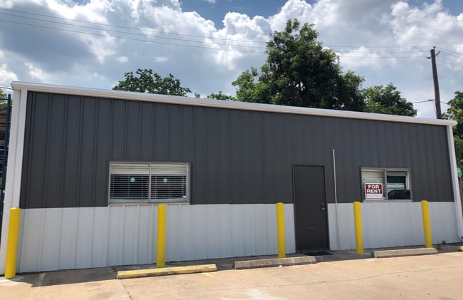
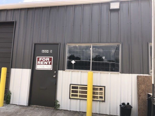
Property Record
6008 W 34Th St, Houston, TX 77092
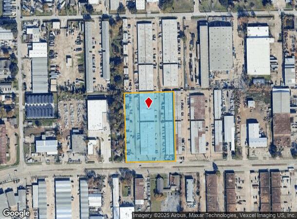
NEARBY LISTINGS FOR SALE OR LEASE
Property Detail
6008 W 34Th St
0590030200002
Sauer
Warehouse
TRS 20A & 21A SAUER
X
Harris
48201C0655M
Texas
2024
3.84 AC
2025
Northwest Inner Loop
520501
Houston
70,950 SF
Houston-The Woodlands-Sugar Land, TX
DEMOGRAPHICS near 6008 W 34Th St
1 Mile
3 Mile
5 Mile
2024 Total Population
11,659
148,404
368,134
2029 Population
11,837
153,208
380,065
Pop Growth 2024-2029
+ 1.53%
+ 3.24%
+ 3.24%
Average Age
37
36
38
2024 Total Households
4,185
56,849
146,321
HH Growth 2024-2029
+ 1.62%
+ 3.26%
+ 3.37%
Median Household Inc
$51,600
$55,267
$69,667
Avg Household Size
2.70
2.50
2.40
2024 Avg HH Vehicles
2.00
2.00
2.00
Median Home Value
$221,028
$356,424
$374,039
Median Year Built
1973
1977
1980
Nearby Places
- Restaurants
- Banks
- Shops
- Fitness
- Groceries
PUBLIC TRANSPORTATION
COMMUTER RAIL
Houston (Sunset Limited - Amtrak)
DRIVE
WALK
Distance
Houston (Sunset Limited - Amtrak)
17 min
9.7 mi
AIRPORT
William P Hobby
DRIVE
WALK
Distance
William P Hobby
38 min
23.4 mi
George Bush Intcntl/Houston
DRIVE
WALK
Distance
George Bush Intcntl/Houston
31 min
23.7 mi
Freight Ports
Port of Houston
DRIVE
WALK
Distance
Port of Houston
29 min
19.0 mi
SALE & LEASE HISTORY
LISTING DATE
SALE/LEASE

Nov 27, 2022
For Sale
Nearby Properties
Address
Land Use
TOTAL SIZE
Lot Size
Zoning
Address
Land Use
TOTAL SIZE
Lot Size
Zoning
224,114 SF
4.24 AC
Address
Land Use
TOTAL SIZE
Lot Size
Zoning
714,049 SF
25.73 AC
Address
Land Use
TOTAL SIZE
Lot Size
Zoning
504,256 SF
6.09 AC
Address
Land Use
TOTAL SIZE
Lot Size
Zoning
375,693 SF
9.16 AC
Address
Land Use
TOTAL SIZE
Lot Size
Zoning
605,420 SF
7.51 AC
Address
Land Use
TOTAL SIZE
Lot Size
Zoning
350,655 SF
16.76 AC
Address
Land Use
TOTAL SIZE
Lot Size
Zoning
279,934 SF
8 AC
Address
Land Use
TOTAL SIZE
Lot Size
Zoning
292,292 SF
10.36 AC
Address
Land Use
TOTAL SIZE
Lot Size
Zoning
443,228 SF
3.15 AC
Address
Land Use
TOTAL SIZE
Lot Size
Zoning
750,156 SF
22.95 AC
Address
Land Use
TOTAL SIZE
Lot Size
Zoning
293,407 SF
9.19 AC
Address
Land Use
TOTAL SIZE
Lot Size
Zoning
378,225 SF
11.51 AC
Address
Land Use
TOTAL SIZE
Lot Size
Zoning
418,456 SF
5.72 AC
Address
Land Use
TOTAL SIZE
Lot Size
Zoning
394,910 SF
15.04 AC
Address
Land Use
TOTAL SIZE
Lot Size
Zoning
308,168 SF
21.34 AC
Address
Land Use
TOTAL SIZE
Lot Size
Zoning
185,068 SF
21.92 AC
Address
Land Use
TOTAL SIZE
Lot Size
Zoning
387,788 SF
17.95 AC
Address
Land Use
TOTAL SIZE
Lot Size
Zoning
229,369 SF
4 AC
Address
Land Use
TOTAL SIZE
Lot Size
Zoning
304,557 SF
4.90 AC
Address
Land Use
TOTAL SIZE
Lot Size
Zoning
409,271 SF
20.70 AC
Address
Land Use
TOTAL SIZE
Lot Size
Zoning
198,259 SF
19.57 AC
Address
Land Use
TOTAL SIZE
Lot Size
Zoning
228,804 SF
3.28 AC
Address
Land Use
TOTAL SIZE
Lot Size
Zoning
259,716 SF
6.31 AC
Address
Land Use
TOTAL SIZE
Lot Size
Zoning
197,117 SF
16.03 AC
Address
Land Use
TOTAL SIZE
Lot Size
Zoning
230,820 SF
6.84 AC
Address
Land Use
TOTAL SIZE
Lot Size
Zoning
444,798 SF
17.17 AC
Address
Land Use
TOTAL SIZE
Lot Size
Zoning
278,462 SF
11.27 AC
Address
Land Use
TOTAL SIZE
Lot Size
Zoning
336,050 SF
14.41 AC
Address
Land Use
TOTAL SIZE
Lot Size
Zoning
330,161 SF
20.90 AC
Address
Land Use
TOTAL SIZE
Lot Size
Zoning
353,758 SF
12.07 AC
The World's #1 Commercial Real Estate Marketplace
Connect with us
© 2025 CoStar Group
The information above has been obtained from sources believed reliable. While we do not doubt its accuracy we have not verified it and make no guarantee, warranty or representation about it. It is your responsibility to independently confirm its accuracy and completeness. Any projections, opinions, assumptions, or estimates used are for example only and do not represent the current or future performance of the property. The value of this transaction to you depends on tax and other factors which should be evaluated by your tax, financial, and legal advisors. You and your advisors should conduct a careful, independent investigation of the property to determine to your satisfaction the suitability of the property for your needs.