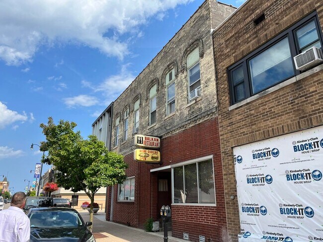
Property Record
601 6Th St, Racine, WI 53403

NEARBY LISTINGS FOR SALE OR LEASE
Property Detail
601 6Th St
Racine-Mount Pleasant, WI
Harbor
276-000000012000
BLK 3 HARBOR ADD LOT 3
Commercialnec
Racine
X
Wisconsin
55101C0231E
3
2024
0.04 AC
2024
Racine East
002900
Milwaukee/Madison
3,296 SF
DEMOGRAPHICS near 601 6Th St
1 Mile
3 Mile
5 Mile
2024 Total Population
14,298
75,871
115,672
2029 Population
14,320
75,325
114,734
Pop Growth 2024-2029
+ 0.15%
(0.72%)
(0.81%)
Average Age
35
38
40
2024 Total Households
5,657
30,483
47,447
HH Growth 2024-2029
+ 0.05%
(0.77%)
(0.87%)
Median Household Inc
$31,382
$51,310
$59,091
Avg Household Size
2.40
2.40
2.30
2024 Avg HH Vehicles
1.00
2.00
2.00
Median Home Value
$91,806
$147,918
$176,533
Median Year Built
1946
1951
1961
Nearby Places
Map Layers
Map Styles
 Street
 Aerial
- Restaurants
- Banks
- Shops
- Fitness
- Groceries
PUBLIC TRANSPORTATION
COMMUTER RAIL
DRIVE
WALK
Distance
15 min
7.0 mi
AIRPORT
General Mitchell International
DRIVE
WALK
Distance
General Mitchell International
35 min
19.8 mi
Freight Ports
Port Milwaukee
DRIVE
WALK
Distance
Port Milwaukee
41 min
25.7 mi
SALE & LEASE HISTORY
LISTING DATE
SALE/LEASE

Dec 22, 2023
For Sale
Aug 25, 2023
For Sale
Nearby Properties
Address
Land Use
TOTAL SIZE
Lot Size
Zoning
Address
Land Use
TOTAL SIZE
Lot Size
Zoning
61,744 SF
42.23 AC
OI
Address
Land Use
TOTAL SIZE
Lot Size
Zoning
14.11 AC
I2
Address
Land Use
TOTAL SIZE
Lot Size
Zoning
180,831 SF
1.49 AC
B4
Address
Land Use
TOTAL SIZE
Lot Size
Zoning
9,982 SF
0.39 AC
B4
Address
Land Use
TOTAL SIZE
Lot Size
Zoning
33.40 AC
I2
Address
Land Use
TOTAL SIZE
Lot Size
Zoning
98.81 AC
Address
Land Use
TOTAL SIZE
Lot Size
Zoning
Address
Land Use
TOTAL SIZE
Lot Size
Zoning
3.54 AC
B4
Address
Land Use
TOTAL SIZE
Lot Size
Zoning
22.72 AC
Address
Land Use
TOTAL SIZE
Lot Size
Zoning
58,485 SF
19.71 AC
I2
Address
Land Use
TOTAL SIZE
Lot Size
Zoning
Address
Land Use
TOTAL SIZE
Lot Size
Zoning
23.15 AC
I2
Address
Land Use
TOTAL SIZE
Lot Size
Zoning
44,439 SF
1.75 AC
B4
Address
Land Use
TOTAL SIZE
Lot Size
Zoning
91,381 SF
6.62 AC
B2
Address
Land Use
TOTAL SIZE
Lot Size
Zoning
8.08 AC
Address
Land Use
TOTAL SIZE
Lot Size
Zoning
71,184 SF
1.05 AC
B4
Address
Land Use
TOTAL SIZE
Lot Size
Zoning
12.10 AC
I2
Address
Land Use
TOTAL SIZE
Lot Size
Zoning
78,748 SF
0.88 AC
I2
Address
Land Use
TOTAL SIZE
Lot Size
Zoning
5.53 AC
R4
Address
Land Use
TOTAL SIZE
Lot Size
Zoning
Address
Land Use
TOTAL SIZE
Lot Size
Zoning
6.77 AC
I2IP
Address
Land Use
TOTAL SIZE
Lot Size
Zoning
209,664 SF
2.82 AC
B5
Address
Land Use
TOTAL SIZE
Lot Size
Zoning
Address
Land Use
TOTAL SIZE
Lot Size
Zoning
21.66 AC
I2
Address
Land Use
TOTAL SIZE
Lot Size
Zoning
95,831 SF
1 AC
B4
Address
Land Use
TOTAL SIZE
Lot Size
Zoning
65,403 SF
3.01 AC
R4
Address
Land Use
TOTAL SIZE
Lot Size
Zoning
24,180 SF
2.20 AC
B2
Address
Land Use
TOTAL SIZE
Lot Size
Zoning
9,832 SF
2.65 AC
R4
Address
Land Use
TOTAL SIZE
Lot Size
Zoning
56,009 SF
0.26 AC
B4
Address
Land Use
TOTAL SIZE
Lot Size
Zoning
4,239 SF
349.70 AC
I2
The World's #1 Commercial Real Estate Marketplace
Connect with us
© 2026 CoStar Group
The information above has been obtained from sources believed reliable. While we do not doubt its accuracy we have not verified it and make no guarantee, warranty or representation about it. It is your responsibility to independently confirm its accuracy and completeness. Any projections, opinions, assumptions, or estimates used are for example only and do not represent the current or future performance of the property. The value of this transaction to you depends on tax and other factors which should be evaluated by your tax, financial, and legal advisors. You and your advisors should conduct a careful, independent investigation of the property to determine to your satisfaction the suitability of the property for your needs.