Property Record
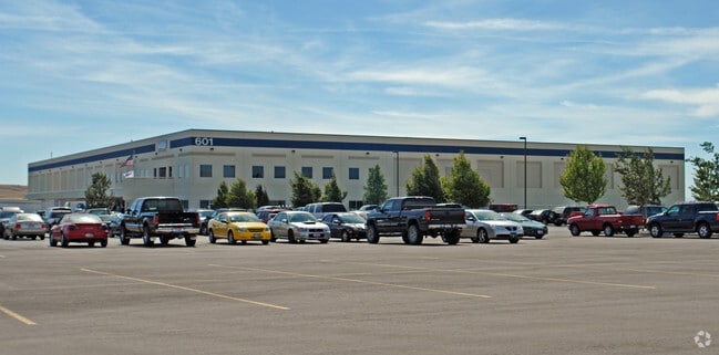
601 W Gowen Rd, Boise, ID 83705


Property Detail
601 W Gowen Rd
S1502223300
PAR #3300 OF NW4 SEC 2 2N 2E & OF SW4 SEC 35 3N 2E PARCEL A ROS 11469 #223200-C #223500-C
Foundry
ADA
M-1D
Idaho
B and X Area of moderate flood hazard, usually the area between the limits of the 100-year and 500-year floods.
40.53 AC
2025
Airport
2025
Boise City/Nampa
001701
Boise City, ID
364,998 SF
NEARBY LISTINGS FOR SALE OR LEASE
DEMOGRAPHICS near 601 W Gowen Rd
1 mile
3 mile
5 mile
2025 Total Population
38
31,599
106,706
2030 Population
42
32,973
112,182
Pop Growth 2025-2030
+ 10.53%
+ 4.35%
+ 5.13%
Average Age
40
40
39
2025 Total Households
14
13,430
45,529
HH Growth 2025-2030
+ 7.14%
+ 4.77%
+ 5.68%
Median Household Inc
$118,749
$94,424
$85,696
Avg Household Size
2.50
2.30
2.20
2025 Avg HH Vehicles
2.00
2.00
2.00
Median Home Value
$607,143
$490,489
$527,720
Median Year Built
2005
1987
1989
Nearby Places
Map Layers
Map Styles
 Street
 Aerial
Layers
 Traffic
 Biking
Places
Listings with unknown addresses are not visible on the map
- Restaurants
- Banks
- Shops
- Fitness
- Groceries
PUBLIC TRANSPORTATION
AIRPORT
Boise Air Trml/Gowen Field
Drive
Walk
Distance
Boise Air Trml/Gowen Field
13 min
2.5 mi
Freight Ports
Port of Portland
Drive
Walk
Distance
Port of Portland
482 min
435.1 mi
Nearby Properties
Address
Land Use
TOTAL SIZE
Lot Size
Zoning
Address
Land Use
TOTAL SIZE
Lot Size
Zoning
ZC-258
Address
Land Use
TOTAL SIZE
Lot Size
Zoning
851,556 SF
78.75 AC
M-2D
Address
Land Use
TOTAL SIZE
Lot Size
Zoning
900,981 SF
86.35 AC
ZC-263
Address
Land Use
TOTAL SIZE
Lot Size
Zoning
122,110 SF
12.66 AC
T-2D/DA
Address
Land Use
TOTAL SIZE
Lot Size
Zoning
356,969 SF
49.72 AC
M-1D
Address
Land Use
TOTAL SIZE
Lot Size
Zoning
203,503 SF
7.93 AC
L-OD
Address
Land Use
TOTAL SIZE
Lot Size
Zoning
245,240 SF
5.40 AC
R-2D
Address
Land Use
TOTAL SIZE
Lot Size
Zoning
214,318 SF
13.77 AC
R-2D
Address
Land Use
TOTAL SIZE
Lot Size
Zoning
277,827 SF
M-2D
Address
Land Use
TOTAL SIZE
Lot Size
Zoning
366,032 SF
10.79 AC
C-4D
Address
Land Use
TOTAL SIZE
Lot Size
Zoning
237,251 SF
20.90 AC
M-1D
Address
Land Use
TOTAL SIZE
Lot Size
Zoning
220,160 SF
12.70 AC
M-1D
Address
Land Use
TOTAL SIZE
Lot Size
Zoning
190,180 SF
14.43 AC
R-2D
Address
Land Use
TOTAL SIZE
Lot Size
Zoning
237,299 SF
20.32 AC
M-1D
Address
Land Use
TOTAL SIZE
Lot Size
Zoning
50,674 SF
49.82 AC
T-2D
Address
Land Use
TOTAL SIZE
Lot Size
Zoning
161,421 SF
10.05 AC
R-1C
Address
Land Use
TOTAL SIZE
Lot Size
Zoning
173,766 SF
9.53 AC
L-OD
Address
Land Use
TOTAL SIZE
Lot Size
Zoning
168,000 SF
M-2D
Address
Land Use
TOTAL SIZE
Lot Size
Zoning
187,820 SF
11.39 AC
M-1D
Address
Land Use
TOTAL SIZE
Lot Size
Zoning
96.73 AC
T-2D
Address
Land Use
TOTAL SIZE
Lot Size
Zoning
165,000 SF
10.60 AC
M-1D
Address
Land Use
TOTAL SIZE
Lot Size
Zoning
158,767 SF
3 AC
M-1D
Address
Land Use
TOTAL SIZE
Lot Size
Zoning
19,359 SF
4.75 AC
C-1D
Address
Land Use
TOTAL SIZE
Lot Size
Zoning
171,774 SF
10.14 AC
M-1D
Address
Land Use
TOTAL SIZE
Lot Size
Zoning
196,326 SF
M-1
Address
Land Use
TOTAL SIZE
Lot Size
Zoning
133,300 SF
18.38 AC
M-1D
Address
Land Use
TOTAL SIZE
Lot Size
Zoning
224,614 SF
9.89 AC
C-2D
Address
Land Use
TOTAL SIZE
Lot Size
Zoning
81.26 AC
T-2D
Address
Land Use
TOTAL SIZE
Lot Size
Zoning
174,290 SF
14.12 AC
C-3D
The World's #1 Commercial Real Estate Marketplace
Connect with us
© 2026 CoStar Group
The information above has been obtained from sources believed reliable. While we do not doubt its accuracy we have not verified it and make no guarantee, warranty or representation about it. It is your responsibility to independently confirm its accuracy and completeness. Any projections, opinions, assumptions, or estimates used are for example only and do not represent the current or future performance of the property. The value of this transaction to you depends on tax and other factors which should be evaluated by your tax, financial, and legal advisors. You and your advisors should conduct a careful, independent investigation of the property to determine to your satisfaction the suitability of the property for your needs.