Property Record
603 Main St, Gorham, NH 03581


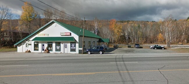
Property Detail
603 Main St
Departmentstore
Coos
CB
New Hampshire
B and X Area of moderate flood hazard, usually the area between the limits of the 100-year and 500-year floods.
34
2024
0.34 AC
2024
Concord/New Hampshire North Area
950900
Other Market Areas
1,434 SF
GORH-000013-000000-000034-U000000
NEARBY LISTINGS FOR SALE OR LEASE
-
-
View all Gorham listings for sale on LoopNet.com
DEMOGRAPHICS near 603 Main St
1 mile
3 mile
5 mile
2025 Total Population
188
4,987
11,156
2030 Population
183
4,867
10,902
Pop Growth 2025-2030
(2.66%)
(2.41%)
(2.28%)
Average Age
46
44
45
2025 Total Households
89
2,353
4,830
HH Growth 2025-2030
(3.37%)
(2.46%)
(2.46%)
Median Household Inc
$50,833
$47,106
$48,295
Avg Household Size
2.10
2.10
2.10
2025 Avg HH Vehicles
2.00
2.00
2.00
Median Home Value
$163,333
$148,659
$143,279
Median Year Built
1961
1947
1948
Nearby Places
Map Layers
Map Styles
 Street
 Aerial
Transit
 Traffic
 Biking
Places
Listings with unknown addresses are not visible on the map
- Restaurants
- Banks
- Shops
- Fitness
- Groceries
SALE & LEASE HISTORY
LISTING DATE
SALE/LEASE

Nov 17, 2022
For Sale
Jan 03, 2020
For Sale
Jan 03, 2020
For Sale
Dec 08, 2020
For Sale
Nearby Properties
Address
Land Use
TOTAL SIZE
Lot Size
Zoning
Address
Land Use
TOTAL SIZE
Lot Size
Zoning
45 AC
IB
Address
Land Use
TOTAL SIZE
Lot Size
Zoning
20 AC
IB
Address
Land Use
TOTAL SIZE
Lot Size
Zoning
156,185 SF
15.92 AC
CB
Address
Land Use
TOTAL SIZE
Lot Size
Zoning
0.92 AC
CB
Address
Land Use
TOTAL SIZE
Lot Size
Zoning
Address
Land Use
TOTAL SIZE
Lot Size
Zoning
1,332 SF
6.07 AC
IB
Address
Land Use
TOTAL SIZE
Lot Size
Zoning
15.50 AC
IB
Address
Land Use
TOTAL SIZE
Lot Size
Zoning
6,573 SF
3.90 AC
CA
Address
Land Use
TOTAL SIZE
Lot Size
Zoning
61,081 SF
2.90 AC
CA
Address
Land Use
TOTAL SIZE
Lot Size
Zoning
74,768 SF
9.71 AC
CB
Address
Land Use
TOTAL SIZE
Lot Size
Zoning
23 AC
IND
Address
Land Use
TOTAL SIZE
Lot Size
Zoning
51,736 SF
5.73 AC
CB
Address
Land Use
TOTAL SIZE
Lot Size
Zoning
1,229 SF
M-USEM
Address
Land Use
TOTAL SIZE
Lot Size
Zoning
41,376 SF
4.73 AC
CB
Address
Land Use
TOTAL SIZE
Lot Size
Zoning
6.90 AC
I
Address
Land Use
TOTAL SIZE
Lot Size
Zoning
10,758 SF
1 AC
CA
Address
Land Use
TOTAL SIZE
Lot Size
Zoning
26,356 SF
5.11 AC
CB
Address
Land Use
TOTAL SIZE
Lot Size
Zoning
41,710 SF
5 AC
CB
Address
Land Use
TOTAL SIZE
Lot Size
Zoning
12,093 SF
0.89 AC
CA
Address
Land Use
TOTAL SIZE
Lot Size
Zoning
24,925 SF
0.85 AC
BG
Address
Land Use
TOTAL SIZE
Lot Size
Zoning
2.04 AC
RR
Address
Land Use
TOTAL SIZE
Lot Size
Zoning
17,185 SF
2.50 AC
CA
Address
Land Use
TOTAL SIZE
Lot Size
Zoning
4,500 SF
3.45 AC
CB
Address
Land Use
TOTAL SIZE
Lot Size
Zoning
1,960 SF
20 AC
RA
Address
Land Use
TOTAL SIZE
Lot Size
Zoning
29,229 SF
9.80 AC
CA
Address
Land Use
TOTAL SIZE
Lot Size
Zoning
2,632 SF
4.25 AC
IND
Address
Land Use
TOTAL SIZE
Lot Size
Zoning
12,178 SF
1.10 AC
CA
Address
Land Use
TOTAL SIZE
Lot Size
Zoning
32,625 SF
0.64 AC
BG
Address
Land Use
TOTAL SIZE
Lot Size
Zoning
7,416 SF
4.88 AC
CB
Address
Land Use
TOTAL SIZE
Lot Size
Zoning
18,784 SF
1.74 AC
CA
The World's #1 Commercial Real Estate Marketplace
Connect with us
© 2026 CoStar Group
The information above has been obtained from sources believed reliable. While we do not doubt its accuracy we have not verified it and make no guarantee, warranty or representation about it. It is your responsibility to independently confirm its accuracy and completeness. Any projections, opinions, assumptions, or estimates used are for example only and do not represent the current or future performance of the property. The value of this transaction to you depends on tax and other factors which should be evaluated by your tax, financial, and legal advisors. You and your advisors should conduct a careful, independent investigation of the property to determine to your satisfaction the suitability of the property for your needs.