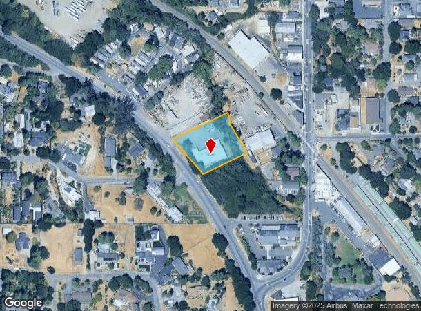
Property Record
6030 Old Redwood Hwy, Penngrove, CA 94951


NEARBY LISTINGS FOR SALE OR LEASE
Property Detail
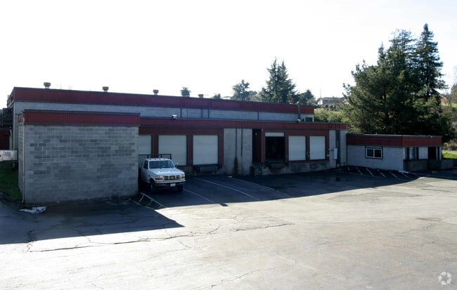
6030 Old Redwood Hwy
047-181-040
Subdivision Of The Mary Ronsheimer Tract
Warehouse
87 FM 47-181-21 CW 29 C/M 86-50238
AE
Sonoma
06097C0891F
California
2024
1.07 AC
2025
Petaluma/Cotati/Rohnert
151205
North Bay/Santa Rosa
25,091 SF
Santa Rosa, CA
DEMOGRAPHICS near 6030 Old Redwood Hwy
1 Mile
3 Mile
5 Mile
2024 Total Population
1,499
31,734
102,102
2029 Population
1,391
31,125
100,921
Pop Growth 2024-2029
(7.20%)
(1.92%)
(1.16%)
Average Age
47
41
42
2024 Total Households
623
12,071
39,668
HH Growth 2024-2029
(7.22%)
(2.03%)
(1.21%)
Median Household Inc
$95,148
$105,547
$97,156
Avg Household Size
2.30
2.60
2.50
2024 Avg HH Vehicles
2.00
2.00
2.00
Median Home Value
$927,248
$759,776
$749,983
Median Year Built
1968
1986
1980
Nearby Places
Map Layers
Map Styles
 Street
 Aerial
- Restaurants
- Banks
- Shops
- Fitness
- Groceries
PUBLIC TRANSPORTATION
COMMUTER RAIL
DRIVE
WALK
Distance
6 min
2.7 mi
DRIVE
WALK
Distance
7 min
3.9 mi
AIRPORT
Charles M Schulz - Sonoma County
DRIVE
WALK
Distance
Charles M Schulz - Sonoma County
25 min
18.8 mi
Freight Ports
Port of Richmond
DRIVE
WALK
Distance
Port of Richmond
51 min
37.7 mi
SALE & LEASE HISTORY
LISTING DATE
SALE/LEASE

Apr 03, 2017
For Sale
Nearby Properties
Address
Land Use
TOTAL SIZE
Lot Size
Zoning
Address
Land Use
TOTAL SIZE
Lot Size
Zoning
589,133 SF
36.26 AC
Address
Land Use
TOTAL SIZE
Lot Size
Zoning
1.18 AC
Address
Land Use
TOTAL SIZE
Lot Size
Zoning
80,392 SF
7.13 AC
Address
Land Use
TOTAL SIZE
Lot Size
Zoning
195,837 SF
16.32 AC
PCD
Address
Land Use
TOTAL SIZE
Lot Size
Zoning
138,520 SF
10.36 AC
ML
Address
Land Use
TOTAL SIZE
Lot Size
Zoning
50,880 SF
4.77 AC
CITYRP
Address
Land Use
TOTAL SIZE
Lot Size
Zoning
93,700 SF
6.02 AC
ML
Address
Land Use
TOTAL SIZE
Lot Size
Zoning
88,482 SF
7.29 AC
Address
Land Use
TOTAL SIZE
Lot Size
Zoning
5,830 SF
5.50 AC
CITYRP
Address
Land Use
TOTAL SIZE
Lot Size
Zoning
83,880 SF
5 AC
ML
Address
Land Use
TOTAL SIZE
Lot Size
Zoning
112,240 SF
6.30 AC
PUD
Address
Land Use
TOTAL SIZE
Lot Size
Zoning
83,977 SF
4.70 AC
Address
Land Use
TOTAL SIZE
Lot Size
Zoning
16,392 SF
6.67 AC
RM
Address
Land Use
TOTAL SIZE
Lot Size
Zoning
81,682 SF
2.59 AC
CITYPE
Address
Land Use
TOTAL SIZE
Lot Size
Zoning
71,884 SF
0.65 AC
Address
Land Use
TOTAL SIZE
Lot Size
Zoning
141,168 SF
9.44 AC
18
Address
Land Use
TOTAL SIZE
Lot Size
Zoning
54,637 SF
0.66 AC
Address
Land Use
TOTAL SIZE
Lot Size
Zoning
51,462 SF
0.90 AC
CITYPE
Address
Land Use
TOTAL SIZE
Lot Size
Zoning
35,864 SF
1.67 AC
PUD
Address
Land Use
TOTAL SIZE
Lot Size
Zoning
90,530 SF
2.61 AC
Address
Land Use
TOTAL SIZE
Lot Size
Zoning
58,299 SF
0.72 AC
Address
Land Use
TOTAL SIZE
Lot Size
Zoning
42,066 SF
1.66 AC
Address
Land Use
TOTAL SIZE
Lot Size
Zoning
6.16 AC
RM
Address
Land Use
TOTAL SIZE
Lot Size
Zoning
44,244 SF
3.44 AC
Address
Land Use
TOTAL SIZE
Lot Size
Zoning
6,882 SF
6.56 AC
CITYPE
Address
Land Use
TOTAL SIZE
Lot Size
Zoning
23,022 SF
1.68 AC
Address
Land Use
TOTAL SIZE
Lot Size
Zoning
Address
Land Use
TOTAL SIZE
Lot Size
Zoning
181,292 SF
66.88 AC
LEA60
Address
Land Use
TOTAL SIZE
Lot Size
Zoning
51,264 SF
1.53 AC
CITYRP
Address
Land Use
TOTAL SIZE
Lot Size
Zoning
42,388 SF
1.11 AC
CITYPE
The World's #1 Commercial Real Estate Marketplace
Connect with us
© 2025 CoStar Group
The information above has been obtained from sources believed reliable. While we do not doubt its accuracy we have not verified it and make no guarantee, warranty or representation about it. It is your responsibility to independently confirm its accuracy and completeness. Any projections, opinions, assumptions, or estimates used are for example only and do not represent the current or future performance of the property. The value of this transaction to you depends on tax and other factors which should be evaluated by your tax, financial, and legal advisors. You and your advisors should conduct a careful, independent investigation of the property to determine to your satisfaction the suitability of the property for your needs.