Property Record
6035 Longbow Dr, Boulder, CO 80301
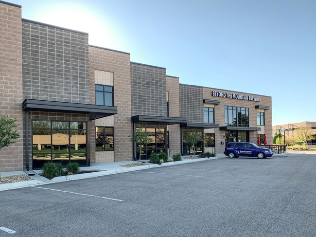


Property Detail
6035 Longbow Dr
Boulder, CO
LOT 5B LONGBOW PARK RPLT F
1463104-88-001
Boulder
Industrialgeneral
Colorado
B and X Area of moderate flood hazard, usually the area between the limits of the 100-year and 500-year floods.
5b
2025
2.24 AC
2026
Boulder
012705
Denver
30,232 SF
NEARBY LISTINGS FOR SALE OR LEASE
DEMOGRAPHICS near 6035 Longbow Dr
1 mile
3 mile
5 mile
2025 Total Population
4,751
26,729
95,843
2030 Population
4,705
26,491
95,905
Pop Growth 2025-2030
(0.97%)
(0.89%)
+ 0.06%
Average Age
40
42
39
2025 Total Households
2,501
11,609
40,097
HH Growth 2025-2030
(1.36%)
(0.96%)
+ 0.11%
Median Household Inc
$92,488
$96,450
$85,709
Avg Household Size
1.80
2.20
2.10
2025 Avg HH Vehicles
2.00
2.00
2.00
Median Home Value
$687,134
$799,563
$952,643
Median Year Built
1985
1983
1981
Nearby Places
Map Layers
Map Styles
 Street
 Aerial
Layers
 Traffic
 Biking
Places
Listings with unknown addresses are not visible on the map
- Restaurants
- Banks
- Shops
- Fitness
- Groceries
PUBLIC TRANSPORTATION
AIRPORT
Denver International
Drive
Walk
Distance
Denver International
57 min
45.2 mi
SALE & LEASE HISTORY
LISTING DATE
SALE/LEASE

Sep 25, 2016
For Lease
Oct 31, 2019
For Lease
May 19, 2017
For Lease
Mar 27, 2018
For Lease
Mar 19, 2018
For Lease
Nearby Properties
Address
Land Use
TOTAL SIZE
Lot Size
Zoning
Address
Land Use
TOTAL SIZE
Lot Size
Zoning
17.51 AC
Address
Land Use
TOTAL SIZE
Lot Size
Zoning
155.96 AC
Address
Land Use
TOTAL SIZE
Lot Size
Zoning
141.82 AC
A
Address
Land Use
TOTAL SIZE
Lot Size
Zoning
329,080 SF
16.41 AC
Address
Land Use
TOTAL SIZE
Lot Size
Zoning
97.48 AC
A
Address
Land Use
TOTAL SIZE
Lot Size
Zoning
558,472 SF
23.18 AC
Address
Land Use
TOTAL SIZE
Lot Size
Zoning
103,400 SF
21.82 AC
Address
Land Use
TOTAL SIZE
Lot Size
Zoning
2,102,591 SF
344.44 AC
Address
Land Use
TOTAL SIZE
Lot Size
Zoning
38.79 AC
RR
Address
Land Use
TOTAL SIZE
Lot Size
Zoning
48.98 AC
A
Address
Land Use
TOTAL SIZE
Lot Size
Zoning
158.19 AC
A
Address
Land Use
TOTAL SIZE
Lot Size
Zoning
159.19 AC
A
Address
Land Use
TOTAL SIZE
Lot Size
Zoning
42.88 AC
RR
Address
Land Use
TOTAL SIZE
Lot Size
Zoning
107.31 AC
A
Address
Land Use
TOTAL SIZE
Lot Size
Zoning
27.92 AC
RR
Address
Land Use
TOTAL SIZE
Lot Size
Zoning
161,711 SF
20.40 AC
MH
Address
Land Use
TOTAL SIZE
Lot Size
Zoning
1,008 SF
16.27 AC
Address
Land Use
TOTAL SIZE
Lot Size
Zoning
1,002 SF
16.71 AC
Address
Land Use
TOTAL SIZE
Lot Size
Zoning
223,669 SF
14.27 AC
Address
Land Use
TOTAL SIZE
Lot Size
Zoning
165.77 AC
A
Address
Land Use
TOTAL SIZE
Lot Size
Zoning
117,336 SF
4.61 AC
Address
Land Use
TOTAL SIZE
Lot Size
Zoning
33.28 AC
A
Address
Land Use
TOTAL SIZE
Lot Size
Zoning
150.10 AC
A
Address
Land Use
TOTAL SIZE
Lot Size
Zoning
83.95 AC
A
Address
Land Use
TOTAL SIZE
Lot Size
Zoning
20.51 AC
GI
Address
Land Use
TOTAL SIZE
Lot Size
Zoning
84.07 AC
A
Address
Land Use
TOTAL SIZE
Lot Size
Zoning
79.23 AC
A
Address
Land Use
TOTAL SIZE
Lot Size
Zoning
76,484 SF
7.06 AC
Address
Land Use
TOTAL SIZE
Lot Size
Zoning
118.35 AC
Address
Land Use
TOTAL SIZE
Lot Size
Zoning
10.78 AC
GI
The World's #1 Commercial Real Estate Marketplace
Connect with us
© 2026 CoStar Group
The information above has been obtained from sources believed reliable. While we do not doubt its accuracy we have not verified it and make no guarantee, warranty or representation about it. It is your responsibility to independently confirm its accuracy and completeness. Any projections, opinions, assumptions, or estimates used are for example only and do not represent the current or future performance of the property. The value of this transaction to you depends on tax and other factors which should be evaluated by your tax, financial, and legal advisors. You and your advisors should conduct a careful, independent investigation of the property to determine to your satisfaction the suitability of the property for your needs.