Property Record
605 Munn Rd, Fort Mill, SC 29715

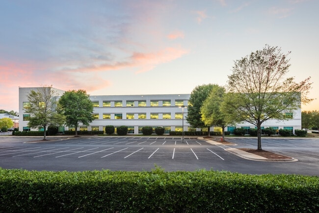
Property Detail
605 Munn Rd
0200901013
PARCEL B PART OF 13.661 AC BEING 11.70 AC/I-77 & MUNN RD -105
Commercialnec
York
B and X Area of moderate flood hazard, usually the area between the limits of the 100-year and 500-year floods.
South Carolina
2025
11.70 AC
2025
York County
061004
Charlotte
165,000 SF
Charlotte-Concord-Gastonia, NC-SC
NEARBY LISTINGS FOR SALE OR LEASE
DEMOGRAPHICS near 605 Munn Rd
1 mile
3 mile
5 mile
2025 Total Population
6,719
41,885
125,745
2030 Population
7,111
44,349
133,729
Pop Growth 2025-2030
+ 5.83%
+ 5.88%
+ 6.35%
Average Age
38
38
39
2025 Total Households
2,469
15,926
47,338
HH Growth 2025-2030
+ 5.75%
+ 5.78%
+ 6.27%
Median Household Inc
$111,187
$106,152
$108,161
Avg Household Size
2.70
2.60
2.60
2025 Avg HH Vehicles
2.00
2.00
2.00
Median Home Value
$483,252
$481,184
$471,957
Median Year Built
2003
2006
2005
Nearby Places
Map Layers
Map Styles
 Street
 Aerial
Layers
 Traffic
 Biking
Places
Listings with unknown addresses are not visible on the map
- Restaurants
- Banks
- Shops
- Fitness
- Groceries
PUBLIC TRANSPORTATION
AIRPORT
Charlotte/Douglas International
Drive
Walk
Distance
Charlotte/Douglas International
30 min
15.9 mi
Concord-Padgett Regional
Drive
Walk
Distance
Concord-Padgett Regional
48 min
32.9 mi
SALE & LEASE HISTORY
LISTING DATE
SALE/LEASE

Jan 25, 2023
For Sale
Dec 21, 2023
For Lease
Dec 03, 2019
For Lease
Nearby Properties
Address
Land Use
TOTAL SIZE
Lot Size
Zoning
Address
Land Use
TOTAL SIZE
Lot Size
Zoning
151,844 SF
11.65 AC
Address
Land Use
TOTAL SIZE
Lot Size
Zoning
401.79 AC
Address
Land Use
TOTAL SIZE
Lot Size
Zoning
335.85 AC
AGC
Address
Land Use
TOTAL SIZE
Lot Size
Zoning
64,338 SF
0.83 AC
Address
Land Use
TOTAL SIZE
Lot Size
Zoning
178,585 SF
17.44 AC
Address
Land Use
TOTAL SIZE
Lot Size
Zoning
167.49 AC
MULTIPLEZ
Address
Land Use
TOTAL SIZE
Lot Size
Zoning
162.78 AC
RCI
Address
Land Use
TOTAL SIZE
Lot Size
Zoning
64,113 SF
6.69 AC
Address
Land Use
TOTAL SIZE
Lot Size
Zoning
197,864 SF
39.37 AC
Address
Land Use
TOTAL SIZE
Lot Size
Zoning
79,600 SF
9.58 AC
Address
Land Use
TOTAL SIZE
Lot Size
Zoning
11,056 SF
1.89 AC
RDI
Address
Land Use
TOTAL SIZE
Lot Size
Zoning
7,772 SF
4.75 AC
Address
Land Use
TOTAL SIZE
Lot Size
Zoning
598,425 SF
102 AC
ID
Address
Land Use
TOTAL SIZE
Lot Size
Zoning
26,733 SF
34.66 AC
PD
Address
Land Use
TOTAL SIZE
Lot Size
Zoning
28,569 SF
0.39 AC
Address
Land Use
TOTAL SIZE
Lot Size
Zoning
2,238 SF
38.21 AC
RCI
Address
Land Use
TOTAL SIZE
Lot Size
Zoning
25,554 SF
14.18 AC
PD
Address
Land Use
TOTAL SIZE
Lot Size
Zoning
18,990 SF
0.23 AC
Address
Land Use
TOTAL SIZE
Lot Size
Zoning
33,312 SF
14.71 AC
Address
Land Use
TOTAL SIZE
Lot Size
Zoning
131,716 SF
13.89 AC
Address
Land Use
TOTAL SIZE
Lot Size
Zoning
155,948 SF
17.02 AC
UD
Address
Land Use
TOTAL SIZE
Lot Size
Zoning
48,912 SF
14.66 AC
Address
Land Use
TOTAL SIZE
Lot Size
Zoning
16,872 SF
19.80 AC
PUD
Address
Land Use
TOTAL SIZE
Lot Size
Zoning
19,426 SF
16.39 AC
PUD
Address
Land Use
TOTAL SIZE
Lot Size
Zoning
280,000 SF
35.63 AC
ID
Address
Land Use
TOTAL SIZE
Lot Size
Zoning
10.57 AC
Address
Land Use
TOTAL SIZE
Lot Size
Zoning
39,312 SF
13.11 AC
Address
Land Use
TOTAL SIZE
Lot Size
Zoning
24,200 SF
2.18 AC
Address
Land Use
TOTAL SIZE
Lot Size
Zoning
16.05 AC
Address
Land Use
TOTAL SIZE
Lot Size
Zoning
147,092 SF
10.63 AC
The World's #1 Commercial Real Estate Marketplace
Connect with us
© 2026 CoStar Group
The information above has been obtained from sources believed reliable. While we do not doubt its accuracy we have not verified it and make no guarantee, warranty or representation about it. It is your responsibility to independently confirm its accuracy and completeness. Any projections, opinions, assumptions, or estimates used are for example only and do not represent the current or future performance of the property. The value of this transaction to you depends on tax and other factors which should be evaluated by your tax, financial, and legal advisors. You and your advisors should conduct a careful, independent investigation of the property to determine to your satisfaction the suitability of the property for your needs.