Property Record
6075 Lance Dr, Riverside, CA 92507


Save to a Folder
{{folder.Name}}
{{folder.ListingIds.length}} Properties
{{folder.ListingIds.length}} Property
Create a New Folder
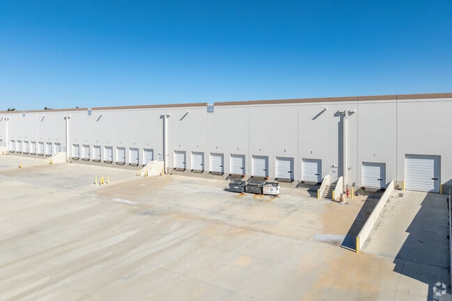
Property Detail
6075 Lance Dr
263-021-001
SUBDIVISIONNAME PM 36879 ACRES 18.17000000 ACREAGEQUALCODE ML LOTTYPE P PARCEL 2 MAPPLATB 245 MAPPLATP 046
Lightindustrial
Riverside
B and X Area of moderate flood hazard, usually the area between the limits of the 100-year and 500-year floods.
California
2024
18.17 AC
2025
Moreno Valley/Perris
050901
Inland Empire (California)
361,346 SF
Riverside-San Bernardino-Ontario, CA
NEARBY LISTINGS FOR SALE OR LEASE
DEMOGRAPHICS near 6075 Lance Dr
1 mile
3 mile
5 mile
2025 Total Population
5,522
77,260
241,757
2030 Population
5,741
79,043
247,262
Pop Growth 2025-2030
+ 3.97%
+ 2.31%
+ 2.28%
Average Age
36
35
36
2025 Total Households
2,234
23,665
71,173
HH Growth 2025-2030
+ 3.67%
+ 1.94%
+ 1.90%
Median Household Inc
$97,299
$95,744
$90,644
Avg Household Size
2.50
2.90
3.20
2025 Avg HH Vehicles
2.00
2.00
2.00
Median Home Value
$699,275
$681,326
$639,087
Median Year Built
1998
1988
1984
Nearby Places
Map Layers
Map Styles
 Street
 Aerial
Layers
 Traffic
 Biking
Places
Listings with unknown addresses are not visible on the map
- Restaurants
- Banks
- Shops
- Fitness
- Groceries
PUBLIC TRANSPORTATION
COMMUTER RAIL
Drive
Walk
Distance
7 min
2.9 mi
Drive
Walk
Distance
12 min
6.2 mi
AIRPORT
Ontario International
Drive
Walk
Distance
Ontario International
32 min
22.9 mi
SALE & LEASE HISTORY
LISTING DATE
SALE/LEASE

Sep 27, 2018
For Sale
Sep 27, 2018
For Lease
Jan 21, 2022
For Lease
Aug 13, 2019
For Sale
Aug 05, 2022
For Sale
Nearby Properties
Address
Land Use
TOTAL SIZE
Lot Size
Zoning
Address
Land Use
TOTAL SIZE
Lot Size
Zoning
709,081 SF
33.17 AC
Address
Land Use
TOTAL SIZE
Lot Size
Zoning
1,012,995 SF
47.62 AC
Address
Land Use
TOTAL SIZE
Lot Size
Zoning
929,918 SF
52.44 AC
Address
Land Use
TOTAL SIZE
Lot Size
Zoning
607,644 SF
26.09 AC
O
Address
Land Use
TOTAL SIZE
Lot Size
Zoning
596,090 SF
29.17 AC
IP
Address
Land Use
TOTAL SIZE
Lot Size
Zoning
95,047 SF
10.25 AC
Address
Land Use
TOTAL SIZE
Lot Size
Zoning
397,994 SF
19.70 AC
H
Address
Land Use
TOTAL SIZE
Lot Size
Zoning
26.96 AC
R3
Address
Land Use
TOTAL SIZE
Lot Size
Zoning
283,209 SF
16.91 AC
R20
Address
Land Use
TOTAL SIZE
Lot Size
Zoning
302,116 SF
30.19 AC
RA
Address
Land Use
TOTAL SIZE
Lot Size
Zoning
620,533 SF
32.50 AC
Address
Land Use
TOTAL SIZE
Lot Size
Zoning
449,040 SF
18.86 AC
BMP
Address
Land Use
TOTAL SIZE
Lot Size
Zoning
126,036 SF
30.90 AC
Address
Land Use
TOTAL SIZE
Lot Size
Zoning
38,560 SF
12.04 AC
R3
Address
Land Use
TOTAL SIZE
Lot Size
Zoning
579,807 SF
30.23 AC
MP
Address
Land Use
TOTAL SIZE
Lot Size
Zoning
430,647 SF
31.09 AC
Address
Land Use
TOTAL SIZE
Lot Size
Zoning
399,615 SF
24.31 AC
Address
Land Use
TOTAL SIZE
Lot Size
Zoning
38,400 SF
15.73 AC
R3
Address
Land Use
TOTAL SIZE
Lot Size
Zoning
252,504 SF
13.11 AC
SP
Address
Land Use
TOTAL SIZE
Lot Size
Zoning
37,010 SF
12.13 AC
Address
Land Use
TOTAL SIZE
Lot Size
Zoning
Address
Land Use
TOTAL SIZE
Lot Size
Zoning
209,734 SF
10.87 AC
R3
Address
Land Use
TOTAL SIZE
Lot Size
Zoning
663,613 SF
44.28 AC
Address
Land Use
TOTAL SIZE
Lot Size
Zoning
16.39 AC
R3
Address
Land Use
TOTAL SIZE
Lot Size
Zoning
600,000 SF
26.89 AC
W-2
Address
Land Use
TOTAL SIZE
Lot Size
Zoning
134,474 SF
7.99 AC
C2
Address
Land Use
TOTAL SIZE
Lot Size
Zoning
253,025 SF
15.62 AC
R3
Address
Land Use
TOTAL SIZE
Lot Size
Zoning
136,738 SF
25.18 AC
Address
Land Use
TOTAL SIZE
Lot Size
Zoning
509,422 SF
36.94 AC
The World's #1 Commercial Real Estate Marketplace
Connect with us
© 2026 CoStar Group
The information above has been obtained from sources believed reliable. While we do not doubt its accuracy we have not verified it and make no guarantee, warranty or representation about it. It is your responsibility to independently confirm its accuracy and completeness. Any projections, opinions, assumptions, or estimates used are for example only and do not represent the current or future performance of the property. The value of this transaction to you depends on tax and other factors which should be evaluated by your tax, financial, and legal advisors. You and your advisors should conduct a careful, independent investigation of the property to determine to your satisfaction the suitability of the property for your needs.