Property Record
6085 Us Highway 259 Rd, Longview, TX 75605

Property Detail
6085 Us Highway 259 Rd
15218
AB 57 J F DIXON SUR TR 16 SEC 3
Commercialnec
GREGG
B
Texas
B and X Area of moderate flood hazard, usually the area between the limits of the 100-year and 500-year floods.
16
2024
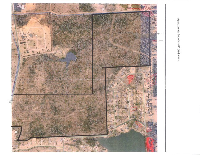
27.37 AC
2025
Longview
010100
Other Market Areas
3,552 SF
Longview, TX
NEARBY LISTINGS FOR SALE OR LEASE
DEMOGRAPHICS near 6085 Us Highway 259 Rd
1 mile
3 mile
5 mile
2025 Total Population
851
9,295
42,391
2030 Population
864
9,513
43,169
Pop Growth 2025-2030
+ 1.53%
+ 2.35%
+ 1.84%
Average Age
43
40
40
2025 Total Households
323
3,864
17,818
HH Growth 2025-2030
+ 1.55%
+ 2.43%
+ 1.98%
Median Household Inc
$116,992
$95,041
$76,298
Avg Household Size
2.60
2.40
2.30
2025 Avg HH Vehicles
2.00
2.00
2.00
Median Home Value
$266,964
$251,212
$252,260
Median Year Built
1984
1993
1985
Nearby Places
Map Layers
Map Styles
 Street
 Aerial
Transit
 Traffic
 Biking
Places
Listings with unknown addresses are not visible on the map
- Restaurants
- Banks
- Shops
- Fitness
- Groceries
PUBLIC TRANSPORTATION
COMMUTER RAIL
Longview (Texas Eagle - Amtrak)
Drive
Walk
Distance
Longview (Texas Eagle - Amtrak)
13 min
8.3 mi
Freight Ports
Port of Shreveport
Drive
Walk
Distance
Port of Shreveport
91 min
77.3 mi
SALE & LEASE HISTORY
LISTING DATE
SALE/LEASE

Aug 30, 2017
For Sale
Nearby Properties
Address
Land Use
TOTAL SIZE
Lot Size
Zoning
Address
Land Use
TOTAL SIZE
Lot Size
Zoning
822,337 SF
142.52 AC
Address
Land Use
TOTAL SIZE
Lot Size
Zoning
1,000,263 SF
109.31 AC
Address
Land Use
TOTAL SIZE
Lot Size
Zoning
10,783 SF
34.54 AC
Address
Land Use
TOTAL SIZE
Lot Size
Zoning
23,835 SF
13.65 AC
Address
Land Use
TOTAL SIZE
Lot Size
Zoning
154,720 SF
62.04 AC
Address
Land Use
TOTAL SIZE
Lot Size
Zoning
7.91 AC
Address
Land Use
TOTAL SIZE
Lot Size
Zoning
52,026 SF
5.65 AC
Address
Land Use
TOTAL SIZE
Lot Size
Zoning
26,232 SF
51.72 AC
Address
Land Use
TOTAL SIZE
Lot Size
Zoning
37,140 SF
49.45 AC
Address
Land Use
TOTAL SIZE
Lot Size
Zoning
43,705 SF
12.87 AC
Address
Land Use
TOTAL SIZE
Lot Size
Zoning
87,794 SF
21 AC
Address
Land Use
TOTAL SIZE
Lot Size
Zoning
45,634 SF
10.54 AC
Address
Land Use
TOTAL SIZE
Lot Size
Zoning
1,300 SF
6.21 AC
B
Address
Land Use
TOTAL SIZE
Lot Size
Zoning
20,250 SF
7.09 AC
Address
Land Use
TOTAL SIZE
Lot Size
Zoning
288 SF
24.43 AC
B
Address
Land Use
TOTAL SIZE
Lot Size
Zoning
74,767 SF
12.77 AC
B
Address
Land Use
TOTAL SIZE
Lot Size
Zoning
3,811 SF
16.79 AC
B
Address
Land Use
TOTAL SIZE
Lot Size
Zoning
14,900 SF
3.99 AC
B
Address
Land Use
TOTAL SIZE
Lot Size
Zoning
19,990 SF
14.47 AC
Address
Land Use
TOTAL SIZE
Lot Size
Zoning
34,160 SF
4.92 AC
B
Address
Land Use
TOTAL SIZE
Lot Size
Zoning
31,968 SF
7.40 AC
Address
Land Use
TOTAL SIZE
Lot Size
Zoning
8,143 SF
3 AC
Address
Land Use
TOTAL SIZE
Lot Size
Zoning
16,173 SF
3 AC
Address
Land Use
TOTAL SIZE
Lot Size
Zoning
9,066 SF
3.70 AC
Address
Land Use
TOTAL SIZE
Lot Size
Zoning
35,894 SF
3.26 AC
Address
Land Use
TOTAL SIZE
Lot Size
Zoning
10,355 SF
11.55 AC
Address
Land Use
TOTAL SIZE
Lot Size
Zoning
11,383 SF
15 AC
Address
Land Use
TOTAL SIZE
Lot Size
Zoning
12,300 SF
3.57 AC
Address
Land Use
TOTAL SIZE
Lot Size
Zoning
18,311 SF
10 AC
Address
Land Use
TOTAL SIZE
Lot Size
Zoning
60,000 SF
4.97 AC
B
The World's #1 Commercial Real Estate Marketplace
Connect with us
© 2026 CoStar Group
The information above has been obtained from sources believed reliable. While we do not doubt its accuracy we have not verified it and make no guarantee, warranty or representation about it. It is your responsibility to independently confirm its accuracy and completeness. Any projections, opinions, assumptions, or estimates used are for example only and do not represent the current or future performance of the property. The value of this transaction to you depends on tax and other factors which should be evaluated by your tax, financial, and legal advisors. You and your advisors should conduct a careful, independent investigation of the property to determine to your satisfaction the suitability of the property for your needs.