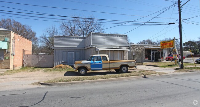
Property Record
610 N Riverside Dr, Fort Worth, TX 76111


Property Detail
610 N Riverside Dr
Dallas-Fort Worth-Arlington, TX
MC ADAMS ADDITION BLOCK 162 LOT 19
01833723
TARRANT
Commercialnec
Texas
B and X Area of moderate flood hazard, usually the area between the limits of the 100-year and 500-year floods.
19
2025
0.12 AC
2025
East Fort Worth
101202
Dallas/Ft Worth
1,472 SF
NEARBY LISTINGS FOR SALE OR LEASE
DEMOGRAPHICS near 610 N Riverside Dr
1 mile
3 mile
5 mile
2025 Total Population
14,045
79,387
261,335
2030 Population
14,986
84,317
277,392
Pop Growth 2025-2030
+ 6.70%
+ 6.21%
+ 6.14%
Average Age
37
37
36
2025 Total Households
4,618
26,635
93,017
HH Growth 2025-2030
+ 7.08%
+ 6.87%
+ 6.54%
Median Household Inc
$59,801
$58,978
$58,891
Avg Household Size
2.90
2.60
2.60
2025 Avg HH Vehicles
2.00
2.00
2.00
Median Home Value
$218,029
$220,574
$226,065
Median Year Built
1952
1965
1968
Nearby Places
Map Layers
Map Styles
 Street
 Aerial
Layers
 Traffic
 Biking
Places
Listings with unknown addresses are not visible on the map
- Restaurants
- Banks
- Shops
- Fitness
- Groceries
PUBLIC TRANSPORTATION
COMMUTER RAIL
Drive
Walk
Distance
6 min
2.9 mi
Drive
Walk
Distance
6 min
2.9 mi
AIRPORT
Dallas-Fort Worth International
Drive
Walk
Distance
Dallas-Fort Worth International
31 min
22.8 mi
Dallas Love Field
Drive
Walk
Distance
Dallas Love Field
42 min
31.5 mi
Nearby Properties
Address
Land Use
TOTAL SIZE
Lot Size
Zoning
Address
Land Use
TOTAL SIZE
Lot Size
Zoning
133,700 SF
6.29 AC
Address
Land Use
TOTAL SIZE
Lot Size
Zoning
738,487 SF
2.11 AC
Address
Land Use
TOTAL SIZE
Lot Size
Zoning
1,009,233 SF
0.92 AC
Address
Land Use
TOTAL SIZE
Lot Size
Zoning
773,033 SF
2.11 AC
Address
Land Use
TOTAL SIZE
Lot Size
Zoning
1,281,000 SF
1.15 AC
Address
Land Use
TOTAL SIZE
Lot Size
Zoning
551,198 SF
3.12 AC
Address
Land Use
TOTAL SIZE
Lot Size
Zoning
650,744 SF
15.68 AC
Address
Land Use
TOTAL SIZE
Lot Size
Zoning
884,928 SF
1.01 AC
Address
Land Use
TOTAL SIZE
Lot Size
Zoning
205,807 SF
3.19 AC
Address
Land Use
TOTAL SIZE
Lot Size
Zoning
1,024,627 SF
0.83 AC
Address
Land Use
TOTAL SIZE
Lot Size
Zoning
764,691 SF
0.92 AC
Address
Land Use
TOTAL SIZE
Lot Size
Zoning
914,300 SF
3.46 AC
Address
Land Use
TOTAL SIZE
Lot Size
Zoning
774,327 SF
11.86 AC
Address
Land Use
TOTAL SIZE
Lot Size
Zoning
1,719,136 SF
18.18 AC
Address
Land Use
TOTAL SIZE
Lot Size
Zoning
537,395 SF
2.82 AC
Address
Land Use
TOTAL SIZE
Lot Size
Zoning
750,215 SF
0.69 AC
Address
Land Use
TOTAL SIZE
Lot Size
Zoning
487,426 SF
4.18 AC
Address
Land Use
TOTAL SIZE
Lot Size
Zoning
419,815 SF
10.26 AC
Address
Land Use
TOTAL SIZE
Lot Size
Zoning
423,917 SF
4.20 AC
Address
Land Use
TOTAL SIZE
Lot Size
Zoning
363,192 SF
2.62 AC
Address
Land Use
TOTAL SIZE
Lot Size
Zoning
699,246 SF
40.69 AC
Address
Land Use
TOTAL SIZE
Lot Size
Zoning
442,989 SF
7.15 AC
Address
Land Use
TOTAL SIZE
Lot Size
Zoning
275,486 SF
9.12 AC
Address
Land Use
TOTAL SIZE
Lot Size
Zoning
257,308 SF
8.13 AC
Address
Land Use
TOTAL SIZE
Lot Size
Zoning
192,500 SF
0.92 AC
Address
Land Use
TOTAL SIZE
Lot Size
Zoning
276,500 SF
7.21 AC
Address
Land Use
TOTAL SIZE
Lot Size
Zoning
334,061 SF
0.69 AC
Address
Land Use
TOTAL SIZE
Lot Size
Zoning
240,000 SF
0.16 AC
Address
Land Use
TOTAL SIZE
Lot Size
Zoning
308,407 SF
4.95 AC
Address
Land Use
TOTAL SIZE
Lot Size
Zoning
248,292 SF
1.01 AC
The World's #1 Commercial Real Estate Marketplace
Connect with us
© 2026 CoStar Group
The information above has been obtained from sources believed reliable. While we do not doubt its accuracy we have not verified it and make no guarantee, warranty or representation about it. It is your responsibility to independently confirm its accuracy and completeness. Any projections, opinions, assumptions, or estimates used are for example only and do not represent the current or future performance of the property. The value of this transaction to you depends on tax and other factors which should be evaluated by your tax, financial, and legal advisors. You and your advisors should conduct a careful, independent investigation of the property to determine to your satisfaction the suitability of the property for your needs.