No Photo
Property Record
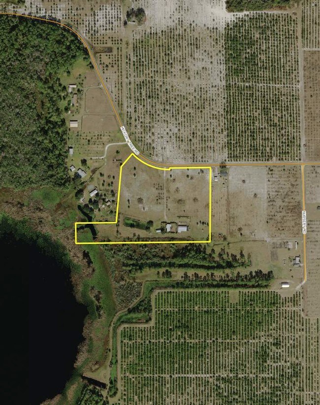
6100 Hickory Tree Rd, Saint Cloud, FL 34772

Property Detail
6100 Hickory Tree Rd
26-26-31-4950-0001-0681
S L & I C PB B PG 59 COM AT SE COR LOT 77, W 153.69 FT TO POB; CONT W 1166.42 FT, N 175.68 FT, E 351.91 FT, N 05 DEG E 486.45 FT, N 41 DEG E 149.35 FT TO WLY R/W, S 48 DEG E 83.66 FT, SELY ALONG R/W OF HICKORY TREE RD 278.5 FT MOL, N 12 FT, E 354.52
Pasture
OSCEOLA
OAC
Florida
AE The base floodplain where base flood elevations are provided. AE Zones are now used on new format FIRMs instead of A1-A30 Zones.
77
2024
13.67 AC
2025
Osceola Outlying
043802
Orlando
4,210 SF
Orlando-Kissimmee-Sanford, FL
NEARBY LISTINGS FOR SALE OR LEASE
DEMOGRAPHICS near 6100 Hickory Tree Rd
1 mile
3 mile
5 mile
2025 Total Population
30
6,040
26,221
2030 Population
36
7,345
31,525
Pop Growth 2025-2030
+ 20.00%
+ 21.61%
+ 20.23%
Average Age
40
38
40
2025 Total Households
11
1,982
9,136
HH Growth 2025-2030
+ 18.18%
+ 22.05%
+ 20.88%
Median Household Inc
$124,999
$95,913
$93,724
Avg Household Size
2.50
3.10
2.90
2025 Avg HH Vehicles
3.00
2.00
2.00
Median Home Value
$874,999
$419,038
$424,350
Median Year Built
2003
2010
2010
Nearby Places
Map Layers
Map Styles
 Street
 Aerial
Layers
 Traffic
 Biking
Places
Listings with unknown addresses are not visible on the map
- Restaurants
- Banks
- Shops
- Fitness
- Groceries
PUBLIC TRANSPORTATION
AIRPORT
Orlando International
Drive
Walk
Distance
Orlando International
44 min
28.4 mi
Freight Ports
Port Canaveral
Drive
Walk
Distance
Port Canaveral
81 min
66.0 mi
Nearby Properties
Address
Land Use
TOTAL SIZE
Lot Size
Zoning
Address
Land Use
TOTAL SIZE
Lot Size
Zoning
229,148 SF
47.05 AC
OAC
Address
Land Use
TOTAL SIZE
Lot Size
Zoning
121,656 SF
9.49 AC
OPD
Address
Land Use
TOTAL SIZE
Lot Size
Zoning
107,288 SF
10.23 AC
OMXD
Address
Land Use
TOTAL SIZE
Lot Size
Zoning
19,606 SF
100.40 AC
OAC
Address
Land Use
TOTAL SIZE
Lot Size
Zoning
103.33 AC
Address
Land Use
TOTAL SIZE
Lot Size
Zoning
1,148 SF
56.79 AC
OAC
Address
Land Use
TOTAL SIZE
Lot Size
Zoning
15,040 SF
5.13 AC
OPD
Address
Land Use
TOTAL SIZE
Lot Size
Zoning
20,046 SF
1.46 AC
OMXD
Address
Land Use
TOTAL SIZE
Lot Size
Zoning
108.50 AC
Address
Land Use
TOTAL SIZE
Lot Size
Zoning
Address
Land Use
TOTAL SIZE
Lot Size
Zoning
9.80 AC
Address
Land Use
TOTAL SIZE
Lot Size
Zoning
12,430 SF
3.02 AC
OPD
Address
Land Use
TOTAL SIZE
Lot Size
Zoning
16,500 SF
2.80 AC
OPD
Address
Land Use
TOTAL SIZE
Lot Size
Zoning
3,290 SF
1.60 AC
OPD
Address
Land Use
TOTAL SIZE
Lot Size
Zoning
3.95 AC
Address
Land Use
TOTAL SIZE
Lot Size
Zoning
1,842 SF
62.92 AC
OIN
Address
Land Use
TOTAL SIZE
Lot Size
Zoning
10,348 SF
326.84 AC
OAC
Address
Land Use
TOTAL SIZE
Lot Size
Zoning
Address
Land Use
TOTAL SIZE
Lot Size
Zoning
60.69 AC
AC
Address
Land Use
TOTAL SIZE
Lot Size
Zoning
5,951 SF
0.28 AC
OPD
Address
Land Use
TOTAL SIZE
Lot Size
Zoning
2.60 AC
Address
Land Use
TOTAL SIZE
Lot Size
Zoning
6.62 AC
OPD
Address
Land Use
TOTAL SIZE
Lot Size
Zoning
24.20 AC
Address
Land Use
TOTAL SIZE
Lot Size
Zoning
2.07 AC
Address
Land Use
TOTAL SIZE
Lot Size
Zoning
2,538 SF
14 AC
Address
Land Use
TOTAL SIZE
Lot Size
Zoning
31.91 AC
Address
Land Use
TOTAL SIZE
Lot Size
Zoning
4,784 SF
4.22 AC
AC
Address
Land Use
TOTAL SIZE
Lot Size
Zoning
Address
Land Use
TOTAL SIZE
Lot Size
Zoning
16.13 AC
The World's #1 Commercial Real Estate Marketplace
Connect with us
© 2026 CoStar Group
The information above has been obtained from sources believed reliable. While we do not doubt its accuracy we have not verified it and make no guarantee, warranty or representation about it. It is your responsibility to independently confirm its accuracy and completeness. Any projections, opinions, assumptions, or estimates used are for example only and do not represent the current or future performance of the property. The value of this transaction to you depends on tax and other factors which should be evaluated by your tax, financial, and legal advisors. You and your advisors should conduct a careful, independent investigation of the property to determine to your satisfaction the suitability of the property for your needs.