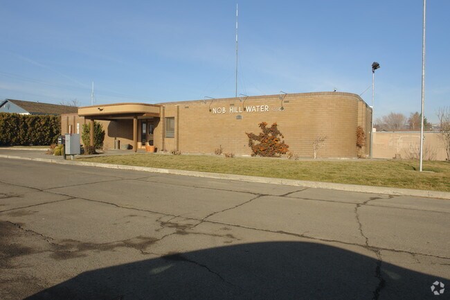
Property Record
6111 Tieton Dr, Yakima, WA 98908


NEARBY LISTINGS FOR SALE OR LEASE
Property Detail
6111 Tieton Dr
Yakima, WA
Westhaven
181321-33487
SECTION 21 TOWNSHIP 13 RANGE 18 QUARTER SW: PLAT WESTHAVEN (V-14): LOT 25
Utilities
Yakima
X
Washington
53077C1029F
25
2025
1.59 AC
2025
Greater Yakima
000903
Yakima
8,272 SF
DEMOGRAPHICS near 6111 Tieton Dr
1 Mile
3 Mile
5 Mile
2024 Total Population
12,182
60,730
117,146
2029 Population
12,462
61,461
117,988
Pop Growth 2024-2029
+ 2.30%
+ 1.20%
+ 0.72%
Average Age
41
40
38
2024 Total Households
4,992
23,866
42,853
HH Growth 2024-2029
+ 2.08%
+ 1.18%
+ 0.70%
Median Household Inc
$65,895
$66,761
$57,138
Avg Household Size
2.40
2.50
2.60
2024 Avg HH Vehicles
2.00
2.00
2.00
Median Home Value
$297,808
$286,118
$264,593
Median Year Built
1981
1976
1973
Nearby Places
Map Layers
Map Styles
 Street
 Aerial
- Restaurants
- Banks
- Shops
- Fitness
- Groceries
PUBLIC TRANSPORTATION
AIRPORT
Yakima Air Trml/McAllister Field
DRIVE
WALK
Distance
Yakima Air Trml/McAllister Field
8 min
3.8 mi
Freight Ports
Port of Tacoma
DRIVE
WALK
Distance
Port of Tacoma
190 min
159.0 mi
Nearby Properties
Address
Land Use
TOTAL SIZE
Lot Size
Zoning
Address
Land Use
TOTAL SIZE
Lot Size
Zoning
331,736 SF
34.95 AC
R1
Address
Land Use
TOTAL SIZE
Lot Size
Zoning
409,453 SF
8.25 AC
R3
Address
Land Use
TOTAL SIZE
Lot Size
Zoning
275,342 SF
16.10 AC
R1
Address
Land Use
TOTAL SIZE
Lot Size
Zoning
326,323 SF
30.05 AC
R2
Address
Land Use
TOTAL SIZE
Lot Size
Zoning
226,069 SF
12.81 AC
C1
Address
Land Use
TOTAL SIZE
Lot Size
Zoning
235,222 SF
14.23 AC
M1
Address
Land Use
TOTAL SIZE
Lot Size
Zoning
329,388 SF
16.13 AC
M1
Address
Land Use
TOTAL SIZE
Lot Size
Zoning
501,270 SF
21.09 AC
M1
Address
Land Use
TOTAL SIZE
Lot Size
Zoning
205,680 SF
24.88 AC
C1
Address
Land Use
TOTAL SIZE
Lot Size
Zoning
119,023 SF
7.42 AC
R3
Address
Land Use
TOTAL SIZE
Lot Size
Zoning
69,675 SF
7.49 AC
R1
Address
Land Use
TOTAL SIZE
Lot Size
Zoning
65,606 SF
3.39 AC
R2
Address
Land Use
TOTAL SIZE
Lot Size
Zoning
114,192 SF
5.07 AC
C1
Address
Land Use
TOTAL SIZE
Lot Size
Zoning
69,675 SF
10.48 AC
R1
Address
Land Use
TOTAL SIZE
Lot Size
Zoning
107,078 SF
14.96 AC
R1
Address
Land Use
TOTAL SIZE
Lot Size
Zoning
132,213 SF
4 AC
R3
Address
Land Use
TOTAL SIZE
Lot Size
Zoning
162,216 SF
11 AC
M1
Address
Land Use
TOTAL SIZE
Lot Size
Zoning
130,114 SF
27.76 AC
R1
Address
Land Use
TOTAL SIZE
Lot Size
Zoning
105,756 SF
6.89 AC
R3
Address
Land Use
TOTAL SIZE
Lot Size
Zoning
93,286 SF
8.87 AC
R3
Address
Land Use
TOTAL SIZE
Lot Size
Zoning
162,933 SF
14.96 AC
SCC
Address
Land Use
TOTAL SIZE
Lot Size
Zoning
97,976 SF
3.98 AC
SCC
Address
Land Use
TOTAL SIZE
Lot Size
Zoning
196,486 SF
10.61 AC
M1
Address
Land Use
TOTAL SIZE
Lot Size
Zoning
118,830 SF
5.34 AC
LCC
Address
Land Use
TOTAL SIZE
Lot Size
Zoning
53,278 SF
5.44 AC
M1
Address
Land Use
TOTAL SIZE
Lot Size
Zoning
86,547 SF
4.41 AC
R3
Address
Land Use
TOTAL SIZE
Lot Size
Zoning
89,850 SF
14.03 AC
R1
Address
Land Use
TOTAL SIZE
Lot Size
Zoning
65,968 SF
1.51 AC
R2
Address
Land Use
TOTAL SIZE
Lot Size
Zoning
255,977 SF
12.08 AC
M1
Address
Land Use
TOTAL SIZE
Lot Size
Zoning
83,430 SF
4.22 AC
SCC
The World's #1 Commercial Real Estate Marketplace
Connect with us
© 2026 CoStar Group
The information above has been obtained from sources believed reliable. While we do not doubt its accuracy we have not verified it and make no guarantee, warranty or representation about it. It is your responsibility to independently confirm its accuracy and completeness. Any projections, opinions, assumptions, or estimates used are for example only and do not represent the current or future performance of the property. The value of this transaction to you depends on tax and other factors which should be evaluated by your tax, financial, and legal advisors. You and your advisors should conduct a careful, independent investigation of the property to determine to your satisfaction the suitability of the property for your needs.