Property Record
6120 Louetta Rd, Spring, TX 77379


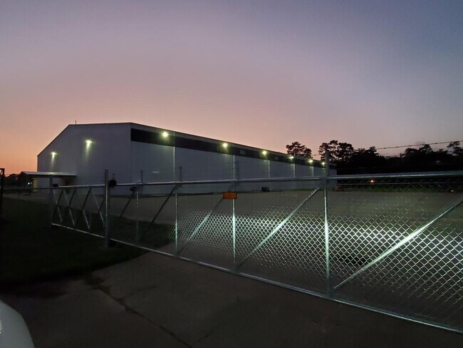

Property Detail
6120 Louetta Rd
0432340000017
RES A BLK 1 PREMIER PUMP
Lightindustrial
HARRIS
AE The base floodplain where base flood elevations are provided. AE Zones are now used on new format FIRMs instead of A1-A30 Zones.
Texas
2024
5.70 AC
2025
North Fwy/Tomball Pky
553803
Houston
53,550 SF
Houston-Pasadena-The Woodlands, TX
NEARBY LISTINGS FOR SALE OR LEASE
DEMOGRAPHICS near 6120 Louetta Rd
1 mile
3 mile
5 mile
2025 Total Population
13,884
104,702
302,702
2030 Population
14,688
111,330
322,650
Pop Growth 2025-2030
+ 5.79%
+ 6.33%
+ 6.59%
Average Age
39
40
38
2025 Total Households
4,586
36,847
106,667
HH Growth 2025-2030
+ 6.00%
+ 6.53%
+ 6.79%
Median Household Inc
$102,618
$99,624
$84,833
Avg Household Size
2.90
2.80
2.80
2025 Avg HH Vehicles
2.00
2.00
2.00
Median Home Value
$345,644
$337,328
$312,333
Median Year Built
1986
1989
1996
Nearby Places
Map Layers
Map Styles
 Street
 Aerial
Layers
 Traffic
 Biking
Places
Listings with unknown addresses are not visible on the map
- Restaurants
- Banks
- Shops
- Fitness
- Groceries
PUBLIC TRANSPORTATION
AIRPORT
George Bush Intcntl/Houston
Drive
Walk
Distance
George Bush Intcntl/Houston
27 min
17.0 mi
William P Hobby
Drive
Walk
Distance
William P Hobby
56 min
34.3 mi
Freight Ports
Port of Houston
Drive
Walk
Distance
Port of Houston
48 min
29.9 mi
SALE & LEASE HISTORY
LISTING DATE
SALE/LEASE

Oct 25, 2018
For Lease
Oct 25, 2018
For Sale
May 08, 2019
For Sale
May 03, 2021
For Sale
May 03, 2021
For Lease
May 03, 2021
For Lease
Feb 25, 2019
For Lease
Feb 25, 2019
For Sale
Feb 08, 2021
For Lease
Dec 29, 2020
For Sale
Nearby Properties
Address
Land Use
TOTAL SIZE
Lot Size
Zoning
Address
Land Use
TOTAL SIZE
Lot Size
Zoning
341,895 SF
17.53 AC
Address
Land Use
TOTAL SIZE
Lot Size
Zoning
394,700 SF
17.34 AC
Address
Land Use
TOTAL SIZE
Lot Size
Zoning
343,806 SF
17.76 AC
Address
Land Use
TOTAL SIZE
Lot Size
Zoning
304,096 SF
14.80 AC
Address
Land Use
TOTAL SIZE
Lot Size
Zoning
286,090 SF
13.25 AC
Address
Land Use
TOTAL SIZE
Lot Size
Zoning
413,131 SF
12.52 AC
Address
Land Use
TOTAL SIZE
Lot Size
Zoning
267,082 SF
11.13 AC
Address
Land Use
TOTAL SIZE
Lot Size
Zoning
348,658 SF
16.72 AC
Address
Land Use
TOTAL SIZE
Lot Size
Zoning
148,450 SF
18.26 AC
Address
Land Use
TOTAL SIZE
Lot Size
Zoning
304,518 SF
15 AC
Address
Land Use
TOTAL SIZE
Lot Size
Zoning
297,961 SF
18.04 AC
Address
Land Use
TOTAL SIZE
Lot Size
Zoning
173,371 SF
5.17 AC
Address
Land Use
TOTAL SIZE
Lot Size
Zoning
222,479 SF
4.82 AC
Address
Land Use
TOTAL SIZE
Lot Size
Zoning
114,917 SF
18.61 AC
Address
Land Use
TOTAL SIZE
Lot Size
Zoning
237,292 SF
11.91 AC
Address
Land Use
TOTAL SIZE
Lot Size
Zoning
247,670 SF
13.38 AC
Address
Land Use
TOTAL SIZE
Lot Size
Zoning
218,967 SF
14.11 AC
Address
Land Use
TOTAL SIZE
Lot Size
Zoning
145,051 SF
6.10 AC
Address
Land Use
TOTAL SIZE
Lot Size
Zoning
214,862 SF
14.92 AC
Address
Land Use
TOTAL SIZE
Lot Size
Zoning
205,054 SF
10.05 AC
Address
Land Use
TOTAL SIZE
Lot Size
Zoning
204,633 SF
10.44 AC
Address
Land Use
TOTAL SIZE
Lot Size
Zoning
224,669 SF
15.40 AC
Address
Land Use
TOTAL SIZE
Lot Size
Zoning
118,475 SF
3.89 AC
Address
Land Use
TOTAL SIZE
Lot Size
Zoning
202,323 SF
9.37 AC
Address
Land Use
TOTAL SIZE
Lot Size
Zoning
350,072 SF
18.36 AC
Address
Land Use
TOTAL SIZE
Lot Size
Zoning
148,611 SF
5.84 AC
Address
Land Use
TOTAL SIZE
Lot Size
Zoning
223,624 SF
21.91 AC
Address
Land Use
TOTAL SIZE
Lot Size
Zoning
242,704 SF
9.89 AC
Address
Land Use
TOTAL SIZE
Lot Size
Zoning
82,892 SF
8.91 AC
Address
Land Use
TOTAL SIZE
Lot Size
Zoning
270,748 SF
11.65 AC
The World's #1 Commercial Real Estate Marketplace
Connect with us
© 2026 CoStar Group
The information above has been obtained from sources believed reliable. While we do not doubt its accuracy we have not verified it and make no guarantee, warranty or representation about it. It is your responsibility to independently confirm its accuracy and completeness. Any projections, opinions, assumptions, or estimates used are for example only and do not represent the current or future performance of the property. The value of this transaction to you depends on tax and other factors which should be evaluated by your tax, financial, and legal advisors. You and your advisors should conduct a careful, independent investigation of the property to determine to your satisfaction the suitability of the property for your needs.