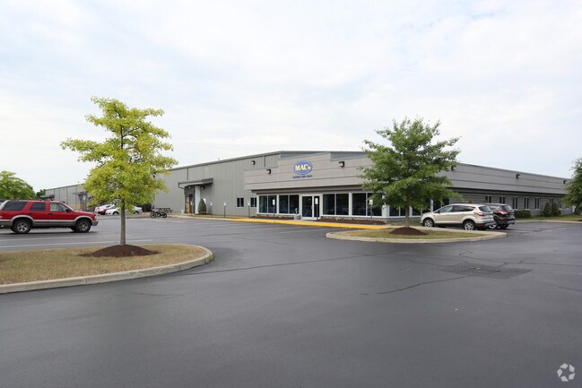
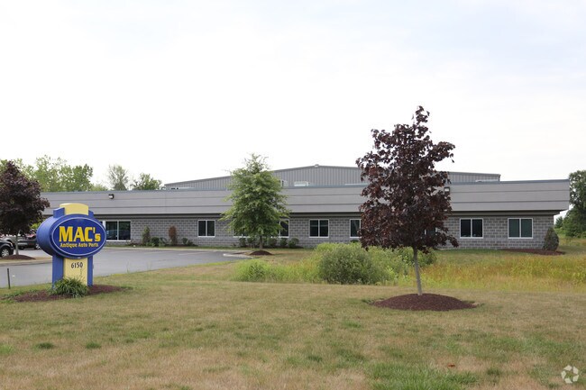
Property Record
6120 S Transit Rd, Lockport, NY 14094

Property Detail
6120 S Transit Rd
293200-137-000-0002-013-000
NIAGARA
Vehiclerentalsvehiclesales
New York
MED COM
13.000
B and X Area of moderate flood hazard, usually the area between the limits of the 100-year and 500-year floods.
9.10 AC
2025
Outlying Niagara County
2025
Buffalo/Niagara Falls
022702
Buffalo-Cheektowaga, NY
25,000 SF
NEARBY LISTINGS FOR SALE OR LEASE
DEMOGRAPHICS near 6120 S Transit Rd
1 mile
3 mile
5 mile
2025 Total Population
4,518
25,694
47,212
2030 Population
4,567
25,526
46,837
Pop Growth 2025-2030
+ 1.08%
(0.65%)
(0.79%)
Average Age
42
42
42
2025 Total Households
2,136
11,349
20,244
HH Growth 2025-2030
+ 1.12%
(0.64%)
(0.81%)
Median Household Inc
$50,743
$64,636
$72,482
Avg Household Size
2.10
2.20
2.30
2025 Avg HH Vehicles
1.00
2.00
2.00
Median Home Value
$65,066
$172,181
$189,955
Median Year Built
1988
1972
1971
Nearby Places
Map Layers
Map Styles
 Street
 Aerial
Layers
 Traffic
 Biking
Places
Listings with unknown addresses are not visible on the map
- Restaurants
- Banks
- Shops
- Fitness
- Groceries
PUBLIC TRANSPORTATION
AIRPORT
Buffalo Niagara International
Drive
Walk
Distance
Buffalo Niagara International
21 min
14.4 mi
Niagara Falls International
Drive
Walk
Distance
Niagara Falls International
25 min
14.4 mi
Nearby Properties
Address
Land Use
TOTAL SIZE
Lot Size
Zoning
Address
Land Use
TOTAL SIZE
Lot Size
Zoning
198.40 AC
Address
Land Use
TOTAL SIZE
Lot Size
Zoning
Address
Land Use
TOTAL SIZE
Lot Size
Zoning
90,347 SF
18.66 AC
B-2
Address
Land Use
TOTAL SIZE
Lot Size
Zoning
65,184 SF
100.76 AC
B-2
Address
Land Use
TOTAL SIZE
Lot Size
Zoning
90.60 AC
AR
Address
Land Use
TOTAL SIZE
Lot Size
Zoning
259,393 SF
33.74 AC
RA
Address
Land Use
TOTAL SIZE
Lot Size
Zoning
516 SF
53.70 AC
Address
Land Use
TOTAL SIZE
Lot Size
Zoning
4,417 SF
61.30 AC
Address
Land Use
TOTAL SIZE
Lot Size
Zoning
206,149 SF
17.86 AC
B-2
Address
Land Use
TOTAL SIZE
Lot Size
Zoning
660 SF
0.99 AC
R3
Address
Land Use
TOTAL SIZE
Lot Size
Zoning
13,828 SF
48.06 AC
I3
Address
Land Use
TOTAL SIZE
Lot Size
Zoning
8,604 SF
15 AC
R-2
Address
Land Use
TOTAL SIZE
Lot Size
Zoning
111,617 SF
16.83 AC
RA
Address
Land Use
TOTAL SIZE
Lot Size
Zoning
130,160 SF
13 AC
B-2
Address
Land Use
TOTAL SIZE
Lot Size
Zoning
108,630 SF
0.77 AC
B2
Address
Land Use
TOTAL SIZE
Lot Size
Zoning
280 SF
31 AC
Address
Land Use
TOTAL SIZE
Lot Size
Zoning
25,758 SF
4.06 AC
B3
Address
Land Use
TOTAL SIZE
Lot Size
Zoning
115,228 SF
10.90 AC
Address
Land Use
TOTAL SIZE
Lot Size
Zoning
Address
Land Use
TOTAL SIZE
Lot Size
Zoning
140,048 SF
13.60 AC
B-2
Address
Land Use
TOTAL SIZE
Lot Size
Zoning
792 SF
20.30 AC
Address
Land Use
TOTAL SIZE
Lot Size
Zoning
46,341 SF
5.33 AC
R1
Address
Land Use
TOTAL SIZE
Lot Size
Zoning
7,692 SF
3.82 AC
R3
Address
Land Use
TOTAL SIZE
Lot Size
Zoning
27.12 AC
Address
Land Use
TOTAL SIZE
Lot Size
Zoning
23,904 SF
2 AC
Address
Land Use
TOTAL SIZE
Lot Size
Zoning
157,785 SF
7.32 AC
I3
Address
Land Use
TOTAL SIZE
Lot Size
Zoning
52,000 SF
30.40 AC
R-1
Address
Land Use
TOTAL SIZE
Lot Size
Zoning
130,946 SF
11.10 AC
B-2
Address
Land Use
TOTAL SIZE
Lot Size
Zoning
81,875 SF
8.67 AC
RA
Address
Land Use
TOTAL SIZE
Lot Size
Zoning
67,960 SF
8.51 AC
B3
The World's #1 Commercial Real Estate Marketplace
Connect with us
© 2026 CoStar Group
The information above has been obtained from sources believed reliable. While we do not doubt its accuracy we have not verified it and make no guarantee, warranty or representation about it. It is your responsibility to independently confirm its accuracy and completeness. Any projections, opinions, assumptions, or estimates used are for example only and do not represent the current or future performance of the property. The value of this transaction to you depends on tax and other factors which should be evaluated by your tax, financial, and legal advisors. You and your advisors should conduct a careful, independent investigation of the property to determine to your satisfaction the suitability of the property for your needs.