Property Record
613 Saint Mihiel Dr, Delran, NJ 08075
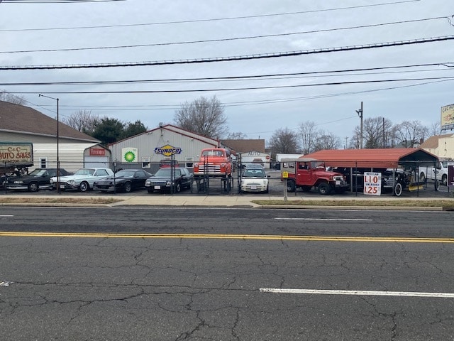


Property Detail
613 Saint Mihiel Dr
30-00403-0000-00010
Burlington
Vehiclerentalsvehiclesales
New Jersey
I2
10
B and X Area of moderate flood hazard, usually the area between the limits of the 100-year and 500-year floods.
0.47 AC
2024
Burlington
2025
Philadelphia
700701
Philadelphia-Camden-Wilmington, PA-NJ-DE-MD
3,680 SF
NEARBY LISTINGS FOR SALE OR LEASE
DEMOGRAPHICS near 613 Saint Mihiel Dr
1 mile
3 mile
5 mile
2025 Total Population
10,356
81,547
314,002
2030 Population
10,710
82,051
313,235
Pop Growth 2025-2030
+ 3.42%
+ 0.62%
(0.24%)
Average Age
40
42
41
2025 Total Households
3,772
32,631
119,030
HH Growth 2025-2030
+ 3.47%
+ 0.37%
(0.31%)
Median Household Inc
$87,787
$88,073
$78,883
Avg Household Size
2.70
2.40
2.60
2025 Avg HH Vehicles
2.00
2.00
2.00
Median Home Value
$253,146
$297,017
$279,915
Median Year Built
1950
1966
1963
Nearby Places
Map Layers
Map Styles
 Street
 Aerial
Transit
 Traffic
 Biking
Places
Listings with unknown addresses are not visible on the map
- Restaurants
- Banks
- Shops
- Fitness
- Groceries
PUBLIC TRANSPORTATION
TRANSIT/SUBWAY
Riverside (River LINE - River LINE (River LINE))
Drive
Walk
Distance
Riverside (River LINE - River LINE (River LINE))
1 min
12 min
0.6 mi
AIRPORT
Philadelphia International
Drive
Walk
Distance
Philadelphia International
38 min
23.5 mi
Trenton Mercer
Drive
Walk
Distance
Trenton Mercer
40 min
24.8 mi
Freight Ports
Port of Philadelphia
Drive
Walk
Distance
Port of Philadelphia
19 min
11.2 mi
SALE & LEASE HISTORY
LISTING DATE
SALE/LEASE

Jan 06, 2023
For Sale
Aug 05, 2021
For Sale
Nearby Properties
Address
Land Use
TOTAL SIZE
Lot Size
Zoning
Address
Land Use
TOTAL SIZE
Lot Size
Zoning
597,188 SF
120.50 AC
RM2
Address
Land Use
TOTAL SIZE
Lot Size
Zoning
96 AC
SPPOA
Address
Land Use
TOTAL SIZE
Lot Size
Zoning
95,280 SF
117.33 AC
I3
Address
Land Use
TOTAL SIZE
Lot Size
Zoning
2,183 SF
61.10 AC
Address
Land Use
TOTAL SIZE
Lot Size
Zoning
2,550 SF
63.76 AC
SPPOA
Address
Land Use
TOTAL SIZE
Lot Size
Zoning
95.79 AC
Address
Land Use
TOTAL SIZE
Lot Size
Zoning
459,320 SF
18 AC
RM2
Address
Land Use
TOTAL SIZE
Lot Size
Zoning
41.25 AC
RSA1
Address
Land Use
TOTAL SIZE
Lot Size
Zoning
5.70 AC
R2
Address
Land Use
TOTAL SIZE
Lot Size
Zoning
437,192 SF
28.03 AC
I2
Address
Land Use
TOTAL SIZE
Lot Size
Zoning
22.49 AC
Address
Land Use
TOTAL SIZE
Lot Size
Zoning
27.33 AC
Address
Land Use
TOTAL SIZE
Lot Size
Zoning
82.32 AC
Address
Land Use
TOTAL SIZE
Lot Size
Zoning
444,322 SF
27.43 AC
SPINS
Address
Land Use
TOTAL SIZE
Lot Size
Zoning
19 AC
Address
Land Use
TOTAL SIZE
Lot Size
Zoning
24.56 AC
Address
Land Use
TOTAL SIZE
Lot Size
Zoning
205,472 SF
8.40 AC
RM2
Address
Land Use
TOTAL SIZE
Lot Size
Zoning
112,440 SF
10.58 AC
CA1
Address
Land Use
TOTAL SIZE
Lot Size
Zoning
88,320 SF
21.03 AC
SPINS
Address
Land Use
TOTAL SIZE
Lot Size
Zoning
20.30 AC
Address
Land Use
TOTAL SIZE
Lot Size
Zoning
19.97 AC
Address
Land Use
TOTAL SIZE
Lot Size
Zoning
39.58 AC
Address
Land Use
TOTAL SIZE
Lot Size
Zoning
208,527 SF
7.80 AC
RM2
Address
Land Use
TOTAL SIZE
Lot Size
Zoning
25,842 SF
3.87 AC
RSA5
Address
Land Use
TOTAL SIZE
Lot Size
Zoning
152,835 SF
4.46 AC
RM2
Address
Land Use
TOTAL SIZE
Lot Size
Zoning
3.44 AC
I-2
Address
Land Use
TOTAL SIZE
Lot Size
Zoning
12,182 SF
47.21 AC
SPPOA
Address
Land Use
TOTAL SIZE
Lot Size
Zoning
17,380 SF
0.28 AC
SPCIV
Address
Land Use
TOTAL SIZE
Lot Size
Zoning
28.64 AC
Address
Land Use
TOTAL SIZE
Lot Size
Zoning
73,356 SF
6.06 AC
CA2
The World's #1 Commercial Real Estate Marketplace
Connect with us
© 2026 CoStar Group
The information above has been obtained from sources believed reliable. While we do not doubt its accuracy we have not verified it and make no guarantee, warranty or representation about it. It is your responsibility to independently confirm its accuracy and completeness. Any projections, opinions, assumptions, or estimates used are for example only and do not represent the current or future performance of the property. The value of this transaction to you depends on tax and other factors which should be evaluated by your tax, financial, and legal advisors. You and your advisors should conduct a careful, independent investigation of the property to determine to your satisfaction the suitability of the property for your needs.