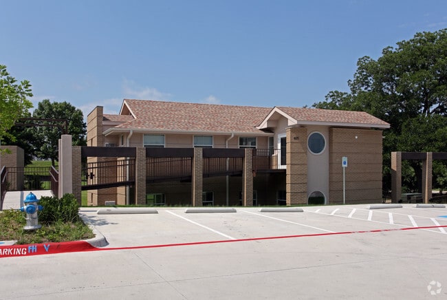
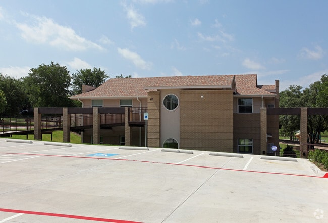
Property Record
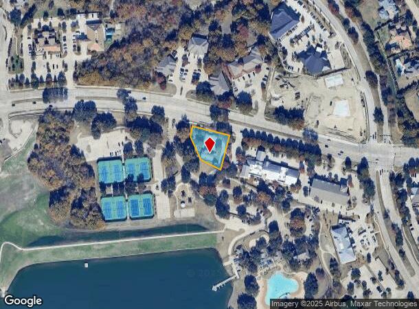
6171 Virginia Pkwy, Mckinney, TX 75071
Current Lease Availabilities
NEARBY LISTINGS FOR SALE OR LEASE
Property Detail
6171 Virginia Pkwy
Dallas-Fort Worth-Arlington, TX
Virginia Ridge Addition (Cmc)
R-8675-00A-004R-1
VIRGINIA RIDGE ADDITION, BLK A, LOT 4R; REPLAT
Officebuilding
Collin
X
Texas
48085C0255J
4r
2024
0.55 AC
2025
Allen/McKinney
030531
Dallas/Ft Worth
3,378 SF
DEMOGRAPHICS near 6171 Virginia Pkwy
1 Mile
3 Mile
5 Mile
2024 Total Population
13,061
110,507
264,123
2029 Population
15,934
134,252
323,062
Pop Growth 2024-2029
+ 22.00%
+ 21.49%
+ 22.31%
Average Age
40
38
36
2024 Total Households
4,594
37,261
89,553
HH Growth 2024-2029
+ 21.94%
+ 21.68%
+ 22.64%
Median Household Inc
$136,445
$126,821
$119,485
Avg Household Size
2.80
2.90
2.90
2024 Avg HH Vehicles
2.00
2.00
2.00
Median Home Value
$463,043
$400,015
$433,366
Median Year Built
2004
2005
2008
Nearby Places
Map Layers
Map Styles
 Street
 Aerial
- Restaurants
- Banks
- Shops
- Fitness
- Groceries
PUBLIC TRANSPORTATION
AIRPORT
Dallas Love Field
DRIVE
WALK
Distance
Dallas Love Field
45 min
33.5 mi
Dallas-Fort Worth International
DRIVE
WALK
Distance
Dallas-Fort Worth International
42 min
34.3 mi
Freight Ports
Port of Shreveport
DRIVE
WALK
Distance
Port of Shreveport
243 min
220.3 mi
Nearby Properties
Address
Land Use
TOTAL SIZE
Lot Size
Zoning
Address
Land Use
TOTAL SIZE
Lot Size
Zoning
1,826,199 SF
117.79 AC
Address
Land Use
TOTAL SIZE
Lot Size
Zoning
469,170 SF
56.84 AC
Address
Land Use
TOTAL SIZE
Lot Size
Zoning
691,265 SF
53.52 AC
Address
Land Use
TOTAL SIZE
Lot Size
Zoning
256,445 SF
10.42 AC
Address
Land Use
TOTAL SIZE
Lot Size
Zoning
585,170 SF
18.69 AC
MF RG-18
Address
Land Use
TOTAL SIZE
Lot Size
Zoning
518,353 SF
28.51 AC
MF-M
Address
Land Use
TOTAL SIZE
Lot Size
Zoning
398,732 SF
25.88 AC
MF-M
Address
Land Use
TOTAL SIZE
Lot Size
Zoning
291,577 SF
69.24 AC
APTTOWNH
Address
Land Use
TOTAL SIZE
Lot Size
Zoning
505,541 SF
19.78 AC
SFR
Address
Land Use
TOTAL SIZE
Lot Size
Zoning
274,184 SF
20.34 AC
COMM
Address
Land Use
TOTAL SIZE
Lot Size
Zoning
300,789 SF
43.28 AC
Address
Land Use
TOTAL SIZE
Lot Size
Zoning
329,086 SF
13.89 AC
MF-M
Address
Land Use
TOTAL SIZE
Lot Size
Zoning
301,764 SF
20.88 AC
MF
Address
Land Use
TOTAL SIZE
Lot Size
Zoning
123,000 SF
0.41 AC
LAC2
Address
Land Use
TOTAL SIZE
Lot Size
Zoning
282,528 SF
5.14 AC
MF-R
Address
Land Use
TOTAL SIZE
Lot Size
Zoning
264,070 SF
15.74 AC
MF-M
Address
Land Use
TOTAL SIZE
Lot Size
Zoning
197,115 SF
10.37 AC
MF-M
Address
Land Use
TOTAL SIZE
Lot Size
Zoning
243,827 SF
13.23 AC
MF
Address
Land Use
TOTAL SIZE
Lot Size
Zoning
201,902 SF
11.22 AC
MF-M
Address
Land Use
TOTAL SIZE
Lot Size
Zoning
185,434 SF
13.70 AC
MF-M
Address
Land Use
TOTAL SIZE
Lot Size
Zoning
217,303 SF
9.01 AC
COMM
Address
Land Use
TOTAL SIZE
Lot Size
Zoning
216,591 SF
33.51 AC
Address
Land Use
TOTAL SIZE
Lot Size
Zoning
232,400 SF
13.32 AC
RG-18
Address
Land Use
TOTAL SIZE
Lot Size
Zoning
168,422 SF
17.11 AC
PD
Address
Land Use
TOTAL SIZE
Lot Size
Zoning
224,254 SF
21.01 AC
SFR
Address
Land Use
TOTAL SIZE
Lot Size
Zoning
118,608 SF
5.24 AC
Address
Land Use
TOTAL SIZE
Lot Size
Zoning
144,545 SF
13.21 AC
COMM MULTI
Address
Land Use
TOTAL SIZE
Lot Size
Zoning
1,025,743 SF
126.16 AC
Address
Land Use
TOTAL SIZE
Lot Size
Zoning
105,321 SF
12.29 AC
Address
Land Use
TOTAL SIZE
Lot Size
Zoning
126,334 SF
26.04 AC
The World's #1 Commercial Real Estate Marketplace
Connect with us
© 2026 CoStar Group
The information above has been obtained from sources believed reliable. While we do not doubt its accuracy we have not verified it and make no guarantee, warranty or representation about it. It is your responsibility to independently confirm its accuracy and completeness. Any projections, opinions, assumptions, or estimates used are for example only and do not represent the current or future performance of the property. The value of this transaction to you depends on tax and other factors which should be evaluated by your tax, financial, and legal advisors. You and your advisors should conduct a careful, independent investigation of the property to determine to your satisfaction the suitability of the property for your needs.