Property Record
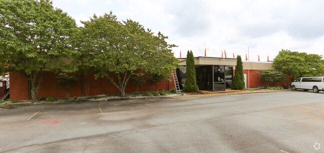
620 23Rd St Nw, Hickory, NC 28601


NEARBY LISTINGS FOR SALE OR LEASE
Property Detail
620 23Rd St Nw
Hickory-Lenoir-Morganton, NC
West Deal Heights
2793155300440000
LOT 1-10 1-10C PL 2-20 PL 2-20
Manufacturinglight
Catawba
X
North Carolina
3710279300K
1-10
2024
9.45 AC
2025
Catawba County
010600
Charlotte
76,154 SF
DEMOGRAPHICS near 620 23Rd St Nw
1 Mile
3 Mile
5 Mile
2024 Total Population
3,620
29,163
65,916
2029 Population
3,762
30,258
68,193
Pop Growth 2024-2029
+ 3.92%
+ 3.75%
+ 3.45%
Average Age
39
41
42
2024 Total Households
1,547
12,031
27,345
HH Growth 2024-2029
+ 3.88%
+ 3.81%
+ 3.51%
Median Household Inc
$43,920
$52,847
$55,969
Avg Household Size
2.30
2.30
2.30
2024 Avg HH Vehicles
2.00
2.00
2.00
Median Home Value
$158,406
$178,291
$186,927
Median Year Built
1973
1972
1979
Nearby Places
Map Layers
Map Styles
 Street
 Aerial
- Restaurants
- Banks
- Shops
- Fitness
- Groceries
SALE & LEASE HISTORY
LISTING DATE
SALE/LEASE

Sep 24, 2016
For Sale
Sep 05, 2017
For Sale
Mar 10, 2017
For Sale
Jul 03, 2017
For Sale
Apr 05, 2017
For Sale
Nearby Properties
Address
Land Use
TOTAL SIZE
Lot Size
Zoning
Address
Land Use
TOTAL SIZE
Lot Size
Zoning
534,243 SF
285.78 AC
Address
Land Use
TOTAL SIZE
Lot Size
Zoning
10,422 SF
4.23 AC
OI
Address
Land Use
TOTAL SIZE
Lot Size
Zoning
19.87 AC
OI
Address
Land Use
TOTAL SIZE
Lot Size
Zoning
27.56 AC
OI
Address
Land Use
TOTAL SIZE
Lot Size
Zoning
9,376 SF
0.75 AC
C-1
Address
Land Use
TOTAL SIZE
Lot Size
Zoning
311,263 SF
37.58 AC
IND
Address
Land Use
TOTAL SIZE
Lot Size
Zoning
7,240 SF
INDUSTRIAL
Address
Land Use
TOTAL SIZE
Lot Size
Zoning
30,415 SF
1.59 AC
C-1
Address
Land Use
TOTAL SIZE
Lot Size
Zoning
146,932 SF
27.08 AC
C-3
Address
Land Use
TOTAL SIZE
Lot Size
Zoning
90,440 SF
5.17 AC
OI
Address
Land Use
TOTAL SIZE
Lot Size
Zoning
9,950 SF
9.42 AC
R-3
Address
Land Use
TOTAL SIZE
Lot Size
Zoning
8,960 SF
14.07 AC
R-4
Address
Land Use
TOTAL SIZE
Lot Size
Zoning
187,241 SF
25.01 AC
Address
Land Use
TOTAL SIZE
Lot Size
Zoning
14.15 AC
OI
Address
Land Use
TOTAL SIZE
Lot Size
Zoning
8.36 AC
OI
Address
Land Use
TOTAL SIZE
Lot Size
Zoning
73,872 SF
NO ZONING
Address
Land Use
TOTAL SIZE
Lot Size
Zoning
137,227 SF
12.03 AC
NC
Address
Land Use
TOTAL SIZE
Lot Size
Zoning
301,264 SF
19.88 AC
I
Address
Land Use
TOTAL SIZE
Lot Size
Zoning
2.36 AC
C-1
Address
Land Use
TOTAL SIZE
Lot Size
Zoning
73,702 SF
13.37 AC
C-2
Address
Land Use
TOTAL SIZE
Lot Size
Zoning
8,246 SF
37.33 AC
OI
Address
Land Use
TOTAL SIZE
Lot Size
Zoning
9.07 AC
NC
Address
Land Use
TOTAL SIZE
Lot Size
Zoning
13.07 AC
OI
Address
Land Use
TOTAL SIZE
Lot Size
Zoning
6,208 SF
6.12 AC
R-3
Address
Land Use
TOTAL SIZE
Lot Size
Zoning
20,503 SF
16.55 AC
INDUSTRIAL
Address
Land Use
TOTAL SIZE
Lot Size
Zoning
2.20 AC
OI
Address
Land Use
TOTAL SIZE
Lot Size
Zoning
101,568 SF
22.78 AC
C-3
Address
Land Use
TOTAL SIZE
Lot Size
Zoning
173,730 SF
16.80 AC
IND
Address
Land Use
TOTAL SIZE
Lot Size
Zoning
5.08 AC
NC
Address
Land Use
TOTAL SIZE
Lot Size
Zoning
272,735 SF
21.83 AC
IND
The World's #1 Commercial Real Estate Marketplace
Connect with us
© 2025 CoStar Group
The information above has been obtained from sources believed reliable. While we do not doubt its accuracy we have not verified it and make no guarantee, warranty or representation about it. It is your responsibility to independently confirm its accuracy and completeness. Any projections, opinions, assumptions, or estimates used are for example only and do not represent the current or future performance of the property. The value of this transaction to you depends on tax and other factors which should be evaluated by your tax, financial, and legal advisors. You and your advisors should conduct a careful, independent investigation of the property to determine to your satisfaction the suitability of the property for your needs.