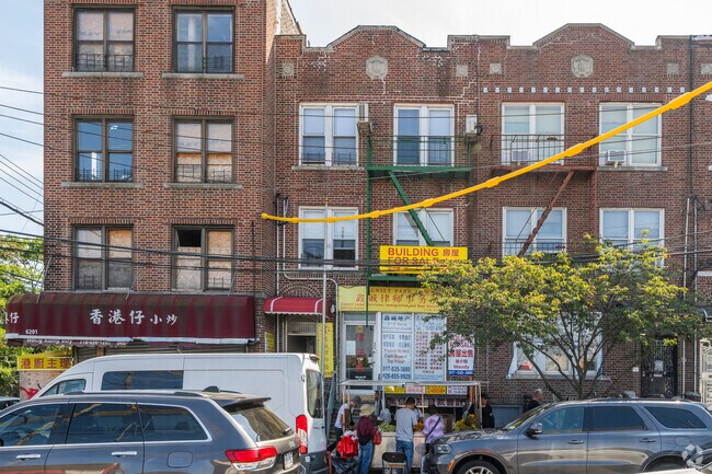
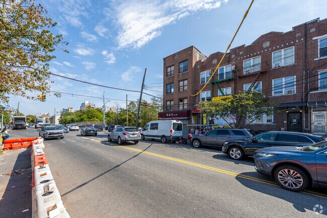
Property Record
6203 8Th Ave, Brooklyn, NY 11220

NEARBY LISTINGS FOR SALE OR LEASE
Property Detail
6203 8Th Ave
05728-0009
DOCID-2013041601128001
Commercialofficeresidentialmixeduse
Kings
X
New York
3604970194F
9
2024
0.05 AC
2025
Sunset Park
012000
Long Island (New York)
6,880 SF
New York-Jersey City-White Plains, NY-NJ
DEMOGRAPHICS near 6203 8Th Ave
1 Mile
3 Mile
5 Mile
2024 Total Population
167,263
736,421
1,822,153
2029 Population
150,985
682,318
1,711,732
Pop Growth 2024-2029
(9.73%)
(7.35%)
(6.06%)
Average Age
37
39
40
2024 Total Households
50,197
247,791
674,275
HH Growth 2024-2029
(10.14%)
(7.68%)
(6.29%)
Median Household Inc
$59,269
$68,481
$73,595
Avg Household Size
3.20
2.80
2.60
2024 Avg HH Vehicles
1.00
1.00
1.00
Median Home Value
$966,800
$958,078
$832,500
Median Year Built
1946
1947
1948
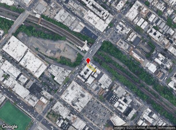
Nearby Places
Map Layers
Map Styles
 Street
 Aerial
- Restaurants
- Banks
- Shops
- Fitness
- Groceries
PUBLIC TRANSPORTATION
TRANSIT/SUBWAY
8 Avenue (N - New York MTA Subway (The Subway))
DRIVE
WALK
Distance
8 Avenue (N - New York MTA Subway (The Subway))
2 min
1 min
0.0 mi
Fort Hamilton Parkway (N Line) (N - New York MTA Subway (The Subway))
DRIVE
WALK
Distance
Fort Hamilton Parkway (N Line) (N - New York MTA Subway (The Subway))
1 min
7 min
0.3 mi
59 Street (N,R Line) (N - New York MTA Subway (The Subway), R - New York MTA Subway (The Subway))
DRIVE
WALK
Distance
59 Street (N,R Line) (N - New York MTA Subway (The Subway), R - New York MTA Subway (The Subway))
4 min
15 min
0.8 mi
Bay Ridge Avenue (R - New York MTA Subway (The Subway))
DRIVE
WALK
Distance
Bay Ridge Avenue (R - New York MTA Subway (The Subway))
4 min
18 min
0.9 mi
55 Street (D - New York MTA Subway (The Subway), M - New York MTA Subway (The Subway))
DRIVE
WALK
Distance
55 Street (D - New York MTA Subway (The Subway), M - New York MTA Subway (The Subway))
3 min
20 min
1.0 mi
COMMUTER RAIL
DRIVE
WALK
Distance
14 min
5.7 mi
Clifton (Staten Island Railway - New York MTA Subway (The Subway))
DRIVE
WALK
Distance
Clifton (Staten Island Railway - New York MTA Subway (The Subway))
13 min
6.1 mi
AIRPORT
John F Kennedy International
DRIVE
WALK
Distance
John F Kennedy International
28 min
14.9 mi
LaGuardia
DRIVE
WALK
Distance
LaGuardia
29 min
16.0 mi
Newark Liberty International
DRIVE
WALK
Distance
Newark Liberty International
33 min
19.6 mi
Freight Ports
NY - Red Hook Container Terminal
DRIVE
WALK
Distance
NY - Red Hook Container Terminal
9 min
4.9 mi
Nearby Properties
Address
Land Use
TOTAL SIZE
Lot Size
Zoning
Address
Land Use
TOTAL SIZE
Lot Size
Zoning
92,440 SF
466.23 AC
R5
Address
Land Use
TOTAL SIZE
Lot Size
Zoning
393.54 AC
PARK
Address
Land Use
TOTAL SIZE
Lot Size
Zoning
1,524,659 SF
170.96 AC
R4
Address
Land Use
TOTAL SIZE
Lot Size
Zoning
577,381 SF
3.19 AC
R6
Address
Land Use
TOTAL SIZE
Lot Size
Zoning
902,000 SF
6.44 AC
M3-1
Address
Land Use
TOTAL SIZE
Lot Size
Zoning
965,600 SF
6.65 AC
R5
Address
Land Use
TOTAL SIZE
Lot Size
Zoning
460,000 SF
3.21 AC
R6
Address
Land Use
TOTAL SIZE
Lot Size
Zoning
335,800 SF
1.51 AC
R6
Address
Land Use
TOTAL SIZE
Lot Size
Zoning
1,324,592 SF
5.13 AC
M3-1
Address
Land Use
TOTAL SIZE
Lot Size
Zoning
397,354 SF
0.61 AC
C5-2
Address
Land Use
TOTAL SIZE
Lot Size
Zoning
427,208 SF
1.30 AC
R6
Address
Land Use
TOTAL SIZE
Lot Size
Zoning
393,092 SF
1.07 AC
R8A
Address
Land Use
TOTAL SIZE
Lot Size
Zoning
371,139 SF
3.22 AC
R5
Address
Land Use
TOTAL SIZE
Lot Size
Zoning
5,359,400 SF
59.07 AC
M2-1
Address
Land Use
TOTAL SIZE
Lot Size
Zoning
286,000 SF
12.63 AC
PARK
Address
Land Use
TOTAL SIZE
Lot Size
Zoning
3,970,000 SF
91.14 AC
M3-1
Address
Land Use
TOTAL SIZE
Lot Size
Zoning
1,466,751 SF
24.79 AC
R5
Address
Land Use
TOTAL SIZE
Lot Size
Zoning
689,850 SF
3.08 AC
M3-1
Address
Land Use
TOTAL SIZE
Lot Size
Zoning
301,400 SF
22.27 AC
M3-1
Address
Land Use
TOTAL SIZE
Lot Size
Zoning
336,534 SF
47.78 AC
M1-1
Address
Land Use
TOTAL SIZE
Lot Size
Zoning
673,895 SF
3.22 AC
M3-1
Address
Land Use
TOTAL SIZE
Lot Size
Zoning
1,112,855 SF
3.52 AC
M3-1
Address
Land Use
TOTAL SIZE
Lot Size
Zoning
139,557 SF
11.47 AC
M1-1
Address
Land Use
TOTAL SIZE
Lot Size
Zoning
623,117 SF
4.16 AC
M3-1
Address
Land Use
TOTAL SIZE
Lot Size
Zoning
218,840 SF
2.52 AC
R6B
Address
Land Use
TOTAL SIZE
Lot Size
Zoning
171,591 SF
0.14 AC
C5-2
Address
Land Use
TOTAL SIZE
Lot Size
Zoning
478,268 SF
4.04 AC
M3-1
Address
Land Use
TOTAL SIZE
Lot Size
Zoning
581,250 SF
3.22 AC
M3-1
Address
Land Use
TOTAL SIZE
Lot Size
Zoning
247,400 SF
4.34 AC
C44A
Address
Land Use
TOTAL SIZE
Lot Size
Zoning
292,528 SF
1.05 AC
R6
The World's #1 Commercial Real Estate Marketplace
Connect with us
© 2026 CoStar Group
The information above has been obtained from sources believed reliable. While we do not doubt its accuracy we have not verified it and make no guarantee, warranty or representation about it. It is your responsibility to independently confirm its accuracy and completeness. Any projections, opinions, assumptions, or estimates used are for example only and do not represent the current or future performance of the property. The value of this transaction to you depends on tax and other factors which should be evaluated by your tax, financial, and legal advisors. You and your advisors should conduct a careful, independent investigation of the property to determine to your satisfaction the suitability of the property for your needs.