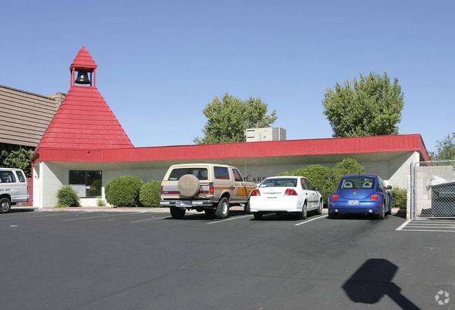
Property Record
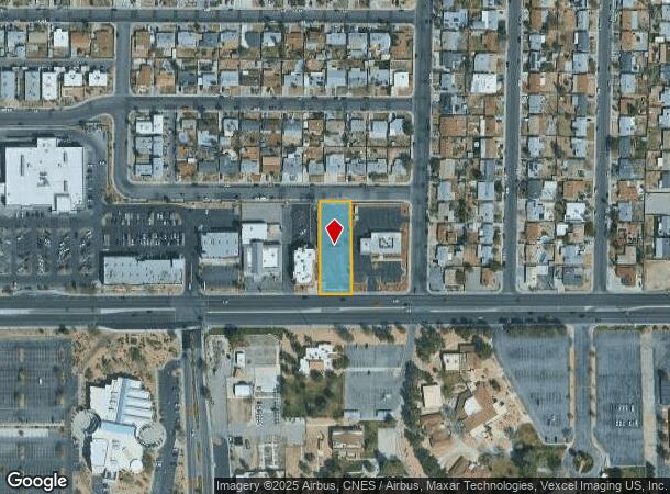
6204 W Charleston Blvd, Las Vegas, NV 89146

NEARBY LISTINGS FOR SALE OR LEASE
Property Detail
6204 W Charleston Blvd
Las Vegas-Henderson-North Las Vegas, NV
Parcel Map File 29 Page 49
138-35-803-004
PARCEL MAP FILE 29 PAGE 49 LOT 2
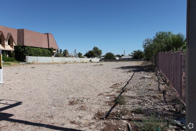
Vacantlandnec
Clark
X
Nevada
32003C2165D
2
2025
0.55 AC
2025
Central West Las Vegas
000103
Las Vegas
DEMOGRAPHICS near 6204 W Charleston Blvd
1 Mile
3 Mile
5 Mile
2024 Total Population
20,920
198,146
475,390
2029 Population
22,376
213,004
511,062
Pop Growth 2024-2029
+ 6.96%
+ 7.50%
+ 7.50%
Average Age
38
39
40
2024 Total Households
7,077
74,874
189,685
HH Growth 2024-2029
+ 6.95%
+ 7.49%
+ 7.59%
Median Household Inc
$47,864
$47,083
$51,416
Avg Household Size
2.80
2.60
2.40
2024 Avg HH Vehicles
2.00
2.00
2.00
Median Home Value
$279,228
$286,987
$333,779
Median Year Built
1975
1984
1989
Nearby Places
Map Layers
Map Styles
 Street
 Aerial
- Restaurants
- Banks
- Shops
- Fitness
- Groceries
PUBLIC TRANSPORTATION
AIRPORT
Harry Reid International
DRIVE
WALK
Distance
Harry Reid International
19 min
9.3 mi
Boulder City Municipal
DRIVE
WALK
Distance
Boulder City Municipal
42 min
31.9 mi
Nearby Properties
Address
Land Use
TOTAL SIZE
Lot Size
Zoning
Address
Land Use
TOTAL SIZE
Lot Size
Zoning
962,611 SF
28.43 AC
Address
Land Use
TOTAL SIZE
Lot Size
Zoning
80.45 AC
CV
Address
Land Use
TOTAL SIZE
Lot Size
Zoning
157.50 AC
Address
Land Use
TOTAL SIZE
Lot Size
Zoning
49,716 SF
59.37 AC
CV
Address
Land Use
TOTAL SIZE
Lot Size
Zoning
12.23 AC
PF
Address
Land Use
TOTAL SIZE
Lot Size
Zoning
28,956 SF
75.82 AC
CV
Address
Land Use
TOTAL SIZE
Lot Size
Zoning
4,872 SF
18.22 AC
R3
Address
Land Use
TOTAL SIZE
Lot Size
Zoning
5,057 SF
9.46 AC
RE
Address
Land Use
TOTAL SIZE
Lot Size
Zoning
8,261 SF
9.36 AC
Address
Land Use
TOTAL SIZE
Lot Size
Zoning
271,484 SF
7.04 AC
C2
Address
Land Use
TOTAL SIZE
Lot Size
Zoning
322,005 SF
29.37 AC
C1
Address
Land Use
TOTAL SIZE
Lot Size
Zoning
6,558 SF
23.36 AC
R3
Address
Land Use
TOTAL SIZE
Lot Size
Zoning
52,058 SF
6.44 AC
C1
Address
Land Use
TOTAL SIZE
Lot Size
Zoning
66.57 AC
CV
Address
Land Use
TOTAL SIZE
Lot Size
Zoning
12,212 SF
8.29 AC
C1
Address
Land Use
TOTAL SIZE
Lot Size
Zoning
285,929 SF
5.06 AC
C1
Address
Land Use
TOTAL SIZE
Lot Size
Zoning
211,331 SF
6.70 AC
USC
Address
Land Use
TOTAL SIZE
Lot Size
Zoning
6,280 SF
8.72 AC
RPD18
Address
Land Use
TOTAL SIZE
Lot Size
Zoning
Address
Land Use
TOTAL SIZE
Lot Size
Zoning
7,148 SF
15.33 AC
L:R-PD20
Address
Land Use
TOTAL SIZE
Lot Size
Zoning
1,838 SF
24.69 AC
R3
Address
Land Use
TOTAL SIZE
Lot Size
Zoning
186,867 SF
3.19 AC
L:C-1
Address
Land Use
TOTAL SIZE
Lot Size
Zoning
4,729 SF
13.01 AC
R3
Address
Land Use
TOTAL SIZE
Lot Size
Zoning
4,978 SF
15.05 AC
R3
Address
Land Use
TOTAL SIZE
Lot Size
Zoning
8.28 AC
PF
Address
Land Use
TOTAL SIZE
Lot Size
Zoning
5,171 SF
4.24 AC
RPD14
Address
Land Use
TOTAL SIZE
Lot Size
Zoning
4.02 AC
C1
Address
Land Use
TOTAL SIZE
Lot Size
Zoning
120,648 SF
11.92 AC
RE
The World's #1 Commercial Real Estate Marketplace
Connect with us
© 2026 CoStar Group
The information above has been obtained from sources believed reliable. While we do not doubt its accuracy we have not verified it and make no guarantee, warranty or representation about it. It is your responsibility to independently confirm its accuracy and completeness. Any projections, opinions, assumptions, or estimates used are for example only and do not represent the current or future performance of the property. The value of this transaction to you depends on tax and other factors which should be evaluated by your tax, financial, and legal advisors. You and your advisors should conduct a careful, independent investigation of the property to determine to your satisfaction the suitability of the property for your needs.