Property Record
6225 Smith Ave, Baltimore, MD 21209


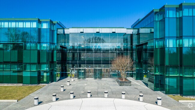
Property Detail
6225 Smith Ave
Baltimore-Columbia-Towson, MD
24 AC PARTIAL EXE ST PAUL CMPNS MT WSHNGTN
03-2400002704
Baltimore City
Commercialacreage
Maryland
02
b
B and X Area of moderate flood hazard, usually the area between the limits of the 100-year and 500-year floods.
24 AC
2024
Reisterstown Rd Corridor
2025
Baltimore
403602
NEARBY LISTINGS FOR SALE OR LEASE
DEMOGRAPHICS near 6225 Smith Ave
1 mile
3 mile
5 mile
2025 Total Population
8,803
122,717
379,535
2030 Population
8,674
120,773
376,030
Pop Growth 2025-2030
(1.47%)
(1.58%)
(0.92%)
Average Age
39
40
41
2025 Total Households
3,722
47,823
156,876
HH Growth 2025-2030
(1.56%)
(1.81%)
(1.04%)
Median Household Inc
$92,332
$79,708
$70,566
Avg Household Size
2.30
2.30
2.20
2025 Avg HH Vehicles
2.00
1.00
1.00
Median Home Value
$474,539
$392,186
$309,779
Median Year Built
1971
1957
1955
Nearby Places
Map Layers
Map Styles
 Street
 Aerial
Layers
 Traffic
 Biking
Places
Listings with unknown addresses are not visible on the map
- Restaurants
- Banks
- Shops
- Fitness
- Groceries
PUBLIC TRANSPORTATION
TRANSIT/SUBWAY
Mount Washington (Hunt Valley & BWI Marshall - Maryland Transit Administration Light Rail (Baltimore Light Rail), Timonium & Cromwell - Maryland Transit Administration Light Rail (Baltimore Light Rail))
Drive
Walk
Distance
Mount Washington (Hunt Valley & BWI Marshall - Maryland Transit Administration Light Rail (Baltimore Light Rail), Timonium & Cromwell - Maryland Transit Administration Light Rail (Baltimore Light Rail))
4 min
14 min
0.7 mi
COMMUTER RAIL
Penn Station (PENN - WASHINGTON - Maryland Area Regional Commuter Trains (The MARC), Penn Line - Maryland Area Regional Commuter Trains (The MARC), Penn Station & Camden Yards - Maryland Area Regional Commuter Trains (The MARC))
Drive
Walk
Distance
Penn Station (PENN - WASHINGTON - Maryland Area Regional Commuter Trains (The MARC), Penn Line - Maryland Area Regional Commuter Trains (The MARC), Penn Station & Camden Yards - Maryland Area Regional Commuter Trains (The MARC))
14 min
6.5 mi
West Baltimore Marc Sb (PENN - WASHINGTON - Maryland Transit Administration)
Drive
Walk
Distance
West Baltimore Marc Sb (PENN - WASHINGTON - Maryland Transit Administration)
19 min
7.8 mi
AIRPORT
Baltimore/Washington International Thurgood Marshall
Drive
Walk
Distance
Baltimore/Washington International Thurgood Marshall
34 min
18.1 mi
Freight Ports
Port of Baltimore
Drive
Walk
Distance
Port of Baltimore
24 min
10.3 mi
SALE & LEASE HISTORY
LISTING DATE
SALE/LEASE

Sep 25, 2016
For Lease
Oct 25, 2019
For Lease
Mar 01, 2023
For Lease
Dec 12, 2017
For Lease
Dec 08, 2017
For Lease
Dec 07, 2017
For Sale
Nearby Properties
Address
Land Use
TOTAL SIZE
Lot Size
Zoning
Address
Land Use
TOTAL SIZE
Lot Size
Zoning
363,750 SF
87 SF
Address
Land Use
TOTAL SIZE
Lot Size
Zoning
1,165,880 SF
55.70 AC
DR2
Address
Land Use
TOTAL SIZE
Lot Size
Zoning
810,716 SF
28.88 AC
H
Address
Land Use
TOTAL SIZE
Lot Size
Zoning
599,187 SF
30.14 AC
EC-2
Address
Land Use
TOTAL SIZE
Lot Size
Zoning
723,067 SF
80.37 AC
OR2
Address
Land Use
TOTAL SIZE
Lot Size
Zoning
23.09 AC
DR16
Address
Land Use
TOTAL SIZE
Lot Size
Zoning
34.99 AC
R-5
Address
Land Use
TOTAL SIZE
Lot Size
Zoning
567,521 SF
8.12 AC
R-9
Address
Land Use
TOTAL SIZE
Lot Size
Zoning
230,316 SF
9.93 AC
DR2
Address
Land Use
TOTAL SIZE
Lot Size
Zoning
117,000 SF
71.11 AC
EC-2
Address
Land Use
TOTAL SIZE
Lot Size
Zoning
12.75 AC
DR16
Address
Land Use
TOTAL SIZE
Lot Size
Zoning
430,271 SF
56.35 AC
EC-2
Address
Land Use
TOTAL SIZE
Lot Size
Zoning
507,813 SF
4.94 AC
TOD-2
Address
Land Use
TOTAL SIZE
Lot Size
Zoning
211,229 SF
7.46 AC
R-9
Address
Land Use
TOTAL SIZE
Lot Size
Zoning
33.46 AC
DR16
Address
Land Use
TOTAL SIZE
Lot Size
Zoning
578,808 SF
30.10 AC
Address
Land Use
TOTAL SIZE
Lot Size
Zoning
27.30 AC
DR16
Address
Land Use
TOTAL SIZE
Lot Size
Zoning
54.25 AC
EC-1
Address
Land Use
TOTAL SIZE
Lot Size
Zoning
15.49 AC
DR16
Address
Land Use
TOTAL SIZE
Lot Size
Zoning
245,951 SF
58.90 AC
EC-1
Address
Land Use
TOTAL SIZE
Lot Size
Zoning
814,033 SF
23.60 AC
OR-2
Address
Land Use
TOTAL SIZE
Lot Size
Zoning
117,680 SF
23.12 AC
H
Address
Land Use
TOTAL SIZE
Lot Size
Zoning
334,557 SF
52 AC
R-6
Address
Land Use
TOTAL SIZE
Lot Size
Zoning
289,194 SF
19.57 AC
H
Address
Land Use
TOTAL SIZE
Lot Size
Zoning
293,603 SF
13.54 AC
R-1-C
Address
Land Use
TOTAL SIZE
Lot Size
Zoning
316,150 SF
14.28 AC
R-6
Address
Land Use
TOTAL SIZE
Lot Size
Zoning
17.08 AC
DR16
Address
Land Use
TOTAL SIZE
Lot Size
Zoning
182,160 SF
23.55 AC
Address
Land Use
TOTAL SIZE
Lot Size
Zoning
44 SF
EC-1
The World's #1 Commercial Real Estate Marketplace
Connect with us
© 2026 CoStar Group
The information above has been obtained from sources believed reliable. While we do not doubt its accuracy we have not verified it and make no guarantee, warranty or representation about it. It is your responsibility to independently confirm its accuracy and completeness. Any projections, opinions, assumptions, or estimates used are for example only and do not represent the current or future performance of the property. The value of this transaction to you depends on tax and other factors which should be evaluated by your tax, financial, and legal advisors. You and your advisors should conduct a careful, independent investigation of the property to determine to your satisfaction the suitability of the property for your needs.