Property Record
6287 Lear Nagle Rd, North Ridgeville, OH 44039


NEARBY LISTINGS FOR SALE OR LEASE
Property Detail
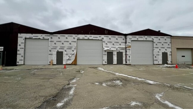
6287 Lear Nagle Rd
Cleveland-Elyria, OH
Ridgeville
07-00-008-115-067
20030906193
Storebuilding
Lorain
AE
Ohio
39035C0138E
8
2024
2.22 AC
2024
Lorain/Avon Lake
080600
Cleveland
24,312 SF
DEMOGRAPHICS near 6287 Lear Nagle Rd
1 Mile
3 Mile
5 Mile
2024 Total Population
7,555
46,914
119,806
2029 Population
7,863
47,911
120,869
Pop Growth 2024-2029
+ 4.08%
+ 2.13%
+ 0.89%
Average Age
43
43
43
2024 Total Households
3,112
18,818
48,157
HH Growth 2024-2029
+ 4.05%
+ 1.98%
+ 0.74%
Median Household Inc
$74,829
$85,183
$87,997
Avg Household Size
2.40
2.40
2.40
2024 Avg HH Vehicles
2.00
2.00
2.00
Median Home Value
$159,825
$220,306
$235,482
Median Year Built
1974
1987
1984
Nearby Places
Map Layers
Map Styles
 Street
 Aerial
- Restaurants
- Banks
- Shops
- Fitness
- Groceries
PUBLIC TRANSPORTATION
COMMUTER RAIL
Elyria Amtrak (Capitol Limited - Amtrak, Lake Shore Limited - Amtrak)
DRIVE
WALK
Distance
Elyria Amtrak (Capitol Limited - Amtrak, Lake Shore Limited - Amtrak)
13 min
6.3 mi
AIRPORT
Cleveland-Hopkins International
DRIVE
WALK
Distance
Cleveland-Hopkins International
17 min
9.8 mi
Freight Ports
Port of Toledo
DRIVE
WALK
Distance
Port of Toledo
114 min
95.5 mi
SALE & LEASE HISTORY
LISTING DATE
SALE/LEASE

Mar 03, 2025
For Lease
Nearby Properties
Address
Land Use
TOTAL SIZE
Lot Size
Zoning
Address
Land Use
TOTAL SIZE
Lot Size
Zoning
128,869 SF
30.06 AC
Address
Land Use
TOTAL SIZE
Lot Size
Zoning
195,990 SF
46.88 AC
RMF-A
Address
Land Use
TOTAL SIZE
Lot Size
Zoning
176,857 SF
8.62 AC
B-2
Address
Land Use
TOTAL SIZE
Lot Size
Zoning
46,133 SF
35.03 AC
RMF-A
Address
Land Use
TOTAL SIZE
Lot Size
Zoning
50,668 SF
9.04 AC
Address
Land Use
TOTAL SIZE
Lot Size
Zoning
128,416 SF
13.42 AC
R-40
Address
Land Use
TOTAL SIZE
Lot Size
Zoning
43,950 SF
9.40 AC
Address
Land Use
TOTAL SIZE
Lot Size
Zoning
39,418 SF
6.05 AC
Address
Land Use
TOTAL SIZE
Lot Size
Zoning
57,126 SF
11.74 AC
Address
Land Use
TOTAL SIZE
Lot Size
Zoning
18,697 SF
4.47 AC
Address
Land Use
TOTAL SIZE
Lot Size
Zoning
73,673 SF
6.80 AC
SR
Address
Land Use
TOTAL SIZE
Lot Size
Zoning
27,445 SF
2 AC
Address
Land Use
TOTAL SIZE
Lot Size
Zoning
50,064 SF
15.73 AC
Address
Land Use
TOTAL SIZE
Lot Size
Zoning
28,595 SF
10.61 AC
Address
Land Use
TOTAL SIZE
Lot Size
Zoning
54,847 SF
6.99 AC
CRG
Address
Land Use
TOTAL SIZE
Lot Size
Zoning
99,422 SF
13.77 AC
Address
Land Use
TOTAL SIZE
Lot Size
Zoning
37,746 SF
9.42 AC
Address
Land Use
TOTAL SIZE
Lot Size
Zoning
42,487 SF
33.33 AC
Address
Land Use
TOTAL SIZE
Lot Size
Zoning
49,926 SF
18.42 AC
Address
Land Use
TOTAL SIZE
Lot Size
Zoning
29,024 SF
7.29 AC
Address
Land Use
TOTAL SIZE
Lot Size
Zoning
55,496 SF
6.29 AC
CRG
Address
Land Use
TOTAL SIZE
Lot Size
Zoning
93,980 SF
12.48 AC
Address
Land Use
TOTAL SIZE
Lot Size
Zoning
8,526 SF
5.19 AC
Address
Land Use
TOTAL SIZE
Lot Size
Zoning
31,185 SF
4.15 AC
Address
Land Use
TOTAL SIZE
Lot Size
Zoning
24,326 SF
7.54 AC
Address
Land Use
TOTAL SIZE
Lot Size
Zoning
11,984 SF
2.07 AC
Address
Land Use
TOTAL SIZE
Lot Size
Zoning
22,681 SF
3.55 AC
OB
Address
Land Use
TOTAL SIZE
Lot Size
Zoning
20,526 SF
3 AC
Address
Land Use
TOTAL SIZE
Lot Size
Zoning
76,672 SF
5.38 AC
IG
Address
Land Use
TOTAL SIZE
Lot Size
Zoning
99,880 SF
7.94 AC
The World's #1 Commercial Real Estate Marketplace
Connect with us
© 2025 CoStar Group
The information above has been obtained from sources believed reliable. While we do not doubt its accuracy we have not verified it and make no guarantee, warranty or representation about it. It is your responsibility to independently confirm its accuracy and completeness. Any projections, opinions, assumptions, or estimates used are for example only and do not represent the current or future performance of the property. The value of this transaction to you depends on tax and other factors which should be evaluated by your tax, financial, and legal advisors. You and your advisors should conduct a careful, independent investigation of the property to determine to your satisfaction the suitability of the property for your needs.