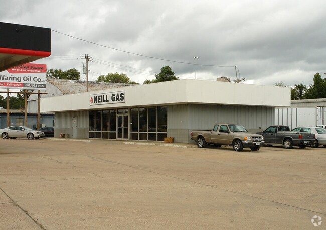
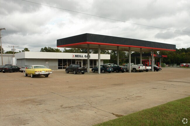
Property Record
630 Highway 80 E, Flowood, MS 39232

Property Detail
630 Highway 80 E
Jackson, MS
LOT 400 X 400 NE4 NW4 S OF RR & N OF HWY 80 & E OF I-55 DB 497 PG 0180 0121385
D08M-000013-00010
RANKIN
Warehouse
Mississippi
AE The base floodplain where base flood elevations are provided. AE Zones are now used on new format FIRMs instead of A1-A30 Zones.
400
2024
3.64 AC
2025
Brandon/Flowood/Pearl
020304
Jackson
20,031 SF
NEARBY LISTINGS FOR SALE OR LEASE
DEMOGRAPHICS near 630 Highway 80 E
1 mile
3 mile
5 mile
2025 Total Population
338
26,233
92,902
2030 Population
360
26,218
92,886
Pop Growth 2025-2030
+ 6.51%
(0.06%)
(0.02%)
Average Age
38
37
38
2025 Total Households
131
10,789
37,870
HH Growth 2025-2030
+ 6.11%
+ 0.04%
(0.15%)
Median Household Inc
$9,705
$40,462
$39,723
Avg Household Size
2.50
2.10
2.30
2025 Avg HH Vehicles
2.00
1.00
2.00
Median Home Value
$62,096
$136,491
$114,430
Median Year Built
1986
1967
1967
Nearby Places
Map Layers
Map Styles
 Street
 Aerial
Transit
 Traffic
 Biking
Places
Listings with unknown addresses are not visible on the map
- Restaurants
- Banks
- Shops
- Fitness
- Groceries
PUBLIC TRANSPORTATION
COMMUTER RAIL
Jackson (City of New Orleans - Amtrak)
Drive
Walk
Distance
Jackson (City of New Orleans - Amtrak)
5 min
2.8 mi
AIRPORT
Jackson-Medgar Wiley Evers International
Drive
Walk
Distance
Jackson-Medgar Wiley Evers International
16 min
7.7 mi
Freight Ports
Port of Greater Baton Rouge
Drive
Walk
Distance
Port of Greater Baton Rouge
196 min
176.2 mi
Nearby Properties
Address
Land Use
TOTAL SIZE
Lot Size
Zoning
Address
Land Use
TOTAL SIZE
Lot Size
Zoning
435,199 SF
1 AC
Address
Land Use
TOTAL SIZE
Lot Size
Zoning
74,923 SF
0.01 AC
Address
Land Use
TOTAL SIZE
Lot Size
Zoning
9,650 SF
0.55 AC
Address
Land Use
TOTAL SIZE
Lot Size
Zoning
7.60 AC
Address
Land Use
TOTAL SIZE
Lot Size
Zoning
Address
Land Use
TOTAL SIZE
Lot Size
Zoning
145,789 SF
6 AC
Address
Land Use
TOTAL SIZE
Lot Size
Zoning
206,400 SF
7.96 AC
Address
Land Use
TOTAL SIZE
Lot Size
Zoning
413,174 SF
2 AC
Address
Land Use
TOTAL SIZE
Lot Size
Zoning
96,444 SF
0.88 AC
Address
Land Use
TOTAL SIZE
Lot Size
Zoning
94.48 AC
Address
Land Use
TOTAL SIZE
Lot Size
Zoning
62.33 AC
Address
Land Use
TOTAL SIZE
Lot Size
Zoning
247,574 SF
0.94 AC
Address
Land Use
TOTAL SIZE
Lot Size
Zoning
45,186 SF
0.15 AC
Address
Land Use
TOTAL SIZE
Lot Size
Zoning
115,200 SF
0.35 AC
Address
Land Use
TOTAL SIZE
Lot Size
Zoning
17,261 SF
18.20 AC
Address
Land Use
TOTAL SIZE
Lot Size
Zoning
46,958 SF
0.77 AC
Address
Land Use
TOTAL SIZE
Lot Size
Zoning
32,886 SF
1 AC
Address
Land Use
TOTAL SIZE
Lot Size
Zoning
31,541 SF
4 AC
Address
Land Use
TOTAL SIZE
Lot Size
Zoning
30,925 SF
38.73 AC
Address
Land Use
TOTAL SIZE
Lot Size
Zoning
2,190,610 SF
2 AC
Address
Land Use
TOTAL SIZE
Lot Size
Zoning
47,885 SF
0.01 AC
Address
Land Use
TOTAL SIZE
Lot Size
Zoning
69,034 SF
0.64 AC
Address
Land Use
TOTAL SIZE
Lot Size
Zoning
40,148 SF
37.47 AC
Address
Land Use
TOTAL SIZE
Lot Size
Zoning
9,081 SF
0.73 AC
Address
Land Use
TOTAL SIZE
Lot Size
Zoning
55,591 SF
1 AC
Address
Land Use
TOTAL SIZE
Lot Size
Zoning
42,520 SF
0.22 AC
Address
Land Use
TOTAL SIZE
Lot Size
Zoning
0.01 AC
Address
Land Use
TOTAL SIZE
Lot Size
Zoning
Address
Land Use
TOTAL SIZE
Lot Size
Zoning
38,189 SF
1 AC
Address
Land Use
TOTAL SIZE
Lot Size
Zoning
28.60 AC
The World's #1 Commercial Real Estate Marketplace
Connect with us
© 2026 CoStar Group
The information above has been obtained from sources believed reliable. While we do not doubt its accuracy we have not verified it and make no guarantee, warranty or representation about it. It is your responsibility to independently confirm its accuracy and completeness. Any projections, opinions, assumptions, or estimates used are for example only and do not represent the current or future performance of the property. The value of this transaction to you depends on tax and other factors which should be evaluated by your tax, financial, and legal advisors. You and your advisors should conduct a careful, independent investigation of the property to determine to your satisfaction the suitability of the property for your needs.