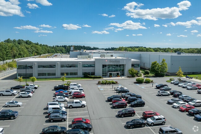
Property Record
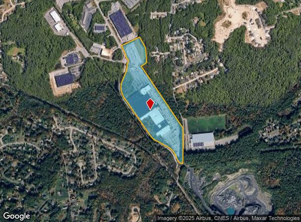
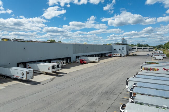
630 John Hancock Rd, Taunton, MA 02780
NEARBY LISTINGS FOR SALE OR LEASE
Property Detail
630 John Hancock Rd
TAUN-000030-000003
Bristol
Commercialbuilding
Massachusetts
X
3
25005C0142F
41.18 AC
2025
Attleboro/New Bedford
2025
Boston
613100
Providence-Warwick, RI-MA
486,363 SF
DEMOGRAPHICS near 630 John Hancock Rd
1 Mile
3 Mile
5 Mile
2024 Total Population
2,428
34,859
77,447
2029 Population
2,404
34,435
76,739
Pop Growth 2024-2029
(0.99%)
(1.22%)
(0.91%)
Average Age
43
42
41
2024 Total Households
944
14,380
30,007
HH Growth 2024-2029
(0.95%)
(1.23%)
(0.93%)
Median Household Inc
$95,974
$61,419
$75,486
Avg Household Size
2.50
2.30
2.50
2024 Avg HH Vehicles
2.00
2.00
2.00
Median Home Value
$354,648
$363,611
$386,011
Median Year Built
1976
1958
1971
Nearby Places
Map Layers
Map Styles
 Street
 Aerial
- Restaurants
- Banks
- Shops
- Fitness
- Groceries
PUBLIC TRANSPORTATION
AIRPORT
Rhode Island Tf Green International
DRIVE
WALK
Distance
Rhode Island Tf Green International
55 min
29.2 mi
Freight Ports
Port of New Bedford Harbor
DRIVE
WALK
Distance
Port of New Bedford Harbor
48 min
28.2 mi
Nearby Properties
Address
Land Use
TOTAL SIZE
Lot Size
Zoning
Address
Land Use
TOTAL SIZE
Lot Size
Zoning
68,024 SF
66.24 AC
RURRES
Address
Land Use
TOTAL SIZE
Lot Size
Zoning
279,756 SF
11.62 AC
OFFDIS
Address
Land Use
TOTAL SIZE
Lot Size
Zoning
559,641 SF
73.61 AC
Address
Land Use
TOTAL SIZE
Lot Size
Zoning
130,851 SF
24.43 AC
URBRES
Address
Land Use
TOTAL SIZE
Lot Size
Zoning
147,285 SF
0.79 AC
CENBIZ
Address
Land Use
TOTAL SIZE
Lot Size
Zoning
157.20 AC
OPSPAC
Address
Land Use
TOTAL SIZE
Lot Size
Zoning
604,133 SF
42.73 AC
Address
Land Use
TOTAL SIZE
Lot Size
Zoning
315,896 SF
24.53 AC
INDUST
Address
Land Use
TOTAL SIZE
Lot Size
Zoning
335,092 SF
27.12 AC
INDUST
Address
Land Use
TOTAL SIZE
Lot Size
Zoning
681,295 SF
65.93 AC
Address
Land Use
TOTAL SIZE
Lot Size
Zoning
212,672 SF
34.40 AC
Address
Land Use
TOTAL SIZE
Lot Size
Zoning
201,634 SF
12.01 AC
Address
Land Use
TOTAL SIZE
Lot Size
Zoning
361,737 SF
20 AC
INDUST
Address
Land Use
TOTAL SIZE
Lot Size
Zoning
25.26 AC
INDUST
Address
Land Use
TOTAL SIZE
Lot Size
Zoning
26.34 AC
Address
Land Use
TOTAL SIZE
Lot Size
Zoning
37.62 AC
URBRES
Address
Land Use
TOTAL SIZE
Lot Size
Zoning
Address
Land Use
TOTAL SIZE
Lot Size
Zoning
160,798 SF
14.31 AC
INDUST
Address
Land Use
TOTAL SIZE
Lot Size
Zoning
39,910 SF
1.05 AC
CENBIZ
Address
Land Use
TOTAL SIZE
Lot Size
Zoning
196,420 SF
21.78 AC
INDUST
Address
Land Use
TOTAL SIZE
Lot Size
Zoning
213,128 SF
12 AC
INDUST
Address
Land Use
TOTAL SIZE
Lot Size
Zoning
5.20 AC
URBRES
Address
Land Use
TOTAL SIZE
Lot Size
Zoning
200,000 SF
14.56 AC
INDUST
Address
Land Use
TOTAL SIZE
Lot Size
Zoning
153,057 SF
13.96 AC
INDUST
Address
Land Use
TOTAL SIZE
Lot Size
Zoning
239,923 SF
14.24 AC
INDUST
Address
Land Use
TOTAL SIZE
Lot Size
Zoning
217,814 SF
11.30 AC
INDUST
Address
Land Use
TOTAL SIZE
Lot Size
Zoning
198,720 SF
15.10 AC
INDUST
Address
Land Use
TOTAL SIZE
Lot Size
Zoning
36,336 SF
6.35 AC
RURRES
Address
Land Use
TOTAL SIZE
Lot Size
Zoning
32.93 AC
BIZDIS
The World's #1 Commercial Real Estate Marketplace
Connect with us
© 2025 CoStar Group
The information above has been obtained from sources believed reliable. While we do not doubt its accuracy we have not verified it and make no guarantee, warranty or representation about it. It is your responsibility to independently confirm its accuracy and completeness. Any projections, opinions, assumptions, or estimates used are for example only and do not represent the current or future performance of the property. The value of this transaction to you depends on tax and other factors which should be evaluated by your tax, financial, and legal advisors. You and your advisors should conduct a careful, independent investigation of the property to determine to your satisfaction the suitability of the property for your needs.