Property Record
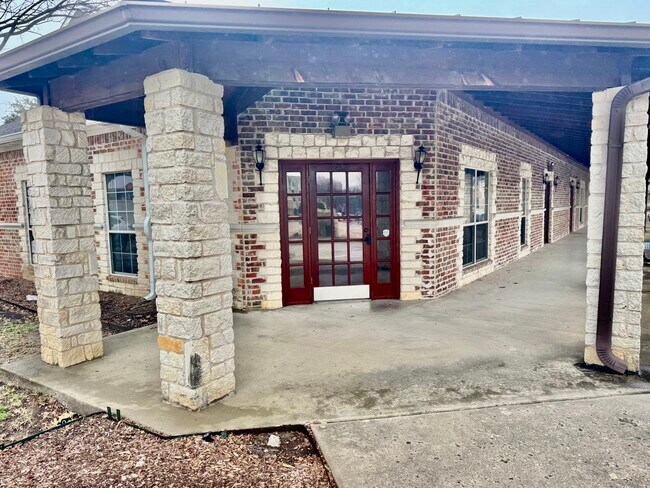
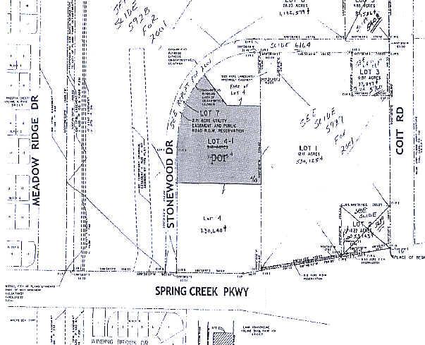
6300 Stonewood Dr, Plano, TX 75024
This Property Is For Sale
Property Detail
6300 Stonewood Dr
Dallas-Fort Worth-Arlington, TX
STONEWOOD PROFESSIONAL BUILDINGS CONDOMINIUMS, UNIT 206, 4.8095 % CMN INT
R-8125-000-2060-1
Collin
Commercialcondominium
Texas
B and X Area of moderate flood hazard, usually the area between the limits of the 100-year and 500-year floods.
206
2025
3.83 AC
2025
Plano
031674
Dallas/Ft Worth
1,861 SF
NEARBY LISTINGS FOR SALE OR LEASE
DEMOGRAPHICS near 6300 Stonewood Dr
1 mile
3 mile
5 mile
2024 Total Population
17,194
145,957
376,705
2029 Population
19,426
164,909
426,802
Pop Growth 2024-2029
+ 12.98%
+ 12.98%
+ 13.30%
Average Age
42
41
40
2024 Total Households
6,774
56,192
154,563
HH Growth 2024-2029
+ 13.21%
+ 13.23%
+ 13.64%
Median Household Inc
$119,128
$126,457
$109,082
Avg Household Size
2.50
2.50
2.40
2024 Avg HH Vehicles
2.00
2.00
2.00
Median Home Value
$519,547
$549,666
$555,154
Median Year Built
1991
1992
1994
Nearby Places
Map Layers
Map Styles
 Street
 Aerial
Transit
 Traffic
 Biking
Places
Listings with unknown addresses are not visible on the map
- Restaurants
- Banks
- Shops
- Fitness
- Groceries
PUBLIC TRANSPORTATION
AIRPORT
Dallas Love Field
Drive
Walk
Distance
Dallas Love Field
31 min
21.4 mi
Dallas-Fort Worth International
Drive
Walk
Distance
Dallas-Fort Worth International
34 min
25.4 mi
Nearby Properties
Address
Land Use
TOTAL SIZE
Lot Size
Zoning
Address
Land Use
TOTAL SIZE
Lot Size
Zoning
779,629 SF
56 AC
Address
Land Use
TOTAL SIZE
Lot Size
Zoning
659,402 SF
24.39 AC
O-M
Address
Land Use
TOTAL SIZE
Lot Size
Zoning
584,998 SF
23.45 AC
Address
Land Use
TOTAL SIZE
Lot Size
Zoning
320,098 SF
20 AC
CE
Address
Land Use
TOTAL SIZE
Lot Size
Zoning
606,071 SF
64.75 AC
SFR
Address
Land Use
TOTAL SIZE
Lot Size
Zoning
1,578,500 SF
91.04 AC
Address
Land Use
TOTAL SIZE
Lot Size
Zoning
401,260 SF
23.33 AC
CE
Address
Land Use
TOTAL SIZE
Lot Size
Zoning
207,793 SF
12.48 AC
CE
Address
Land Use
TOTAL SIZE
Lot Size
Zoning
252,305 SF
9.22 AC
Address
Land Use
TOTAL SIZE
Lot Size
Zoning
545,224 SF
42.80 AC
Address
Land Use
TOTAL SIZE
Lot Size
Zoning
442,484 SF
APTS
Address
Land Use
TOTAL SIZE
Lot Size
Zoning
435,683 SF
18.25 AC
COMM
Address
Land Use
TOTAL SIZE
Lot Size
Zoning
388,870 SF
25.54 AC
Address
Land Use
TOTAL SIZE
Lot Size
Zoning
442,184 SF
11.65 AC
MF-E
Address
Land Use
TOTAL SIZE
Lot Size
Zoning
156,000 SF
9 AC
CE
Address
Land Use
TOTAL SIZE
Lot Size
Zoning
296,434 SF
19.66 AC
CE
Address
Land Use
TOTAL SIZE
Lot Size
Zoning
382,817 SF
47.69 AC
CE
Address
Land Use
TOTAL SIZE
Lot Size
Zoning
467,134 SF
24.13 AC
MF-M
Address
Land Use
TOTAL SIZE
Lot Size
Zoning
245,542 SF
26.31 AC
RT/O-M
Address
Land Use
TOTAL SIZE
Lot Size
Zoning
405,642 SF
5.55 AC
MF-E
Address
Land Use
TOTAL SIZE
Lot Size
Zoning
308,670 SF
25.10 AC
Address
Land Use
TOTAL SIZE
Lot Size
Zoning
461,983 SF
43.65 AC
Address
Land Use
TOTAL SIZE
Lot Size
Zoning
486,949 SF
6.42 AC
O-M
Address
Land Use
TOTAL SIZE
Lot Size
Zoning
408,256 SF
27.66 AC
MF-M
Address
Land Use
TOTAL SIZE
Lot Size
Zoning
230,621 SF
18.91 AC
CE
Address
Land Use
TOTAL SIZE
Lot Size
Zoning
217,626 SF
4.57 AC
CE
Address
Land Use
TOTAL SIZE
Lot Size
Zoning
366,470 SF
31.19 AC
LC
Address
Land Use
TOTAL SIZE
Lot Size
Zoning
394,405 SF
39.02 AC
Address
Land Use
TOTAL SIZE
Lot Size
Zoning
346,959 SF
12.68 AC
RT
Address
Land Use
TOTAL SIZE
Lot Size
Zoning
377,553 SF
27.62 AC
CE
The World's #1 Commercial Real Estate Marketplace
Connect with us
© 2026 CoStar Group
The information above has been obtained from sources believed reliable. While we do not doubt its accuracy we have not verified it and make no guarantee, warranty or representation about it. It is your responsibility to independently confirm its accuracy and completeness. Any projections, opinions, assumptions, or estimates used are for example only and do not represent the current or future performance of the property. The value of this transaction to you depends on tax and other factors which should be evaluated by your tax, financial, and legal advisors. You and your advisors should conduct a careful, independent investigation of the property to determine to your satisfaction the suitability of the property for your needs.