Property Record
6301 Whitley Rd, Watauga, TX 76148


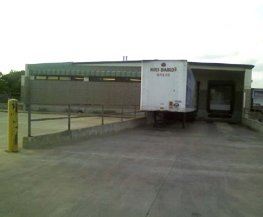

Property Detail
6301 Whitley Rd
03850447
DREW, SMITH SURVEY ABSTRACT 419 TRACT 3A01
Commercialnec
TARRANT
B and X Area of moderate flood hazard, usually the area between the limits of the 100-year and 500-year floods.
Texas
2025
2.99 AC
2025
NE Tarrant/Alliance
113809
Dallas/Ft Worth
12,513 SF
Dallas-Fort Worth-Arlington, TX
NEARBY LISTINGS FOR SALE OR LEASE
DEMOGRAPHICS near 6301 Whitley Rd
1 mile
3 mile
5 mile
2025 Total Population
17,029
137,051
303,987
2030 Population
17,799
143,172
318,181
Pop Growth 2025-2030
+ 4.52%
+ 4.47%
+ 4.67%
Average Age
37
38
38
2025 Total Households
5,745
50,386
109,864
HH Growth 2025-2030
+ 4.70%
+ 4.63%
+ 4.89%
Median Household Inc
$87,016
$85,974
$91,560
Avg Household Size
2.90
2.70
2.70
2025 Avg HH Vehicles
2.00
2.00
2.00
Median Home Value
$242,406
$306,935
$338,417
Median Year Built
1982
1988
1991
Nearby Places
Map Layers
Map Styles
 Street
 Aerial
Transit
 Traffic
 Biking
Places
Listings with unknown addresses are not visible on the map
- Restaurants
- Banks
- Shops
- Fitness
- Groceries
PUBLIC TRANSPORTATION
COMMUTER RAIL
Drive
Walk
Distance
13 min
6.7 mi
Drive
Walk
Distance
18 min
9.6 mi
AIRPORT
Dallas-Fort Worth International
Drive
Walk
Distance
Dallas-Fort Worth International
29 min
19.3 mi
Dallas Love Field
Drive
Walk
Distance
Dallas Love Field
39 min
28.0 mi
Nearby Properties
Address
Land Use
TOTAL SIZE
Lot Size
Zoning
Address
Land Use
TOTAL SIZE
Lot Size
Zoning
547,836 SF
2 AC
Address
Land Use
TOTAL SIZE
Lot Size
Zoning
332,094 SF
19.33 AC
Address
Land Use
TOTAL SIZE
Lot Size
Zoning
352,354 SF
17.02 AC
Address
Land Use
TOTAL SIZE
Lot Size
Zoning
381,000 SF
8.74 AC
Address
Land Use
TOTAL SIZE
Lot Size
Zoning
350,153 SF
19.73 AC
Address
Land Use
TOTAL SIZE
Lot Size
Zoning
433,894 SF
18.99 AC
Address
Land Use
TOTAL SIZE
Lot Size
Zoning
385,697 SF
15.94 AC
Address
Land Use
TOTAL SIZE
Lot Size
Zoning
327,325 SF
16.87 AC
Address
Land Use
TOTAL SIZE
Lot Size
Zoning
285,672 SF
19.20 AC
Address
Land Use
TOTAL SIZE
Lot Size
Zoning
344,992 SF
17.49 AC
Address
Land Use
TOTAL SIZE
Lot Size
Zoning
312,219 SF
17.82 AC
Address
Land Use
TOTAL SIZE
Lot Size
Zoning
248,993 SF
15.40 AC
Address
Land Use
TOTAL SIZE
Lot Size
Zoning
263,411 SF
7.32 AC
Address
Land Use
TOTAL SIZE
Lot Size
Zoning
368,751 SF
19.97 AC
Address
Land Use
TOTAL SIZE
Lot Size
Zoning
293,972 SF
17.30 AC
Address
Land Use
TOTAL SIZE
Lot Size
Zoning
301,972 SF
19.32 AC
Address
Land Use
TOTAL SIZE
Lot Size
Zoning
266,403 SF
16.67 AC
Address
Land Use
TOTAL SIZE
Lot Size
Zoning
270,394 SF
16.43 AC
Address
Land Use
TOTAL SIZE
Lot Size
Zoning
296,724 SF
17.58 AC
Address
Land Use
TOTAL SIZE
Lot Size
Zoning
261,579 SF
30.93 AC
Address
Land Use
TOTAL SIZE
Lot Size
Zoning
241,064 SF
12.63 AC
Address
Land Use
TOTAL SIZE
Lot Size
Zoning
307,568 SF
13.13 AC
Address
Land Use
TOTAL SIZE
Lot Size
Zoning
248,166 SF
12.05 AC
Address
Land Use
TOTAL SIZE
Lot Size
Zoning
220,111 SF
10 AC
Address
Land Use
TOTAL SIZE
Lot Size
Zoning
245,684 SF
18.11 AC
Address
Land Use
TOTAL SIZE
Lot Size
Zoning
187,236 SF
9.85 AC
Address
Land Use
TOTAL SIZE
Lot Size
Zoning
130,253 SF
17.92 AC
Address
Land Use
TOTAL SIZE
Lot Size
Zoning
176,242 SF
11.59 AC
Address
Land Use
TOTAL SIZE
Lot Size
Zoning
195,678 SF
12.24 AC
Address
Land Use
TOTAL SIZE
Lot Size
Zoning
197,860 SF
19.82 AC
The World's #1 Commercial Real Estate Marketplace
Connect with us
© 2026 CoStar Group
The information above has been obtained from sources believed reliable. While we do not doubt its accuracy we have not verified it and make no guarantee, warranty or representation about it. It is your responsibility to independently confirm its accuracy and completeness. Any projections, opinions, assumptions, or estimates used are for example only and do not represent the current or future performance of the property. The value of this transaction to you depends on tax and other factors which should be evaluated by your tax, financial, and legal advisors. You and your advisors should conduct a careful, independent investigation of the property to determine to your satisfaction the suitability of the property for your needs.