Property Record
6320 Nw 97Th Ave, Doral, FL 33178
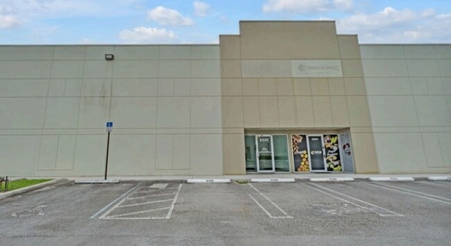

This Property Is For Sale
NEARBY LISTINGS FOR SALE OR LEASE
Property Detail
6320 Nw 97Th Ave
35-3017-016-0040
Flightway Commerce Park Condo
Warehouse
FLIGHTWAY COMMERCE PARK CONDO UNIT 4 BLDG 6300 UNDIV 3.91% INT IN COMMON ELEMENTS OFF REC 22233-4315 COC 22756-4404 10 2004 1
X
Miami/Dade
12086C0278L
Florida
2024
Miami Airport North
2025
South Florida
009057
Miami-Miami Beach-Kendall, FL
8,750 SF
DEMOGRAPHICS near 6320 Nw 97Th Ave
1 Mile
3 Mile
5 Mile
2024 Total Population
16,104
97,602
368,881
2029 Population
17,660
106,166
393,951
Pop Growth 2024-2029
+ 9.66%
+ 8.77%
+ 6.80%
Average Age
37
38
42
2024 Total Households
5,236
31,827
124,654
HH Growth 2024-2029
+ 9.61%
+ 8.81%
+ 6.73%
Median Household Inc
$98,213
$87,415
$65,361
Avg Household Size
3.00
3.00
2.90
2024 Avg HH Vehicles
2.00
2.00
2.00
Median Home Value
$652,964
$593,396
$419,978
Median Year Built
2010
2004
1985
Nearby Places
Map Layers
Map Styles
 Street
 Aerial
- Restaurants
- Banks
- Shops
- Fitness
- Groceries
PUBLIC TRANSPORTATION
COMMUTER RAIL
Palmetto (Metrorail Green Line - Miami-Dade Transit (Metrorail/Metromover))
DRIVE
WALK
Distance
Palmetto (Metrorail Green Line - Miami-Dade Transit (Metrorail/Metromover))
7 min
3.0 mi
Okeechobee (Metrorail Green Line - Miami-Dade Transit (Metrorail/Metromover))
DRIVE
WALK
Distance
Okeechobee (Metrorail Green Line - Miami-Dade Transit (Metrorail/Metromover))
10 min
4.7 mi
AIRPORT
Miami International
DRIVE
WALK
Distance
Miami International
17 min
6.8 mi
Fort Lauderdale/Hollywood International
DRIVE
WALK
Distance
Fort Lauderdale/Hollywood International
42 min
30.3 mi
Freight Ports
Port of Miami
DRIVE
WALK
Distance
Port of Miami
29 min
16.3 mi
Nearby Properties
Address
Land Use
TOTAL SIZE
Lot Size
Zoning
Address
Land Use
TOTAL SIZE
Lot Size
Zoning
1,071,874 SF
6.73 AC
4802
Address
Land Use
TOTAL SIZE
Lot Size
Zoning
312,996 SF
157.16 AC
8900
Address
Land Use
TOTAL SIZE
Lot Size
Zoning
851,502 SF
11.73 AC
6119
Address
Land Use
TOTAL SIZE
Lot Size
Zoning
481,242 SF
13.61 AC
6400
Address
Land Use
TOTAL SIZE
Lot Size
Zoning
777,714 SF
7.59 AC
9450
Address
Land Use
TOTAL SIZE
Lot Size
Zoning
666,015 SF
4 AC
6119
Address
Land Use
TOTAL SIZE
Lot Size
Zoning
582,921 SF
4.51 AC
6119
Address
Land Use
TOTAL SIZE
Lot Size
Zoning
585,943 SF
22.41 AC
3800
Address
Land Use
TOTAL SIZE
Lot Size
Zoning
475,423 SF
14.56 AC
9450
Address
Land Use
TOTAL SIZE
Lot Size
Zoning
929,765 SF
453.69 AC
6119
Address
Land Use
TOTAL SIZE
Lot Size
Zoning
899,162 SF
9.89 AC
7700
Address
Land Use
TOTAL SIZE
Lot Size
Zoning
608,139 SF
5.80 AC
6119
Address
Land Use
TOTAL SIZE
Lot Size
Zoning
612,289 SF
3.38 AC
6119
Address
Land Use
TOTAL SIZE
Lot Size
Zoning
540,427 SF
26.86 AC
3700
Address
Land Use
TOTAL SIZE
Lot Size
Zoning
498,676 SF
25.96 AC
9450
Address
Land Use
TOTAL SIZE
Lot Size
Zoning
145.77 AC
7700
Address
Land Use
TOTAL SIZE
Lot Size
Zoning
687,804 SF
3.84 AC
9450
Address
Land Use
TOTAL SIZE
Lot Size
Zoning
755,156 SF
29.44 AC
7100
Address
Land Use
TOTAL SIZE
Lot Size
Zoning
538,715 SF
24.72 AC
7100
Address
Land Use
TOTAL SIZE
Lot Size
Zoning
352,663 SF
0.65 AC
6119
Address
Land Use
TOTAL SIZE
Lot Size
Zoning
359,107 SF
9.58 AC
9450
Address
Land Use
TOTAL SIZE
Lot Size
Zoning
468,218 SF
17.06 AC
7100
Address
Land Use
TOTAL SIZE
Lot Size
Zoning
344,101 SF
0.74 AC
6119
Address
Land Use
TOTAL SIZE
Lot Size
Zoning
533,605 SF
10.86 AC
9450
Address
Land Use
TOTAL SIZE
Lot Size
Zoning
687,304 SF
3.03 AC
6119
Address
Land Use
TOTAL SIZE
Lot Size
Zoning
648,867 SF
33.08 AC
7100
Address
Land Use
TOTAL SIZE
Lot Size
Zoning
255,793 SF
17.14 AC
8000
Address
Land Use
TOTAL SIZE
Lot Size
Zoning
527,157 SF
4.15 AC
6119
Address
Land Use
TOTAL SIZE
Lot Size
Zoning
538,739 SF
5.05 AC
7100
Address
Land Use
TOTAL SIZE
Lot Size
Zoning
387,903 SF
4.49 AC
6119
The World's #1 Commercial Real Estate Marketplace
Connect with us
© 2025 CoStar Group
The information above has been obtained from sources believed reliable. While we do not doubt its accuracy we have not verified it and make no guarantee, warranty or representation about it. It is your responsibility to independently confirm its accuracy and completeness. Any projections, opinions, assumptions, or estimates used are for example only and do not represent the current or future performance of the property. The value of this transaction to you depends on tax and other factors which should be evaluated by your tax, financial, and legal advisors. You and your advisors should conduct a careful, independent investigation of the property to determine to your satisfaction the suitability of the property for your needs.