Property Record
63678 19Th Ave, North Palm Springs, CA 92258
NEARBY LISTINGS FOR SALE OR LEASE
Property Detail
63678 19Th Ave
666-320-015
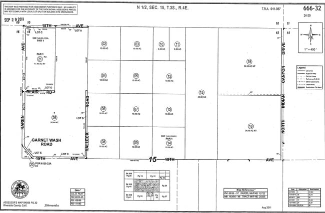
40.00 ACRES IN POR NE 1/4 OF SEC 15 T3S R4E FOR TOTAL DESCRIPTION SEE ASSESSORS MAPS
Commercialacreage
Riverside
X
California
06065C0895G
40 AC
2024
Coachella Valley
2025
Inland Empire (California)
044524
Riverside-San Bernardino-Ontario, CA
DEMOGRAPHICS near 63678 19Th Ave
1 Mile
3 Mile
5 Mile
2024 Total Population
343
1,629
59,457
2029 Population
354
1,725
64,279
Pop Growth 2024-2029
+ 3.21%
+ 5.89%
+ 8.11%
Average Age
36
37
39
2024 Total Households
101
497
21,949
HH Growth 2024-2029
+ 1.98%
+ 5.43%
+ 8.17%
Median Household Inc
$39,499
$42,000
$51,491
Avg Household Size
3.30
3.10
2.60
2024 Avg HH Vehicles
2.00
2.00
2.00
Median Home Value
$88,709
$121,901
$397,254
Median Year Built
1983
1984
1987
Nearby Places
Map Layers
Map Styles
 Street
 Aerial
- Restaurants
- Banks
- Shops
- Fitness
- Groceries
PUBLIC TRANSPORTATION
COMMUTER RAIL
Palm Springs Amtrak (Sunset Limited - Amtrak, Texas Eagle - Amtrak)
DRIVE
WALK
Distance
Palm Springs Amtrak (Sunset Limited - Amtrak, Texas Eagle - Amtrak)
7 min
2.1 mi
AIRPORT
Palm Springs International
DRIVE
WALK
Distance
Palm Springs International
14 min
7.6 mi
Freight Ports
Port of San Diego
DRIVE
WALK
Distance
Port of San Diego
150 min
122.9 mi
Nearby Properties
Address
Land Use
TOTAL SIZE
Lot Size
Zoning
Address
Land Use
TOTAL SIZE
Lot Size
Zoning
200,720 SF
10.49 AC
Address
Land Use
TOTAL SIZE
Lot Size
Zoning
64.91 AC
MSC
Address
Land Use
TOTAL SIZE
Lot Size
Zoning
650,865 SF
94.91 AC
Address
Land Use
TOTAL SIZE
Lot Size
Zoning
78,903 SF
18.25 AC
M1
Address
Land Use
TOTAL SIZE
Lot Size
Zoning
16,460 SF
3.98 AC
Address
Land Use
TOTAL SIZE
Lot Size
Zoning
53,897 SF
6.63 AC
IP
Address
Land Use
TOTAL SIZE
Lot Size
Zoning
82,900 SF
19.43 AC
W2
Address
Land Use
TOTAL SIZE
Lot Size
Zoning
57,585 SF
4 AC
Address
Land Use
TOTAL SIZE
Lot Size
Zoning
48,148 SF
2.11 AC
LI
Address
Land Use
TOTAL SIZE
Lot Size
Zoning
48,223 SF
2.11 AC
LI
Address
Land Use
TOTAL SIZE
Lot Size
Zoning
29,244 SF
7.65 AC
Address
Land Use
TOTAL SIZE
Lot Size
Zoning
173,602 SF
23.92 AC
MSC
Address
Land Use
TOTAL SIZE
Lot Size
Zoning
32,874 SF
1.14 AC
M
Address
Land Use
TOTAL SIZE
Lot Size
Zoning
40,000 SF
2.30 AC
Address
Land Use
TOTAL SIZE
Lot Size
Zoning
34,188 SF
16.06 AC
W2
Address
Land Use
TOTAL SIZE
Lot Size
Zoning
39,553 SF
2.13 AC
M
Address
Land Use
TOTAL SIZE
Lot Size
Zoning
105,548 SF
4.34 AC
W2
Address
Land Use
TOTAL SIZE
Lot Size
Zoning
31,410 SF
0.41 AC
Address
Land Use
TOTAL SIZE
Lot Size
Zoning
21,000 SF
2.27 AC
CPS
Address
Land Use
TOTAL SIZE
Lot Size
Zoning
27,066 SF
2.11 AC
LI
Address
Land Use
TOTAL SIZE
Lot Size
Zoning
30,776 SF
1.07 AC
IL
Address
Land Use
TOTAL SIZE
Lot Size
Zoning
27,748 SF
0.35 AC
Address
Land Use
TOTAL SIZE
Lot Size
Zoning
22,950 SF
1.26 AC
IL
Address
Land Use
TOTAL SIZE
Lot Size
Zoning
27,748 SF
0.34 AC
Address
Land Use
TOTAL SIZE
Lot Size
Zoning
95.11 AC
Address
Land Use
TOTAL SIZE
Lot Size
Zoning
16,460 SF
0.22 AC
Address
Land Use
TOTAL SIZE
Lot Size
Zoning
16,460 SF
0.23 AC
The World's #1 Commercial Real Estate Marketplace
Connect with us
© 2026 CoStar Group
The information above has been obtained from sources believed reliable. While we do not doubt its accuracy we have not verified it and make no guarantee, warranty or representation about it. It is your responsibility to independently confirm its accuracy and completeness. Any projections, opinions, assumptions, or estimates used are for example only and do not represent the current or future performance of the property. The value of this transaction to you depends on tax and other factors which should be evaluated by your tax, financial, and legal advisors. You and your advisors should conduct a careful, independent investigation of the property to determine to your satisfaction the suitability of the property for your needs.