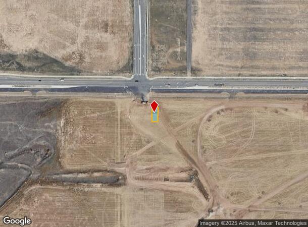
Property Record
6370 N Lisbon St, Aurora, CO 80019

Current Lease Availabilities
NEARBY LISTINGS FOR SALE OR LEASE
Property Detail
6370 N Lisbon St
Denver
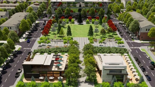
Painted Prairie
Denver-Aurora-Centennial, CO
PAINTED PRAIRIE SUBD FLG 3 BLK 1 LOT 18
1821-11-2-02-001
Adams
Townhouserowhouse
Colorado
2024
18
2025
0.07 AC
008354
East I-70/Montbello
1,877 SF
DEMOGRAPHICS near 6370 N Lisbon St
1 mile
3 mile
5 mile
2024 Total Population
2,308
42,586
81,206
2029 Population
2,402
44,124
83,299
Pop Growth 2024-2029
+ 4.07%
+ 3.61%
+ 2.58%
Average Age
35
34
34
2024 Total Households
816
13,177
24,651
HH Growth 2024-2029
+ 4.17%
+ 4.12%
+ 2.96%
Median Household Inc
$106,250
$91,507
$88,222
Avg Household Size
2.80
3.10
3.10
2024 Avg HH Vehicles
2.00
2.00
2.00
Median Home Value
$463,661
$400,717
$384,035
Median Year Built
2007
2007
2004
Nearby Places
Map Layers
Map Styles
 Street
 Aerial
Transit
 Traffic
 Biking
Places
Listings with unknown addresses are not visible on the map
- Restaurants
- Banks
- Shops
- Fitness
- Groceries
PUBLIC TRANSPORTATION
COMMUTER RAIL
Drive
Walk
Distance
8 min
2.9 mi
Drive
Walk
Distance
14 min
6.0 mi
AIRPORT
Denver International
Drive
Walk
Distance
Denver International
15 min
7.4 mi
Nearby Properties
Address
Land Use
TOTAL SIZE
Lot Size
Zoning
Address
Land Use
TOTAL SIZE
Lot Size
Zoning
1,996,111 SF
73.07 AC
Address
Land Use
TOTAL SIZE
Lot Size
Zoning
1,214,982 SF
149.04 AC
I-MX-8
Address
Land Use
TOTAL SIZE
Lot Size
Zoning
258,315 SF
16.83 AC
Address
Land Use
TOTAL SIZE
Lot Size
Zoning
938,254 SF
74.01 AC
Address
Land Use
TOTAL SIZE
Lot Size
Zoning
110,192 SF
2.95 AC
C-MU-30
Address
Land Use
TOTAL SIZE
Lot Size
Zoning
200,105 SF
34.54 AC
C-MU-20
Address
Land Use
TOTAL SIZE
Lot Size
Zoning
489,080 SF
65.53 AC
Address
Land Use
TOTAL SIZE
Lot Size
Zoning
288,020 SF
49.76 AC
Address
Land Use
TOTAL SIZE
Lot Size
Zoning
670,320 SF
35.50 AC
Address
Land Use
TOTAL SIZE
Lot Size
Zoning
185,812 SF
20.93 AC
C-MU-20
Address
Land Use
TOTAL SIZE
Lot Size
Zoning
108,548 SF
2.98 AC
C-MU-20
Address
Land Use
TOTAL SIZE
Lot Size
Zoning
134,052 SF
6.77 AC
C-MX
Address
Land Use
TOTAL SIZE
Lot Size
Zoning
541,840 SF
27.24 AC
Address
Land Use
TOTAL SIZE
Lot Size
Zoning
55,590 SF
2.48 AC
GTWY
Address
Land Use
TOTAL SIZE
Lot Size
Zoning
99,800 SF
4.03 AC
GTWY
Address
Land Use
TOTAL SIZE
Lot Size
Zoning
172,878 SF
2.46 AC
C-MU-20
Address
Land Use
TOTAL SIZE
Lot Size
Zoning
71,229 SF
2.58 AC
C-MX
Address
Land Use
TOTAL SIZE
Lot Size
Zoning
217,995 SF
12.31 AC
S-SU-D
Address
Land Use
TOTAL SIZE
Lot Size
Zoning
353,350 SF
28.91 AC
Address
Land Use
TOTAL SIZE
Lot Size
Zoning
90,368 SF
2.86 AC
C-MX
Address
Land Use
TOTAL SIZE
Lot Size
Zoning
60,021 SF
1.86 AC
C-MU-10
Address
Land Use
TOTAL SIZE
Lot Size
Zoning
64,635 SF
2.06 AC
C-MX
Address
Land Use
TOTAL SIZE
Lot Size
Zoning
437,144 SF
11.58 AC
Address
Land Use
TOTAL SIZE
Lot Size
Zoning
121,970 SF
12.12 AC
C-MU-20
Address
Land Use
TOTAL SIZE
Lot Size
Zoning
57,899 SF
2.52 AC
C-MU-20
Address
Land Use
TOTAL SIZE
Lot Size
Zoning
82,039 SF
2.60 AC
C-MX
Address
Land Use
TOTAL SIZE
Lot Size
Zoning
116,914 SF
13.43 AC
PUD
Address
Land Use
TOTAL SIZE
Lot Size
Zoning
142,413 SF
4.29 AC
C-MU-20
Address
Land Use
TOTAL SIZE
Lot Size
Zoning
366,808 SF
11.38 AC
C-MU-20
Address
Land Use
TOTAL SIZE
Lot Size
Zoning
107,276 SF
3.43 AC
C-MU-20
The World's #1 Commercial Real Estate Marketplace
Connect with us
© 2026 CoStar Group
The information above has been obtained from sources believed reliable. While we do not doubt its accuracy we have not verified it and make no guarantee, warranty or representation about it. It is your responsibility to independently confirm its accuracy and completeness. Any projections, opinions, assumptions, or estimates used are for example only and do not represent the current or future performance of the property. The value of this transaction to you depends on tax and other factors which should be evaluated by your tax, financial, and legal advisors. You and your advisors should conduct a careful, independent investigation of the property to determine to your satisfaction the suitability of the property for your needs.