Property Record
648 E 800 S, Orem, UT 84097
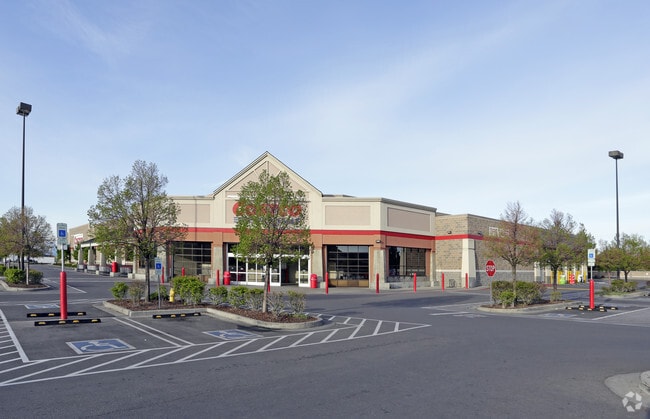
Property Detail
648 E 800 S
Provo-Orem-Lehi, UT
LOT 15A, UNIVERSITY MALL UPLACE ASTON COURT SUB AREA 3.172 AC.
57-043-0017
Utah
Warehouse
Utah
2024
15a
2025
13.17 AC
001001
Utah County
157,768 SF
Salt Lake City
NEARBY LISTINGS FOR SALE OR LEASE
DEMOGRAPHICS near 648 E 800 S
1 mile
3 mile
5 mile
2025 Total Population
17,145
153,859
258,308
2030 Population
18,778
168,483
283,781
Pop Growth 2025-2030
+ 9.52%
+ 9.50%
+ 9.86%
Average Age
33
32
31
2025 Total Households
5,618
46,192
78,938
HH Growth 2025-2030
+ 10.18%
+ 10.59%
+ 10.86%
Median Household Inc
$77,722
$77,747
$77,938
Avg Household Size
2.90
3.00
3.10
2025 Avg HH Vehicles
2.00
2.00
2.00
Median Home Value
$566,627
$541,349
$552,015
Median Year Built
1983
1987
1990
Nearby Places
Map Layers
Map Styles
 Street
 Aerial
Transit
 Traffic
 Biking
Places
Listings with unknown addresses are not visible on the map
- Restaurants
- Banks
- Shops
- Fitness
- Groceries
PUBLIC TRANSPORTATION
COMMUTER RAIL
Orem Central Station (FrontRunner - Utah Transit Authority (UTA))
Drive
Walk
Distance
Orem Central Station (FrontRunner - Utah Transit Authority (UTA))
9 min
3.7 mi
Provo Amtrak (California Zephyr - Amtrak)
Drive
Walk
Distance
Provo Amtrak (California Zephyr - Amtrak)
9 min
4.7 mi
AIRPORT
Provo Municipal
Drive
Walk
Distance
Provo Municipal
16 min
9.1 mi
Freight Ports
Port of Stockton
Drive
Walk
Distance
Port of Stockton
756 min
735.7 mi
Nearby Properties
Address
Land Use
TOTAL SIZE
Lot Size
Zoning
Address
Land Use
TOTAL SIZE
Lot Size
Zoning
1,744,846 SF
19.25 AC
Address
Land Use
TOTAL SIZE
Lot Size
Zoning
206,178 SF
16.64 AC
Address
Land Use
TOTAL SIZE
Lot Size
Zoning
1,003,185 SF
9.57 AC
Address
Land Use
TOTAL SIZE
Lot Size
Zoning
623,237 SF
14.06 AC
Address
Land Use
TOTAL SIZE
Lot Size
Zoning
530,326 SF
8.14 AC
Address
Land Use
TOTAL SIZE
Lot Size
Zoning
222,763 SF
10.71 AC
Address
Land Use
TOTAL SIZE
Lot Size
Zoning
736,672 SF
7.04 AC
Address
Land Use
TOTAL SIZE
Lot Size
Zoning
627,022 SF
9.16 AC
Address
Land Use
TOTAL SIZE
Lot Size
Zoning
349,971 SF
11.43 AC
Address
Land Use
TOTAL SIZE
Lot Size
Zoning
310,818 SF
1.17 AC
Address
Land Use
TOTAL SIZE
Lot Size
Zoning
219,346 SF
2.20 AC
Address
Land Use
TOTAL SIZE
Lot Size
Zoning
199,119 SF
17.18 AC
Address
Land Use
TOTAL SIZE
Lot Size
Zoning
323,674 SF
13.81 AC
Address
Land Use
TOTAL SIZE
Lot Size
Zoning
430,273 SF
15.74 AC
Address
Land Use
TOTAL SIZE
Lot Size
Zoning
122,784 SF
12.46 AC
Address
Land Use
TOTAL SIZE
Lot Size
Zoning
245,657 SF
5.60 AC
Address
Land Use
TOTAL SIZE
Lot Size
Zoning
212,820 SF
12.90 AC
Address
Land Use
TOTAL SIZE
Lot Size
Zoning
401,381 SF
3.50 AC
Address
Land Use
TOTAL SIZE
Lot Size
Zoning
154,685 SF
13.20 AC
Address
Land Use
TOTAL SIZE
Lot Size
Zoning
222,803 SF
18.48 AC
Address
Land Use
TOTAL SIZE
Lot Size
Zoning
268,060 SF
11.73 AC
Address
Land Use
TOTAL SIZE
Lot Size
Zoning
311,697 SF
6.49 AC
Address
Land Use
TOTAL SIZE
Lot Size
Zoning
107,840 SF
0.98 AC
Address
Land Use
TOTAL SIZE
Lot Size
Zoning
139,462 SF
3.93 AC
Address
Land Use
TOTAL SIZE
Lot Size
Zoning
124,242 SF
9.33 AC
Address
Land Use
TOTAL SIZE
Lot Size
Zoning
266,887 SF
8.12 AC
Address
Land Use
TOTAL SIZE
Lot Size
Zoning
194,483 SF
10.66 AC
Address
Land Use
TOTAL SIZE
Lot Size
Zoning
155,726 SF
13.64 AC
Address
Land Use
TOTAL SIZE
Lot Size
Zoning
179,347 SF
13.55 AC
Address
Land Use
TOTAL SIZE
Lot Size
Zoning
300,810 SF
7.32 AC
The World's #1 Commercial Real Estate Marketplace
Connect with us
© 2026 CoStar Group
The information above has been obtained from sources believed reliable. While we do not doubt its accuracy we have not verified it and make no guarantee, warranty or representation about it. It is your responsibility to independently confirm its accuracy and completeness. Any projections, opinions, assumptions, or estimates used are for example only and do not represent the current or future performance of the property. The value of this transaction to you depends on tax and other factors which should be evaluated by your tax, financial, and legal advisors. You and your advisors should conduct a careful, independent investigation of the property to determine to your satisfaction the suitability of the property for your needs.